Reservoirs & lochs · Yorkshire & the Humber
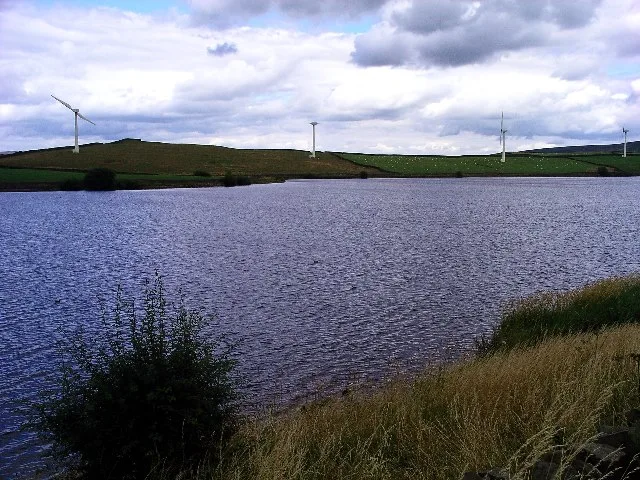
Leighton Reservoir
Leighton Reservoir — lake in the United Kingdom.

Wikimedia Commons contributors — see linked file page for photographer and licence licence
Plan your visit
- Typical visit
- 1 h–2.5 h
- Free entry
- Dog-friendly
About
Leighton Reservoir is a reservoir in the United Kingdom. Wikidata describes it as: "lake in the United Kingdom". Coordinates: 54.2031°, -1.7567°.
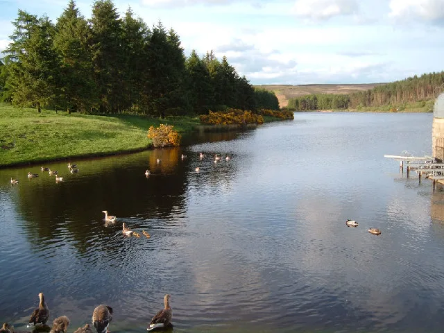
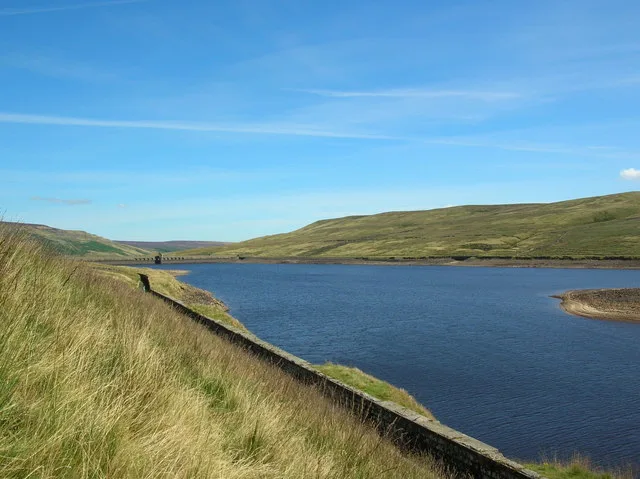
Photo gallery
Protected designations
- Site of Special Scientific Interest: East Nidderdale Moors (Flamstone Pin - High Ruckles) SSSI
- Area of Outstanding Natural Beauty: Nidderdale
Designations sourced from Natural England open data under OGL v3.
From the Wikipedia article
Leighton Reservoir is a reservoir which drains via the River Burn to the River Ure in North Yorkshire, England. It neighbours Roundhill Reservoir and is about 4 miles (6.4 km) west of Masham. It takes its name from the nearby village of Leighton. Work on the reservoir was started by the Leeds Corporation Waterworks in 1908, and although the major parts of the building process were over by March 1926, the final cementation was not completed until 1941. The reservoir was allowed to fill with water over the winter of 1926–1927. A newspaper report from 1910, estimated that the final cost of the construction would be £437,000 (equivalent to £44,505,000 in 2025). Although the Leeds Corporation intended to build another reservoir in Colsterdale on the River Burn, this never came to pass, and Leighton Reservoir was constructed on two tributaries of the Burn; Pott Beck and Spruce Gell. Water from the reservoir is used to compensate for abstraction from the River Ure. Although not in Nidderdale, the reservoir is within the Nidderdale Area of Outstanding Natural Beauty. Leighton is accessible for fishing and has a car park. The reservoir is on land owned by the Swinton Estate and they stock the waters with fish. Like its near neighbours in Upper Nidderdale, the construction of Leighton reservoir (and Roundhill) necessitated the building of an industrial railway to bring in materials for construction. A 2 ft (610 mm) 6-mile (9.7 km) railway was built from the north end of Masham railway station where a transhipment yard was located to transfer freight between the narrow and standard gauge lines. The line opened in 1905 and was closed by 1930. The reservoir has a mean depth of 36 feet (11.1 m), a surface area of 91 acres (37 hectares), a catchment area of 5,600 acres (2,260 hectares), and it lies at an elevation of 617 feet (188 m) above sea level.
Excerpt from Wikipedia under CC BY-SA 4.0. See the source article linked in Sources below.
- Coordinates
- 54.2031, -1.7567
- District
- North Yorkshire
- Parish
- Healey
- Postcode
- HG4 4LS
- Parliamentary constituency
- Skipton and Ripon
- Official site
- www.ripongazette.co.uk
Sources
- wikidata: Q6519781 (CC0)
- wikipedia: Leighton Reservoir (CC BY-SA 4.0)
- commons: Leighton Reservoir.jpg (CC BY-SA 4.0)
Other places nearby
Loading nearby places…
Nearby
 📷 3
📷 3Memorials & monuments · Yorkshire & the Humber
Memorial To The 15Th Battalion West Yorkshire Regiment (The Leeds Pals)
Memorial To The 15Th Battalion West Yorkshire Regiment (The Leeds Pals) — Grade II listed building-listed memorial in england-yorkshire, United Kingdom.
📷 4Memorials & monuments · Yorkshire & the Humber
Leeds Pals
Leeds Pals — a memorial in england-yorkshire, United Kingdom.
 📷 3
📷 3Reservoirs & lochs · Yorkshire & the Humber
Roundhill Reservoir
Roundhill Reservoir — reservoir in North Yorkshire, England, UK.
 📷 4
📷 4Memorials & monuments · Yorkshire & the Humber
Arnagill Tower
Arnagill Tower — Grade II listed building-listed memorial in england-yorkshire, United Kingdom.
Caravan parks · Yorkshire & the Humber
Fearby Caravan and Camp Site
Fearby Caravan and Camp Site — a caravan park in england yorkshire.
 📷 3
📷 3Historic bridges · Yorkshire & the Humber
Seat At Quarry Gill Bridge
Seat At Quarry Gill Bridge — Grade II listed building-listed bridge in england-yorkshire, United Kingdom.
More places in this region
 Flagship📷 3
Reservoirs & lochs · Yorkshire & the Humber
Chelker Reservoir
Chelker Reservoir — reservoir in North Yorkshire, England, UK.
 Flagship📷 5
Reservoirs & lochs · Yorkshire & the Humber
Cod Beck Reservoir
Cod Beck Reservoir — reservoir in North Yorkshire, England, UK.
 📷 5
📷 5Reservoirs & lochs · Yorkshire & the Humber
Angram Reservoir
Angram Reservoir — reservoir in North Yorkshire, England, UK.
 📷 5
📷 5Reservoirs & lochs · Yorkshire & the Humber
Baitings Reservoir
Baitings Reservoir — reservoir in West Yorkshire, England, UK.
Frequently asked questions
- Where is Leighton Reservoir?
- Leighton Reservoir is in Yorkshire, United Kingdom (postcode HG4 4LS), in the parish of Healey.
- Is Leighton Reservoir a protected site?
- Yes — Leighton Reservoir is part of the East Nidderdale Moors (Flamstone Pin - High Ruckles) SSSI Site of Special Scientific Interest and the Nidderdale National Landscape (AONB).
- How do I get to Leighton Reservoir?
- Drivers can navigate to postcode HG4 4LS. It sits within the Skipton and Ripon parliamentary constituency.