Museums · South East England
Leeds, Kent
Leeds is a village and civil parish in the Maidstone district of Kent, England.

N Chadwick — CC BY-SA 2.0 via Wikimedia Commons licence
Plan your visit
- Typical visit
- 1.5 h–3 h
- Best time of year
- Year-round
- Family-friendly
- Limited wheelchair access
About
Leeds, Kent is a museum in england-south-east, United Kingdom, listed in the Wikipedia register of British heritage and tourism sites. See the linked Wikipedia article for full details.
Photo gallery
From the Wikipedia article
Leeds is a village and civil parish in the Maidstone district of Kent, England.
Excerpt from Wikipedia under CC BY-SA 4.0. See the source article linked in Sources below.
Background
Description
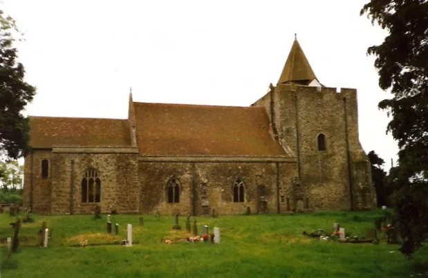
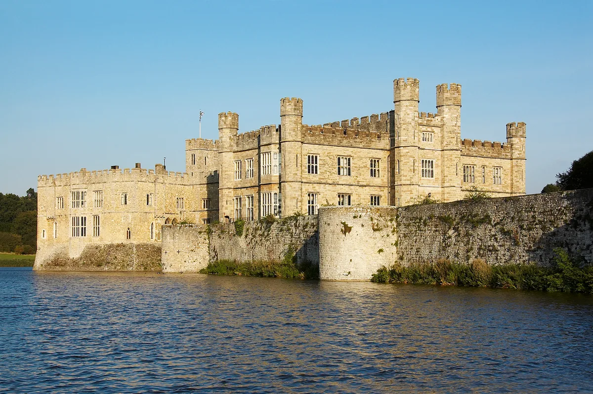
St Nicholas's Church has the second largest Norman tower in England. Leeds Priory was dissolved in 1539. To the east of the village is Leeds Castle. The church and the castle are Grade I listed buildings and the site of the priory is a scheduled monument. To the west and between Otham and Leeds the area of Caring is located. Caring has a number of modern farmhouses, in the style of an Oast house. Another attraction is the old Vineyard, a free tourist feature. It also has a primary school, Leeds and Broomfield Church of England Primary.
Sourced from Wikipedia under CC BY-SA 4.0.
- Coordinates
- 51.2463, 0.6066
- County
- Kent
- District
- Maidstone
- Parish
- Leeds
- Postcode
- ME17 1RX
- Parliamentary constituency
- Faversham and Mid Kent
Sources
- wikipedia: Leeds, Kent (CC BY-SA 4.0)
Other places nearby
Loading nearby places…
Nearby
 📷 5
📷 5Abbeys & priories · South East England
Leeds Priory
Leeds Priory — uk eclesiastic monument site.
 📷 5
📷 5Historic houses · South East England
Manor House
Manor House — historic building in Leeds, Maidstone, Kent, England, United Kingdom.
 📷 5
📷 5Historic churches · South East England
St Nicholas's Church, Leeds
St Nicholas's Church, Leeds — church in Leeds, Kent, England, UK.
 📷 5
📷 5Historic houses · South East England
Battel Hall
Battel Hall — house in Leeds, Maidstone, England, UK.
 📷 5
📷 5Historic bridges · London
Bridge At Fulling Mill Farm To North West Of Farmhouse
Bridge At Fulling Mill Farm To North West Of Farmhouse — Grade II listed building-listed bridge in england-london, United Kingdom.
 📷 5
📷 5Castles · South East England
Leeds Castle
Leeds Castle — castle in Kent, England, UK.
More museums in this region
 📷 5
📷 5Museums · South East England
Adjutant General's Corps Museum
Adjutant General's Corps Museum — military museum in Winchester, Hampshire, England, United Kingdom.
 📷 5
📷 5Museums · South East England
Alexander Keiller Museum
Alexander Keiller Museum — museum in South West England, United Kingdom.
 📷 5
📷 5Museums · South East England
Amberley Museum
Amberley Museum — open-air industrial museum in West Sussex, United Kingdom.
 📷 5
📷 5Museums · South East England
American Museum and Gardens
American Museum and Gardens — culture and arts museum near Bath, England, United Kingdom.
Frequently asked questions
- Where is Leeds, Kent?
- Leeds, Kent is in South East England, in the United Kingdom — coordinates 51.2463°, 0.6066°.
- Is Leeds, Kent wheelchair accessible?
- Partially — OpenStreetMap notes limited wheelchair access at Leeds, Kent. Check ahead for specific facilities.