Mountain bike trails · Scottish Lowlands
Larg Hill Blue Trail
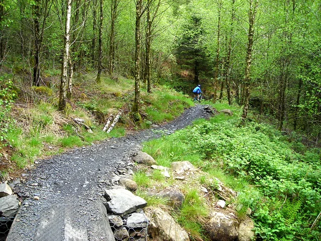
Larg Hill Blue Trail — a mtb trail in scotland lowlands.
Plan your visit
- Typical visit
- 1 h–2 h
About
Larg Hill Blue Trail is a mtb trail located in scotland lowlands, mapped by OpenStreetMap contributors. Detailed amenities and visitor information may vary; check the OSM page for the latest tagged metadata.
- Coordinates
- 54.9614, -4.4301
Sources
- osm: r18592347 (ODbL)
Other places nearby
Loading nearby places…
Nearby
 📷 3
📷 3Public art & sculpture · Scottish Lowlands
Gem Stane
Gem Stane — a public art in scotland-lowlands, United Kingdom.
Mountain bike trails · Scottish Lowlands
The Twister
The Twister — a mtb trail in scotland lowlands.
 📷 3
📷 3Archaeological sites · Scottish Lowlands
Kirroughtree Forest
Kirroughtree Forest — forest in Dumfries and Galloway, Scotland, UK.
 📷 5
📷 5Historic bridges · Scottish Lowlands
Craignine Bridge
Craignine Bridge — category B listed building-listed bridge in scotland-lowlands, United Kingdom.
Vineyards · Scottish Lowlands
Parliament Knowe
Parliament Knowe — a UK vineyard in scotland lowlands, producing English or Welsh wine from cool-climate grape varieties.
 📷 5
📷 5Historic bridges · Scottish Lowlands
Old Bridge of Palnure
Old Bridge of Palnure — category C listed building-listed bridge in scotland-lowlands, United Kingdom.
More places in this region
 Flagship📷 4
Mountain bike trails · Scottish Lowlands
Glentress 7stanes
Scotland's busiest mountain bike trail centre, near Peebles in the Tweed Valley.
Mountain bike trails · Scottish Lowlands
Quercus Trail
Quercus Trail — a mtb trail in scotland lowlands.
Mountain bike trails · Scottish Lowlands
Cyclewise Coaching Trail
Cyclewise Coaching Trail — a mtb trail in scotland lowlands.
Mountain bike trails · Scottish Lowlands
The Ae-Line
The Ae-Line — a mtb trail in scotland lowlands.
Frequently asked questions
- Where is Larg Hill Blue Trail?
- Larg Hill Blue Trail is in Scottish Lowlands, in the United Kingdom — coordinates 54.9614°, -4.4301°.