Parks · East of England
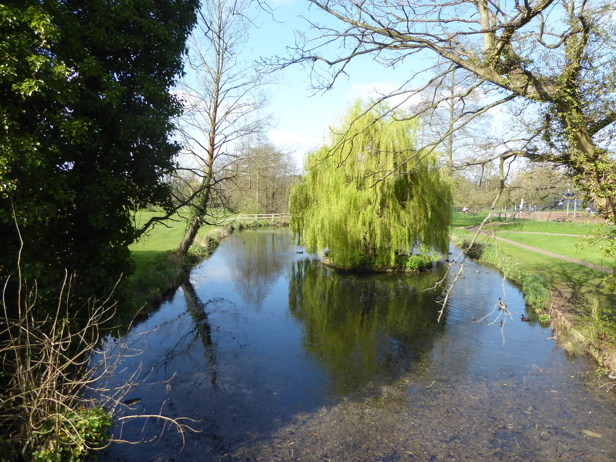
Landseer Park
Landseer Park — park in Ipswich, Suffolk, England.

Wikimedia Commons contributors — see linked file page for photographer and licence licence
Plan your visit
- Typical visit
- 1 h–2 h
- Nearest railway station
- Derby Road · 1.4 km
- Free entry
- Family-friendly
- Dog-friendly
About
Landseer Park is a public park in the United Kingdom. Wikidata describes it as: "park in Ipswich, Suffolk, England". Coordinates: 52.0394°, 1.1725°.
Photo gallery
Protected designations
- Area of Outstanding Natural Beauty: Suffolk Coast & Heaths
Designations sourced from Natural England open data under OGL v3.
From the Wikipedia article
Landseer Park is a large open green space north of Landseer Road, in the eastern suburbs of Ipswich, Suffolk, England. It is home to the Ipswich BMX Club. National Cycle Route 51 passes through the park. It is designated a County Wildlife Site.
Excerpt from Wikipedia under CC BY-SA 4.0. See the source article linked in Sources below.
Background
History
The area used to be wooded valley with a brook running down from east to west and into the River Orwell. The 1902 Ordnance Survey map shows an area known as Clapgate, which means a "gate on to a waste or common—which the animals going to the common can push open but which shuts automatically so that they cannot get out." There is also a wooded area marked as Alder Carr, a kind of land form also featured on the same map in the nearby Holywells Estate. This name is retained on the Ipswich Wildlife Audit 2013 map. The audit describes how up until the 1960s the site consisted of various mature trees set in woodland, alongside shrubland, and wetland features such as wet meadows, fen, streams and…
Sourced from Wikipedia under CC BY-SA 4.0.
- Coordinates
- 52.0394, 1.1725
- County
- Suffolk
- District
- Ipswich
- Parish
- Ipswich, unparished area
- Postcode
- IP3 0QG
- Parliamentary constituency
- Ipswich
- Nearest railway station
- Derby Road — 1.4 km
Sources
- wikidata: Q24538405 (CC0)
- wikipedia: Landseer Park (CC BY-SA 4.0)
- commons: Landseer Park - view west from east end of park.jpg (CC BY-SA 4.0)
Other places nearby
Loading nearby places…
Nearby
 📷 3
📷 3Memorials & monuments · East of England
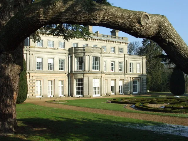
Holywells Park Stable Block And Tower
Holywells Park Stable Block And Tower — Grade II listed building-listed memorial in england-east, United Kingdom.
 📷 4
📷 4Historic houses · East of England
Cliff Brewery
Cliff Brewery — a Grade II*-listed historic house in england-east, United Kingdom.
 📷 3
📷 3Country parks · East of England
Holywells Park
Holywells Park — park in Ipswich, Suffolk, England.
 📷 3
📷 3Historic churches · East of England
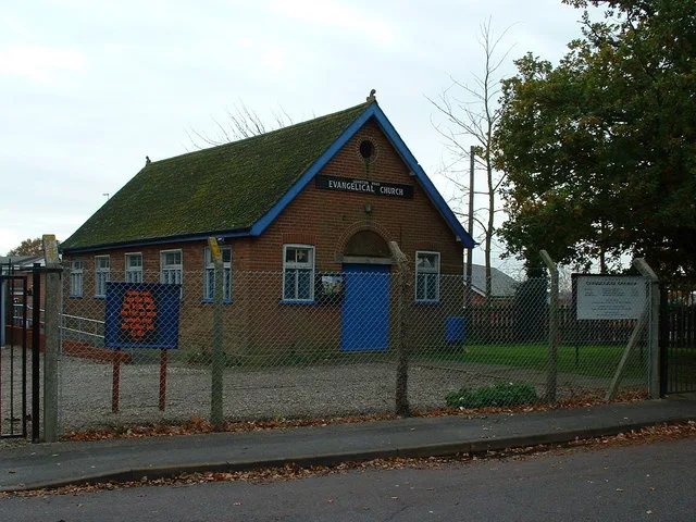
Leighton Road Evangelical Church
Leighton Road Evangelical Church — church in Ipswich, Suffolk, UK.
 📷 3
📷 3Public art & sculpture · East of England
Beyond the Horizon
Beyond the Horizon — a public art in england-east, United Kingdom.
 📷 5
📷 5Harbours & ports · East of England
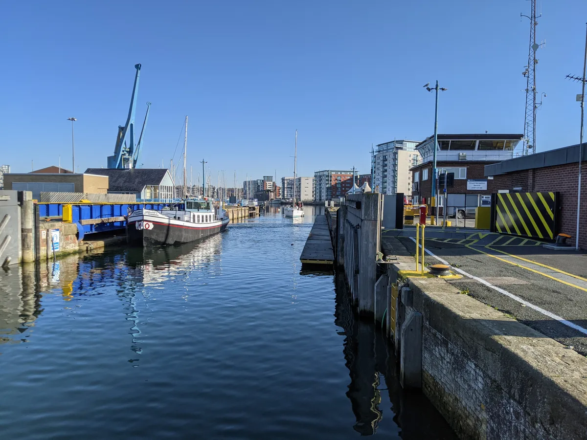
Port of Ipswich
Port of Ipswich — major port in Suffolk, England.
More parks in this region
 📷 5
📷 5Parks · East of England
Chantry Park
Chantry Park — park in Ipswich, Suffolk, England, UK.
 📷 3
📷 3Parks · East of England
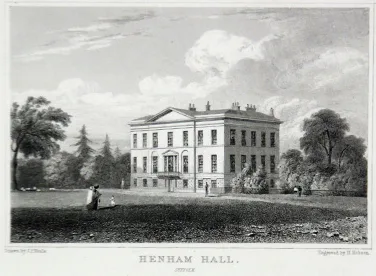
Henham Park
Henham Park — park in Wangford with Henham, East Suffolk, Suffolk, England, UK.
 📷 3
📷 3Parks · East of England
Wivenhoe Park
Wivenhoe Park — area of parkland near Colchester.
 📷 3
📷 3Parks · East of England
Alexandra Park
Alexandra Park — park in Ipswich, Suffolk, United Kingdom.
Frequently asked questions
- Where is Landseer Park?
- Landseer Park is in Suffolk, East of England, United Kingdom (postcode IP3 0QG), in the parish of Ipswich, unparished area.
- Is Landseer Park a protected site?
- Yes — Landseer Park is part of the Suffolk Coast & Heaths National Landscape (AONB).
- Is Landseer Park free to visit?
- Yes, Landseer Park is free to enter.
- How do I get to Landseer Park?
- The nearest railway station is Derby Road, about 1.4 km away. Drivers can navigate to postcode IP3 0QG.