Historic bridges · South West England
Landacre Lane
Landacre Lane is a historic bridge in the United Kingdom.

Wikimedia Commons contributors — see linked file page for photographer and licence licence
Plan your visit
- Typical visit
- 15 min–30 min
- Free entry
- Family-friendly
- Dog-friendly
About
Landacre Lane is a named historic bridge in the United Kingdom. Coordinates: 51.1122°, -3.6921°. This entry is part of The Great Britain Guide, a free, ad-free, open-data tourist directory.
Photo gallery
Heritage listing
Landacre Bridge carries Landacre Lane across the River Barle near Withypool on Exmoor in the English county of Somerset. It has been designated as a scheduled monument and a Grade II* listed building. The stone bridge has five arches each with a span of 9 feet (2.7 m). It has pointed arches with cutwaters. On either side of the road carriageway are parapets 0.6 metres (2 ft 0 in) high. It was built in the late medieval period with the first documentary evidence being from 1610. Restoration work was undertaken in 1875, and again following damage during flooding in 1952. The grassy banks are grazed by sheep and provide an environment for Montbretia, Ivy-leaved Bellflower and Bottle Sedge, with the wetter areas supporting Bog-bean, Marsh Speedwell, Bog Asphodel and Round-leaved Sundew.
From the Historic England List Entry under OGL v3.
Protected designations
- Site of Special Scientific Interest: North Exmoor SSSI
- Site of Special Scientific Interest: River Barle SSSI
- Site of Special Scientific Interest: South Exmoor SSSI
Designations sourced from Natural England open data under OGL v3.
From the Wikipedia article
Landacre Bridge carries Landacre Lane across the River Barle near Withypool on Exmoor in the English county of Somerset. It has been designated as a scheduled monument and a Grade II* listed building. The stone bridge has five arches each with a span of 9 feet (2.7 m). It has pointed arches with cutwaters. On either side of the road carriageway are parapets 0.6 metres (2 ft 0 in) high. It was built in the late medieval period with the first documentary evidence being from 1610. Restoration work was undertaken in 1875, and again following damage during flooding in 1952. The grassy banks are grazed by sheep and provide an environment for Montbretia, Ivy-leaved Bellflower and Bottle Sedge, with the wetter areas supporting Bog-bean, Marsh Speedwell, Bog Asphodel and Round-leaved Sundew. The river itself has populations of Watermilfoil and the hybrid between Monkeyflower and Blood-drop-emlets. The bridge has also given its name to a Morris Dance by Exmoor Border Morris, which they performed at the bridge in 2016.
Excerpt from Wikipedia under CC BY-SA 4.0. See the source article linked in Sources below.
- Coordinates
- 51.1122, -3.6921
- District
- Somerset
- Parish
- Withypool and Hawkridge
- Postcode
- TA24 7SD
- Parliamentary constituency
- Tiverton and Minehead
- Opening
- | inaugurated =
Sources
- osm: w28806865 (ODbL)
- wikipedia: Landacre Bridge (CC BY-SA 4.0)
- commons: Landacre bridge - geograph.org.uk - 80371.jpg (CC BY-SA 4.0)
Other places nearby
Loading nearby places…
Nearby
 📷 5
📷 5Castles · South West England
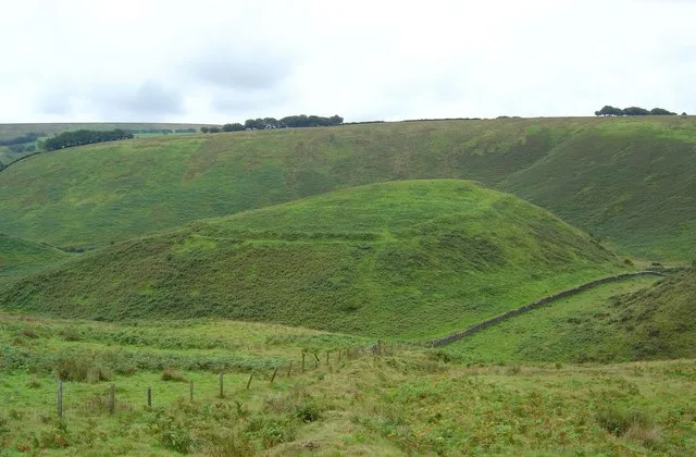
Cow Castle
Cow Castle — hillfort in Somerset, England, UK.
 📷 3
📷 3Stone circles · South West England
Withypool Stone Circle
Withypool Stone Circle — a stone circle in england-south-west, United Kingdom.
 📷 5
📷 5Historic bridges · South West England
Withypool Bridge
Withypool Bridge — Grade II* listed building-listed bridge in england-south-west, United Kingdom.
Campsites · South West England
Westermill Farm Campsite
Westermill Farm Campsite — a campsite in england south west.
 📷 3
📷 3Historic houses · South West England
Wheal Eliza
Wheal Eliza — a historic house in england-south-west, United Kingdom.
 📷 3
📷 3National parks · South West England
Exmoor National Park
Exmoor National Park — a other in england-south-west, United Kingdom.
More bridges in this region
 📷 5
📷 5Historic bridges · South West England
Albert Road Viaduct
Albert Road Viaduct is a historic bridge in the United Kingdom.
 📷 5
📷 5Historic bridges · South West England
Angarrack Viaduct
Angarrack Viaduct is a historic bridge in the United Kingdom.
 📷 5
📷 5Historic bridges · South West England
Avon Bridge
Avon Bridge is a historic bridge in the United Kingdom.
 📷 5
📷 5Historic bridges · South West England
Bailey Bridge
Bailey Bridge is a historic bridge in the United Kingdom.
Frequently asked questions
- Where is Landacre Lane?
- Landacre Lane is in South-West England, United Kingdom (postcode TA24 7SD), in the parish of Withypool and Hawkridge.
- Who owns Landacre Lane?
- Landacre Lane is owned by | maint =.
- Is Landacre Lane a listed building?
- Landacre Lane is officially recognised as scheduled monument listed.
- Is Landacre Lane a protected site?
- Yes — Landacre Lane is part of the North Exmoor SSSI Site of Special Scientific Interest and the River Barle SSSI Site of Special Scientific Interest.
- Is Landacre Lane free to visit?
- Yes, Landacre Lane is free to enter.
- How do I get to Landacre Lane?
- Drivers can navigate to postcode TA24 7SD. It sits within the Tiverton and Minehead parliamentary constituency.