Towns & cities · West Midlands
Lamport
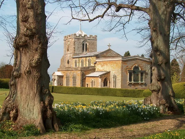
Lamport — village and civil parish in Northamptonshire, England, UK.

Wikimedia Commons contributors — see linked file page for photographer and licence licence
Plan your visit
- Typical visit
- 3 h–6 h
- Nearest railway station
- Pitsford and Brampton · 8.0 km
- Free entry
- Family-friendly
- Dog-friendly
About
Lamport is a town, city, village or settlement in the United Kingdom. It covers approximately 1,861 km². Recent population estimates put it at around 207 people. Address: NN6. Wikidata describes it as: "village and civil parish in Northamptonshire, England, UK". Coordinates: 52.3634°, -0.8927°.
Photo gallery
From the Wikipedia article
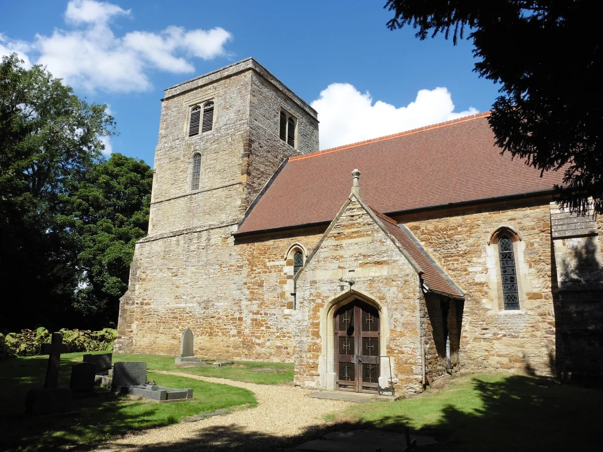
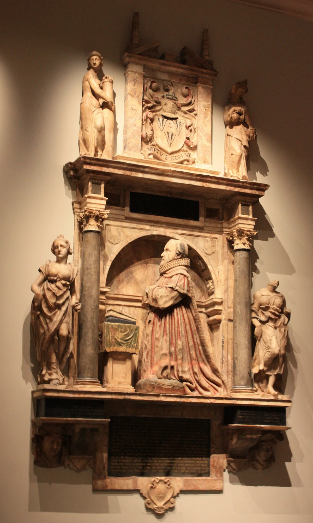
Lamport is a village and civil parish in West Northamptonshire, England. The village is on the A508, about 8 miles (13 km) south of Market Harborough and 8 miles (13 km) north of Northampton. Nearby is Lamport Hall. At the time of the 2001 census, the parish's population was 207 people, including Hanging Houghton and increasing to 225 at the 2011 Census. The name of the village means 'Long town'. Between 1859 and 1960, the village was served by Lamport railway station just north of the village running trains south to Northampton and north to Market Harborough. This is now part of the heritage Northampton & Lamport Railway, but as of 2018 the tracks have not yet been rebuilt as far as Lamport. The parish Church of All Saints is a Grade I listed building. It has a medieval tower but the remainder was built in the 17th, 18th and 19th centuries. The 19th century part is the south vestry, designed by G.F. Bodley. The church contains monuments to members of the Isham family who lived at Lamport Hall from 1560 to 1976. Lamport Hall, the seat of the Isham baronets for around 350 years, stands opposite the church. The Carnegie Medal-winning author Denys Watkins-Pitchford, who wrote under the pseudonym BB, was born in Lamport; his father was rector.
Excerpt from Wikipedia under CC BY-SA 4.0. See the source article linked in Sources below.
- Coordinates
- 52.3634, -0.8927
- District
- West Northamptonshire
- Parish
- Lamport
- Postcode
- NN6
- Parliamentary constituency
- Daventry
- Population
- 207
- Nearest railway station
- Pitsford and Brampton — 8 km
Sources
- wikidata: Q950810 (CC0)
- wikipedia: Lamport, Northamptonshire (CC BY-SA 4.0)
- commons: Lamport - geograph.org.uk - 324822.jpg (CC BY-SA 4.0)
Other places nearby
Loading nearby places…
Nearby
 📷 3
📷 3Historic churches · West Midlands
Church of All Saints, Lamport
Church of All Saints, Lamport — church in Lamport, Northamptonshire, England, UK.
 📷 4
📷 4Historic houses · West Midlands
Lamport Hall
Lamport Hall — a Grade I-listed historic house in england-west-midlands, United Kingdom.
 📷 4
📷 4Gardens · West Midlands
Maidwell Hall School
Maidwell Hall School — a garden in england-west-midlands, United Kingdom.
 ★ Iconic📷 3
Abbeys & priories · West Midlands
Church of St Mary the Virgin
Church of St Mary the Virgin — church in Maidwell, Northamptonshire, England, UK.
📷 4Cathedrals · West Midlands
Church of St Mary the Virgin
Church of St Mary the Virgin is a cathedral in the United Kingdom.
 📷 3
📷 3Hill forts · West Midlands
Faxton
Faxton — human settlement in Lamport, West Northamptonshire, England, UK.
More towns in this region
 Flagship📷 3
Towns & cities · West Midlands
Adderbury
Adderbury — village and civil parish in Cherwell district, Oxfordshire, England.
 Flagship📷 3
Towns & cities · West Midlands
Admington
Admington — village in Warwickshire, England, UK.
 Flagship📷 3
Towns & cities · West Midlands
Aldington
Aldington — village in Worcestershire, United Kingdom.
 Flagship📷 5
Towns & cities · West Midlands
Anstey
Anstey — large village in Leicestershire, England.
Frequently asked questions
- Where is Lamport?
- Lamport is in the West Midlands, United Kingdom (postcode NN6), in the parish of Lamport.
- Is Lamport free to visit?
- Yes, Lamport is free to enter.
- How do I get to Lamport?
- Drivers can navigate to postcode NN6. It sits within the Daventry parliamentary constituency.