Towns & cities · South West England
Lamorna
Lamorna — village in the parish of St Buryan, Lamorna and Paul, Cornwall.

Wikimedia Commons contributors — see linked file page for photographer and licence licence
Plan your visit
- Typical visit
- 3 h–6 h
- Nearest railway station
- Penzance · 7.0 km
- Free entry
- Family-friendly
- Dog-friendly
About
Lamorna is a town, city, village or settlement in the United Kingdom. Address: TR19. Wikidata describes it as: "village in the parish of St Buryan, Lamorna and Paul, Cornwall". Coordinates: 50.0630°, -5.5644°.
Photo gallery
Protected designations
- Area of Outstanding Natural Beauty: Cornwall
Designations sourced from Natural England open data under OGL v3.
From the Wikipedia article
Lamorna (Cornish: Nansmornow) is a village, valley and cove in west Cornwall, England, UK. It is on the Penwith peninsula approximately 4 miles (6 km) south of Penzance. Lamorna became popular with the artists of the Newlyn School, including Alfred Munnings, Laura Knight and Harold Knight, and is also known for former residents Derek and Jean Tangye who farmed land and wrote "The Minack Chronicles".
Excerpt from Wikipedia under CC BY-SA 4.0. See the source article linked in Sources below.
Background
History
, c. 1920]] The first record of tin streaming is in the 1380s when Alan Hoskyn was killed (murder was not proven) during a dispute with Trewoofe, after the stream was diverted. Mounds along the stream are evidence of past activity. Kemyel Mill was operated by the Hoskyn family from at least the 14th century until the 1920s, but is now a gift shop under different ownership. In the 17th century a privateer vessel owned by the Penrose family was regularly moored in the cove and was wrecked during a storm. At one time five cannon were on the sea floor in 15 m of water, and one is now at Stoney Cove, Leicestershire where it is used at an underwater archaeological training area. A number of…
Sourced from Wikipedia under CC BY-SA 4.0.
- Coordinates
- 50.0630, -5.5644
- District
- Cornwall
- Parish
- St. Buryan, Lamorna and Paul
- Postcode
- TR19
- Parliamentary constituency
- St Ives
- Nearest railway station
- Penzance — 7 km
Sources
- wikidata: Q827975 (CC0)
- wikipedia: Lamorna (CC BY-SA 4.0)
- commons: Former post office, Lamorna - geograph.org.uk - 781980.jpg (CC BY-SA 4.0)
Other places nearby
Loading nearby places…
Nearby
 📷 3
📷 3Natural landmarks · South West England
Chygurno
Chygurno — a other in england-south-west, United Kingdom.
 📷 3
📷 3Archaeological sites · South West England
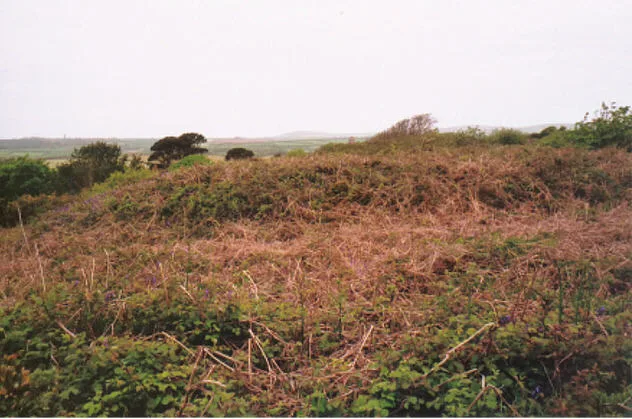
Round, courtyard house, stone hut circle settlement and field system 275m north of Castallack Carn
Round, courtyard house, stone hut circle settlement and field system 275m north of Castallack Carn — archaeological site in Cornwall, England, UK.
 📷 4
📷 4Lighthouses · South West England
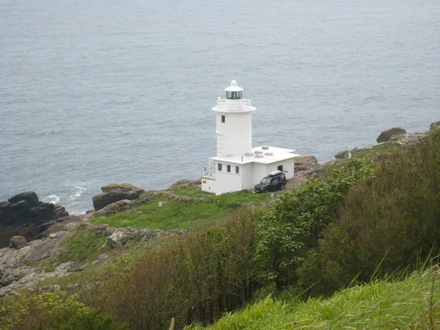
Tater Du Lighthouse
Tater Du Lighthouse — lighthouse in Cornwall, England.
 📷 3
📷 3Natural landmarks · South West England
The Pipers
The Pipers — a other in england-south-west, United Kingdom.
Campsites · South West England
Boleigh Farm Campsite
Boleigh Farm Campsite — a campsite in england south west.
 📷 5
📷 5Hill forts · South West England
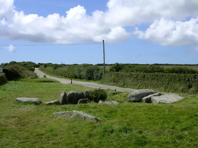
Tregiffian Burial Chamber
Tregiffian Burial Chamber — archaeological site in Cornwall, South West England, England, UK.
More towns in this region
 Flagship📷 10
Towns & cities · South West England
All Saints
All Saints — village and civil parish in Devon, England, UK.
 Flagship📷 10
Towns & cities · South West England
Axmouth
Axmouth — village and civil parish in Devon, England, UK.
 ★ Iconic📷 10
Towns & cities · South West England
Beer
Beer — village and civil parish in Devon, UK.
 Flagship📷 10
Towns & cities · South West England
Branscombe
Branscombe — village and civil parish in Devon, UK.
Frequently asked questions
- Where is Lamorna?
- Lamorna is in South-West England, United Kingdom (postcode TR19), in the parish of St. Buryan, Lamorna and Paul.
- Is Lamorna a protected site?
- Yes — Lamorna is part of the Cornwall National Landscape (AONB).
- Is Lamorna free to visit?
- Yes, Lamorna is free to enter.
- How do I get to Lamorna?
- The nearest railway station is Penzance, about 7.0 km away. Drivers can navigate to postcode TR19.