Forests & woodlands · London
King's Meads
King's Meads is a forest or woodland in the United Kingdom.
_-_geograph.org.uk_-_4367804.jpg?width=1200)
Wikimedia Commons contributors — see linked file page for photographer and licence licence
_-_geograph.org.uk_-_4367804.jpg)
Plan your visit
- Typical visit
- 1 h–3 h
- Nearest railway station
- Ware · 1.2 km
- Free entry
- Family-friendly
- Dog-friendly
About
King's Meads is a named forest, woodland or nature reserve in the United Kingdom. Coordinates: 51.8074°, -0.0455°. This entry is part of The Great Britain Guide, a free, ad-free, open-data tourist directory.
Photo gallery
From the Wikipedia article
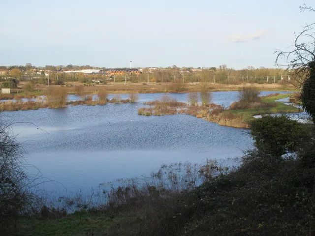
King's Meads is a nature reserve between the towns of Hertford and Ware in Hertfordshire. It is managed by the Herts and Middlesex Wildlife Trust, and with an area of 96 hectares (237 acres) it is the largest of the Trust's reserves. The site has been registered by the Trust as Common land, but the registration for some areas was disallowed due to objections. The name King's Meads was given to what were previously known as The Meads by Herts and Middlesex Wildlife Trust in 2015, although the original King's Meads—sold by Charles I to Hertford Corporation in 1627 for £100, equivalent to £23,102 in 2025—form only a small part of the nature reserve. Other parts of The Meads, particularly in Ware, have been in private and communal ownership since the Middle Ages, with names such a Lady's Mead, Widows Mead, Mill Mead, Broad Mead and Chadwell Mead. The site is water meadows which are subject to flooding in winter. 265 wildflower species have been recorded, including some which are rare in the county such as reflexed salt-marsh grass and lesser sea spurrey. It has large populations of water birds, and is an important site for over-wintering European stonechats. 119 bird species have been recorded. There is access from the Lee Navigation towpath and from Mead Lane. The New River runs through the site, and the A10 road passes over it on the Kingsmead Viaduct.
Excerpt from Wikipedia under CC BY-SA 4.0. See the source article linked in Sources below.
- Coordinates
- 51.8074, -0.0455
- County
- Hertfordshire
- District
- East Hertfordshire
- Parish
- Ware
- Postcode
- SG12 9LF
- Parliamentary constituency
- Hertford and Stortford
- Nearest railway station
- Ware — 1.2 km
- Official site
- www.hertswildlifetrust.org.uk
Sources
- osm: r10607277 (ODbL)
- wikipedia: King's Meads (CC BY-SA 4.0)
- commons: King's Meads north of Chadwell Spring (2) - geograph.org.uk - 4367804.jpg (CC BY-SA 4.0)
Other places nearby
Loading nearby places…
Nearby
 📷 5
📷 5Historic bridges · London
Bridge Over New River On The Meads At Tl 3481 1390
Bridge Over New River On The Meads At Tl 3481 1390 — Grade II listed building-listed bridge in england-london, United Kingdom.
 📷 5
📷 5Wildlife reserves · London
King's Meads
King's Meads — nature reserve in Ware, Hertfordshire, United Kingdom.
 📷 5
📷 5Historic bridges · London
Kingsmead Viaduct
Kingsmead Viaduct is a historic bridge in the United Kingdom.
 📷 5
📷 5Historic bridges · London
Bridge At Ngr Tl 3451 1372
Bridge At Ngr Tl 3451 1372 — Grade II listed building-listed bridge in england-london, United Kingdom.
📷 5Historic bridges · London
Bridge At Ngr Tl 3449 1373
Bridge At Ngr Tl 3449 1373 — Grade II listed building-listed bridge in england-london, United Kingdom.
 📷 5
📷 5Archaeological sites · London
Section of Ermine Street
Section of Ermine Street — a archaeological in england-london, United Kingdom.
More forests in this region
 📷 5
📷 5Forests & woodlands · London
Ackroyd Drive Green Link
Ackroyd Drive Green Link is a forest or woodland in the United Kingdom.
 📷 5
📷 5Forests & woodlands · London
Adams Road Bird Sanctuary
Adams Road Bird Sanctuary is a forest or woodland in the United Kingdom.
 📷 5
📷 5Forests & woodlands · London
Adelaide Nature Reserve
Adelaide Nature Reserve is a forest or woodland in the United Kingdom.
 📷 5
📷 5Forests & woodlands · London
Angel's Wings
Angel's Wings — Public artwork by Thomas Heatherwick.
Frequently asked questions
- Where is King's Meads?
- King's Meads is in Hertfordshire, London, United Kingdom (postcode SG12 9LF), in the parish of Ware.
- Is King's Meads free to visit?
- Yes, King's Meads is free to enter.
- How do I get to King's Meads?
- The nearest railway station is Ware, about 1.2 km away. Drivers can navigate to postcode SG12 9LF.