Towns & cities · North East England
King's Meaburn
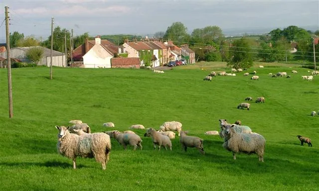
King's Meaburn — village and civil parish in Cumbria, UK.
.jpg?width=1200)
Wikimedia Commons contributors — see linked file page for photographer and licence licence
.jpg)
Plan your visit
- Typical visit
- 3 h–6 h
- Nearest railway station
- Appleby · 6.2 km
- Free entry
- Family-friendly
- Dog-friendly
About
King's Meaburn is a town, city, village or settlement in the United Kingdom. Recent population estimates put it at around 105 people. Address: CA10. Wikidata describes it as: "village and civil parish in Cumbria, UK". Coordinates: 54.5830°, -2.5830°.
Photo gallery
Protected designations
- Site of Special Scientific Interest: River Eden and Tributaries SSSI
- Area of Outstanding Natural Beauty: North Pennines
Designations sourced from Natural England open data under OGL v3.
From the Wikipedia article
King's Meaburn (English: ) is a village and civil parish in the Westmorland and Furness district, in the ceremonial county of Cumbria, England. It is located 5 miles (8.0 km) from Appleby-in-Westmorland and 10 miles (16 km) from Penrith, situated in the valley of the River Lyvennet. The river flows just to the west of the village and was crossed by a ford on the road to Newby and Morland. According to the 2001 census, the parish had a population of 105, which increased to 135 according to the 2011 Census. The village is renowned for hosting an annual Beer Festival at The White Horse.
Excerpt from Wikipedia under CC BY-SA 4.0. See the source article linked in Sources below.
Background
History
King's Meaburn was believed to be an Anglo-Saxon settlement during the 7th and 8th centuries, which is supported by the Anglo-Saxon origin of its name. The name "Meaburn" derives from "Meadburn," signifying a meadow by a stream. The name King's Meaburn goes back to the 12th century. The King at the time, Henry II, gave part of the village's lands to Sir Hugh de Morville, and the other part to his sister, Maud de Veteripont. Sir Hugh eventually fell out of favour with the King, after which the King reclaimed Sir Hugh's section of the land, and hence the name King's Meaburn. The land that belonged to Maud was and to this day (September 2008) is called Maulds Meaburn. One notable event in the…
Sourced from Wikipedia under CC BY-SA 4.0.
- Coordinates
- 54.5830, -2.5830
- District
- Westmorland and Furness
- Parish
- King's Meaburn
- Postcode
- CA10
- Parliamentary constituency
- Westmorland and Lonsdale
- Population
- 105
- Nearest railway station
- Appleby — 6.2 km
Sources
- wikidata: Q1024028 (CC0)
- wikipedia: King's Meaburn (CC BY-SA 4.0)
- commons: Kings Meaburn Ford (geograph 3893267).jpg (CC BY-SA 4.0)
Other places nearby
Loading nearby places…
Nearby
 📷 4
📷 4Other places · North East England
Littlebeck
Littlebeck in England North East, United Kingdom.
Caravan parks · North East England
Highgate Holiday Park
Highgate Holiday Park — a caravan park in england north east.
 📷 5
📷 5Castles · North East England
Bewley Castle
Bewley Castle — a castle in england-north-east, United Kingdom.
Caravan parks · North East England
Newby End Farm Caravan Site
Newby End Farm Caravan Site — a caravan park in england north east.
 📷 3
📷 3Public art & sculpture · Scottish Lowlands
Bolton Pinfold Cone
Bolton Pinfold Cone — a public art in scotland-lowlands, United Kingdom.
 📷 5
📷 5Towns & cities · Scottish Lowlands
Bolton
Bolton — village and civil parish in Cumbria, England, UK.
More towns in this region
 Flagship📷 3
Towns & cities · North East England
Newby
Newby — village and civil parish in Hambleton, North Yorkshire, England, UK.
 📷 5
📷 5Towns & cities · North East England
Archdeacon Newton
Archdeacon Newton — village and civil parish in County Durham, England, UK.
 📷 3
📷 3Towns & cities · North East England
Bampton
Bampton — village and civil parish in Eden, Cumbria, England.
 📷 3
📷 3Towns & cities · North East England
Bomby
Bomby — village in Cumbria, UK.
Frequently asked questions
- Where is King's Meaburn?
- King's Meaburn is in North-East England, United Kingdom (postcode CA10), in the parish of King's Meaburn.
- Is King's Meaburn a protected site?
- Yes — King's Meaburn is part of the River Eden and Tributaries SSSI Site of Special Scientific Interest and the North Pennines National Landscape (AONB).
- Is King's Meaburn free to visit?
- Yes, King's Meaburn is free to enter.
- How do I get to King's Meaburn?
- The nearest railway station is Appleby, about 6.2 km away. Drivers can navigate to postcode CA10.