Mountains & hills · East Midlands
Kinder Scout
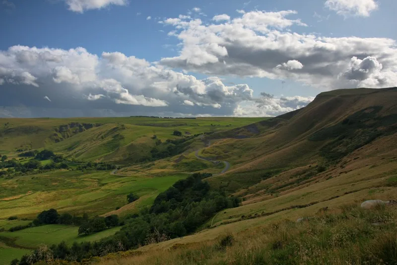
Kinder Scout — Named summit at 636 m.

Wikimedia Commons contributors — see linked file page for photographer and licence licence
_-_geograph.org.uk_-_80943.jpg)
Plan your visit
- Typical visit
- 3 h–8 h
- Best time of year
- Late spring – early autumn (May–Oct)
- Nearest railway station
- Edale · 4.4 km
- Free entry
- Dog-friendly
About
Kinder Scout is a named summit in the United Kingdom. Wikidata describes it as: "Named summit at 636 m.". Coordinates: 53.3848°, -1.8739°.
Photo gallery
Protected designations
- Site of Special Scientific Interest: Dark Peak SSSI
- National Nature Reserve: KINDER SCOUT
Designations sourced from Natural England open data under OGL v3.
From the Wikipedia article
Kinder Scout is a moorland plateau and National Nature Reserve in the Dark Peak of the Derbyshire Peak District in England. Part of the moor, at 636 metres (2,087 ft) above sea level, is the highest point in the Peak District, in Derbyshire and the East Midlands.
Excerpt from Wikipedia under CC BY-SA 4.0. See the source article linked in Sources below.
Background
Description
Kinder Scout is part of the Dark Peak Site of Special Scientific Interest, and part of the plateau was designated as a National Nature Reserve in 2009. Much of the area is owned and managed by the National Trust as part of its High Peak Estate. The city of Manchester and the Greater Manchester conurbation can be seen from the western edges, as can Winter Hill near Bolton and, in good weather, the mountains of Snowdonia in North Wales. To the north, across the Snake Pass, lie the high moors of Bleaklow and Black Hill, which are of similar elevation; the Pennine Way long-distance footpath crosses the three hills on its route from nearby Edale to Kirk Yetholm in Scotland. Kinder Scout featured…
Visiting
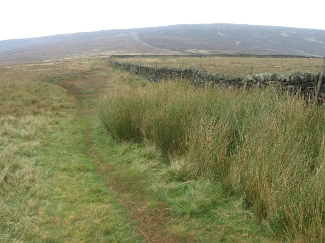
Kinder Scout is accessible from the villages of Hayfield and Edale in the High Peak of Derbyshire. It is a popular hiking location and the Pennine Way crosses Kinder Scout and the moors to the north. This has resulted in the erosion of the underlying peat, prompting work by Derbyshire County Council and the Peak District National Park Authority to repair it, in conjunction with the landowner, the National Trust. The Four Inns Walk, a competitive hiking event, crosses over Kinder Scout. The plateau was the location of the Kinder Scout Mass Trespass in 1932. From the National Park's inception, a large area of the high moorland north of Edale was designated as "open country". In 2003, the…
Sourced from Wikipedia under CC BY-SA 4.0.
- Coordinates
- 53.3848, -1.8739
- Address
- Chichester |publisher=Summersdale |isbn=978-1-84-953239-6 |pages=234–241 }}</ref>
- Nearest railway station
- Edale — 4.4 km
- Official site
- www.nuttalls.com
Sources
- osm: n29133498 (ODbL)
- wikipedia: Kinder Scout (CC BY-SA 4.0)
- commons: Kinder Scout (northwestern end) - geograph.org.uk - 80943.jpg (CC BY-SA 4.0)
Featured in this guide
Other places nearby
Loading nearby places…
Nearby
 Flagship📷 5
National parks · East Midlands
Peak District
Peak District is a Upland area in England.
 📷 3
📷 3Burial mounds & barrows · East Midlands
Kinder Low Bowl Barrow
Kinder Low Bowl Barrow — a burial mound in england-east-midlands, United Kingdom.
Wild swimming spots · East Midlands
Mermaid's pool
Mermaid's pool — a wild swimming in england east midlands.
 📷 3
📷 3Memorials & monuments · East Midlands
Edale Cross
Edale Cross — a memorial in england-east-midlands, United Kingdom.
 📷 3
📷 3Mountains & hills · East Midlands
Brown Knoll
Brown Knoll — Named summit at 569 m.
 📷 3
📷 3Mountains & hills · East Midlands
Grindslow Knoll
Grindslow Knoll — Named summit at 601 m.
More mountains in this region
 📷 3
📷 3Mountains & hills · East Midlands
Axe Edge Moor
Axe Edge Moor — Named summit at 551 m.
Mountains & hills · East Midlands
Beacon Hill
Beacon Hill — Named summit at 244.5 m.
Mountains & hills · East Midlands
Beacon Hill
Beacon Hill — Named summit at 105 m.
 📷 3
📷 3Mountains & hills · East Midlands
Black Edge - Summit
Black Edge - Summit — Named summit at 506.7 m.
Frequently asked questions
- Where is Kinder Scout?
- Kinder Scout is in the East Midlands, United Kingdom.
- Is Kinder Scout a protected site?
- Yes — Kinder Scout is part of the Dark Peak SSSI Site of Special Scientific Interest and the KINDER SCOUT National Nature Reserve.
- Is Kinder Scout free to visit?
- Yes, Kinder Scout is free to enter.
- How do I get to Kinder Scout?
- The nearest railway station is Edale, about 4.4 km away.