Other places · South East England
Interpretation of Ruins
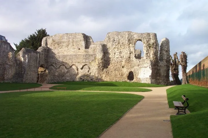
Interpretation of Ruins — Public artwork (sculpture) by Jens Flemming Sørensen.
.jpg?width=1200)
Wikimedia Commons contributors — see linked file page for photographer and licence licence
.jpg)
Plan your visit
- Typical visit
- 1 h–2 h
- Nearest railway station
- Reading · 0.6 km
About
Interpretation of Ruins is a place of interest in the United Kingdom. Wikidata describes it as: "Public artwork (sculpture) by Jens Flemming Sørensen.". Coordinates: 51.4559°, -0.9654°.
Photo gallery
Place summary
Interpretation of Ruins is an artistic installation located in Reading, South-East England. It is situated in an unparished area and is notable for its contemporary approach to the theme of ruins.
AI-generated from the structured facts on this page (operator, designation, listing, era). Not a substitute for visiting.
- Coordinates
- 51.4559, -0.9654
- District
- Reading
- Parish
- Reading, unparished area
- Postcode
- RG1 3BA
- Parliamentary constituency
- Reading Central
- Nearest railway station
- Reading — 0.6 km
- Opening
- sunrise-sunset
- Official site
- www.reading.gov.uk
Sources
- osm: n1619520712 (ODbL)
- commons: Sculpture by Jens Flemming Sørensen (Geograph-4388230-by-Bill-Nicholls).jpg (CC BY-SA 4.0)
Other places nearby
Loading nearby places…
Nearby
 📷 5
📷 5Other places · South East England
Robed Figure
Robed Figure — Public artwork (statue) by Elisabeth Frink.
 ★ Iconic📷 5
Abbeys & priories · South East England
Reading Abbey
Reading Abbey — ruined abbey in the English town of Reading, founded in 1121 by King Henry I.
 📷 5
📷 5Archaeological sites · South East England
Reading Abbey: a Cluniac and Benedictine monastery and Civil War earthwork
Reading Abbey: a Cluniac and Benedictine monastery and Civil War earthwork — archaeological site in Reading, Berkshire, England, UK.
 📷 5
📷 5Memorials & monuments · South East England
International Brigade Memorial
International Brigade Memorial is a memorial in the United Kingdom.
 📷 5
📷 5Memorials & monuments · South East England
Henry I Memorial Cross
Henry I Memorial Cross — a memorial in england-south-east, United Kingdom.
 📷 5
📷 5Historic houses · South East England
HM Prison Reading
HM Prison Reading — a Grade II*-listed historic house in england-south-east, United Kingdom.
More places in this region
 📷 5
📷 5Other places · South East England
Afloat
Afloat — Public artwork (sculpture) by Hamish Black.
 📷 5
📷 5Other places · South East England
Bexhill Farmers' Market
Bexhill Farmers' Market is a place of interest in the United Kingdom.
 📷 5
📷 5Other places · South East England
Denbigh Carving
Denbigh Carving — Public artwork (sculpture) by Joc Hare.
 📷 5
📷 5Other places · South East England
Dinosaur Egg
Dinosaur Egg — Public artwork (sculpture) by Dave Lucas.
Frequently asked questions
- Where is Interpretation of Ruins?
- Interpretation of Ruins is in South East England, in the United Kingdom — coordinates 51.4559°, -0.9654°. The nearest railway station is Reading, around 0.6 km away.
- What are the opening hours for Interpretation of Ruins?
- OpenStreetMap records opening hours as: sunrise-sunset. Check the official site to confirm seasonal changes.