Stadiums · West Midlands
Hyde Road
Hyde Road — stadium used by Belle Vue Aces 1928–1987.

Wikimedia Commons contributors — see linked file page for photographer and licence licence
Plan your visit
- Typical visit
- 1.5 h–3 h
- Nearest railway station
- Ashburys · 0.9 km
About
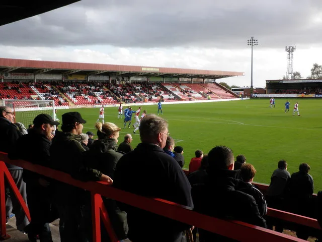
Hyde Road is a stadium in the United Kingdom. Wikidata describes it as: "stadium used by Belle Vue Aces 1928–1987". Coordinates: 53.4639°, -2.1947°.
Photo gallery
From the Wikipedia article
Hyde Road Stadium, in Manchester, England, often referred to as Belle Vue was the home of the Belle Vue Aces speedway team. The stadium's capacity was 40,000 and it was built in 1928 and used until demolished in 1987. It was claimed, incorrectly, to have been the first purpose-built speedway track in Britain.
Excerpt from Wikipedia under CC BY-SA 4.0. See the source article linked in Sources below.
Background
History
Part of the complex of buildings and attractions that formed Belle Vue Zoological Gardens the Hyde Road stadium was originally constructed in 1886, as an athletics ground. It was named after Hyde Road, a road which begins at the east end of Ardwick Green South in Ardwick and runs east towards Hyde. At the boundary between Gorton and Denton it continues as Manchester Road. In 1928, the owners of the gardens decided to convert the stadium for use as a speedway venue. It was already used at that time as a football ground for the Manchester Central F.C. The opening speedway meeting here was staged on 23 March 1929, when Arthur Franklyn won the Golden Helmet. Following the announcement that…
Sourced from Wikipedia under CC BY-SA 4.0.
- Coordinates
- 53.4639, -2.1947
- District
- Manchester
- Parish
- Manchester, unparished area
- Postcode
- M12 4RX
- Parliamentary constituency
- Gorton and Denton
- Nearest railway station
- Ashburys — 0.9 km
Sources
- wikidata: Q5953751 (CC0)
- wikipedia: Hyde Road (speedway) (CC BY-SA 4.0)
- commons: BelleVueSpeedway.jpg (CC BY-SA 4.0)
Other places nearby
Loading nearby places…
Nearby
 📷 3
📷 3Zoos & aquariums · West Midlands
Belle Vue Zoological Gardens
Belle Vue Zoological Gardens — former zoo, amusement park, exhibition hall complex and speedway in Manchester, England.
 📷 3
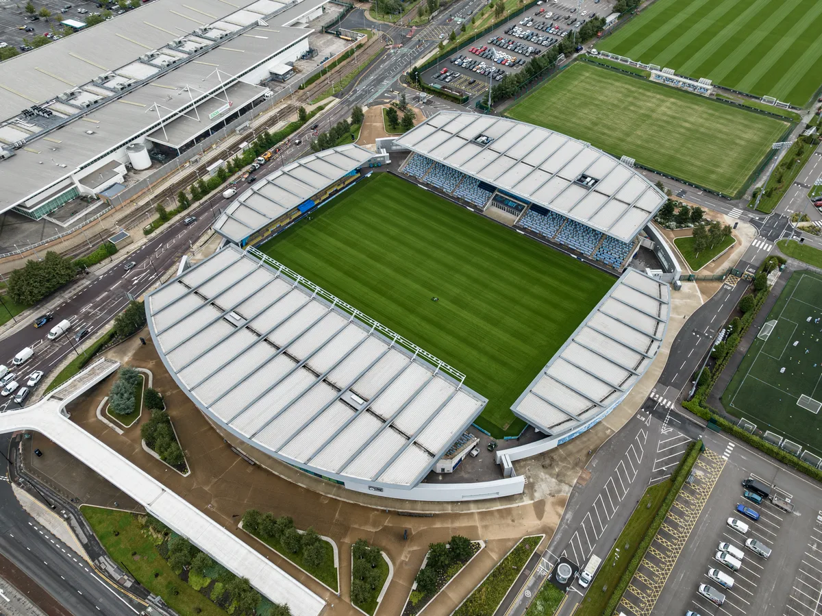
📷 3Stadiums · West Midlands
National Speedway Stadium
National Speedway Stadium — Stadium in Manchester, England.
 📷 5
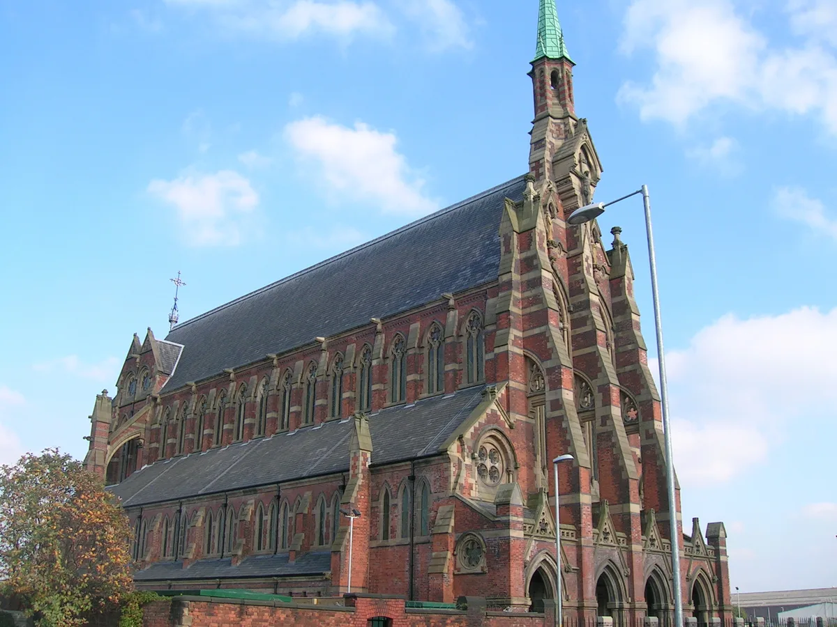
📷 5Historic churches · West Midlands
Gorton Monastery
Gorton Monastery — former Franciscan friary in Gorton, in east Manchester, England.
 📷 5
📷 5Theatres · West Midlands
Conway Cinema
Conway Cinema — a cinema heritage in england-west-midlands, United Kingdom.
📷 3Gardens · West Midlands
Space Studios Manchester
Space Studios Manchester — a garden in england-west-midlands, United Kingdom.
 📷 5
📷 5Theatres · West Midlands
Showcase Cinemas Manchester
Showcase Cinemas Manchester — a cinema heritage in england-west-midlands, United Kingdom.
More places in this region
 📷 3
📷 3Stadiums · West Midlands
Abbey Greyhound Stadium
Abbey Greyhound Stadium is a stadium in the United Kingdom.
 📷 3
📷 3Stadiums · West Midlands
Academy Stadium
Academy Stadium — football stadium in Manchester, UK.
 📷 3
📷 3Stadiums · West Midlands
Adams Park
Adams Park — football stadium in England.
 📷 3
📷 3Stadiums · West Midlands
Aggborough
Aggborough — English football stadium.
Frequently asked questions
- Where is Hyde Road?
- Hyde Road is in West Midlands, in the United Kingdom — coordinates 53.4639°, -2.1947°. The nearest railway station is Ashburys, around 0.9 km away.