Mountains & hills · North West England
Howes
Howes — Named summit at 590 m.

Wikimedia Commons contributors — see linked file page for photographer and licence licence
Plan your visit
- Typical visit
- 3 h–8 h
- Best time of year
- Late spring – early autumn (May–Oct)
- Free entry
- Dog-friendly
About
Howes is a named summit in the United Kingdom. Wikidata describes it as: "Named summit at 590 m.". Coordinates: 54.4862°, -2.7762°.
Photo gallery
Protected designations
- Site of Special Scientific Interest: River Eden and Tributaries SSSI
Designations sourced from Natural England open data under OGL v3.
From the Wikipedia article
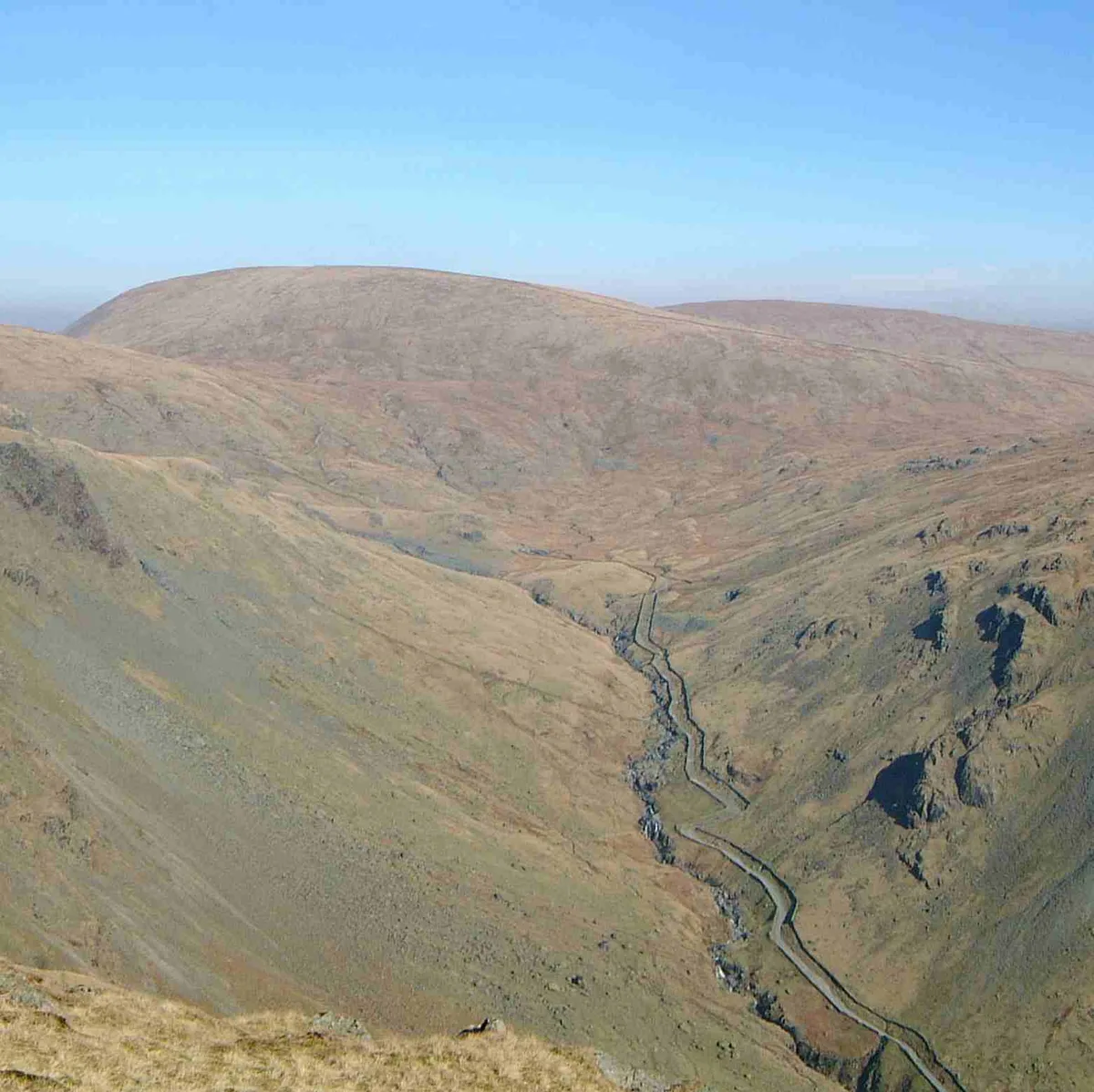
Howes is a subsidiary summit of Branstree in the English Lake District, south east of Selside Pike in Cumbria. It is the subject of a chapter of Wainwright's book The Outlying Fells of Lakeland. Wainwright's route starts at Swindale Head and follows Swindale Beck, then passes over Nabs Moor at 1,613 feet (492 m) to reach the summit of Howes at 1,930 feet (590 m), dropping down to Mosedale Beck to complete an anticlockwise circuit. Wainwright states that Howes is "merely a subsidiary and undistinguished summit on the broad eastern flank of Barnstree. There is nothing exciting about it" but commends the sight of Mosedale quarry and the waterfalls of Swindale Head which he describes as "extremely fine, up to Lodore standard".
Excerpt from Wikipedia under CC BY-SA 4.0. See the source article linked in Sources below.
- Coordinates
- 54.4862, -2.7762
Sources
- osm: n2462716268 (ODbL)
- wikipedia: Howes (fell) (CC BY-SA 4.0)
- commons: Summit Nabs Moor - geograph.org.uk - 801576.jpg (CC BY-SA 4.0)
Other places nearby
Loading nearby places…
Nearby
 📷 3
📷 3Natural landmarks · North West England
Selside Pike
Selside Pike — mountain in United Kingdom.
 📷 3
📷 3Mountains & hills · North West England
Branstree
Branstree — Named summit at 711.5 m.
 📷 3
📷 3Natural landmarks · North West England
Branstree
Branstree is a natural landmark in the United Kingdom.
 📷 3
📷 3Natural landmarks · North West England
Tarn Crag (Far Eastern Fells)
Tarn Crag (Far Eastern Fells) — fell in the Lake District, Cumbria, England.
 📷 3
📷 3Mountains & hills · North West England
Tarn Crag
Tarn Crag — Named summit at 663.9 m.
 📷 3
📷 3Mountains & hills · North West England
Seat Robert
Seat Robert — Named summit at 515 m.
More mountains in this region
 📷 3
📷 3Mountains & hills · North West England
Allen Crags
Allen Crags — Named summit at 785 m.
 📷 3
📷 3Mountains & hills · North West England
Alum Pot
Alum Pot — Open shaft pothole in North Yorkshire.
 📷 3
📷 3Mountains & hills · North West England
Arnside Knott
Arnside Knott — Named summit at 159 m.
 📷 3
📷 3Mountains & hills · North West England
Aye Gill Pike
Aye Gill Pike — Named summit at 556.3 m.
Frequently asked questions
- Where is Howes?
- Howes is in North-West England, United Kingdom.
- Is Howes a protected site?
- Yes — Howes is part of the River Eden and Tributaries SSSI Site of Special Scientific Interest.
- Is Howes free to visit?
- Yes, Howes is free to enter.