Historic churches · South West England
Horfield
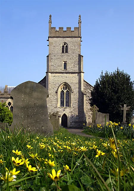
Horfield is a suburb of the city of Bristol, in southwest England. It lies on Bristol's northern edge, its border with Filton marking part of the boundary between Bristol and South Gloucestershire. Bi

Derek Harper — CC BY-SA 2.0 via Wikimedia Commons licence
Plan your visit
- Typical visit
- 30 min–1 h
- Free entry
About
Horfield is a suburb of the city of Bristol, in southwest England. It lies on Bristol's northern edge, its border with Filton marking part of the boundary between Bristol and South Gloucestershire. Bishopston lies directly to the south. Monks Park and Golden Hill are to the west. Lockleaze and Ashley Down are on the eastern fringe. The Gloucester Road (A38) runs north–south through the suburb. Horfield is also the name of an electoral ward for Bristol City Council. The ward includes Monks Park and Southmead Hospital, but does not include the southern part of Horfield, including Horfield Common and Horfield Prison, which is in Bishopston ward.
Photo gallery
From the Wikipedia article
Horfield is a suburb of the city of Bristol, in southwest England. It lies on Bristol's northern edge, its border with Filton marking part of the boundary between Bristol and South Gloucestershire. Bishopston lies directly to the south. Monks Park and Golden Hill are to the west. Lockleaze and Ashley Down are on the eastern fringe. The Gloucester Road (A38) runs north–south through the suburb. Horfield is also the name of an electoral ward for Bristol City Council. The ward includes Monks Park and Southmead Hospital, but does not include the southern part of Horfield, including Horfield Common and Horfield Prison, which is in Bishopston ward.
Excerpt from Wikipedia under CC BY-SA 4.0. See the source article linked in Sources below.
Background
History
The name is Anglo-Saxon in origin, and means "filthy open land" (Old English horu and feld). Horfield was a parish in the hundred of Berkeley in Gloucestershire, which included Bishopston, Golden Hill, Lockleaze and part of Ashley Down. Historically, the area had a reputation as a lawless place because Horfield Wood was the haunt of thieves and vagrants. The area remained rural until the early 19th century. Following the 1831 Bristol Riots, during which the local gaol burnt down, Horfield Prison was completed in 1847. A permanent military presence was established in the city with the completion of Horfield Barracks also in 1847. Horfield was mostly developed from the mid 19th century…
Sourced from Wikipedia under CC BY-SA 4.0.
- Coordinates
- 51.4900, -2.5805
- District
- Bristol, City of
- Parish
- Bristol, City of, unparished area
- Postcode
- BS7 0AL
- Parliamentary constituency
- Bristol North West
- Official site
- www.bristol.gov.uk
Sources
- wikipedia: Horfield (CC BY-SA 4.0)
Other places nearby
Loading nearby places…
Nearby
 📷 5
📷 5Museums · South West England
Memorial Stadium (Bristol)
Memorial Stadium (Bristol) — a museum in england-south-west, United Kingdom.
 📷 5
📷 5Historic churches · South West England
Church of the Holy Trinity with St Edmund
Church of the Holy Trinity with St Edmund — church in Bristol, England, UK.
 📷 5
📷 5Historic churches · South West England
Shahporan
Shahporan — a church in england-south-west, United Kingdom.
 📷 3
📷 3Memorials & monuments · South West England
Archibald Alec Leach (Cary Grant)
Archibald Alec Leach (Cary Grant) — a memorial in england-south-west, United Kingdom.
 📷 3
📷 3Theatres · South Wales
Premier Cinema Theatre
Premier Cinema Theatre in Wales South, United Kingdom.
 📷 3
📷 3Public art & sculpture · South West England
Wounded Lion
Wounded Lion — a public art in england-south-west, United Kingdom.
More places in this region
 📷 5
📷 5Historic churches · South West England
Abbey Church of St Mary and St Petroc
Abbey Church of St Mary and St Petroc — church in Bodmin, Cornwall, England, UK; former monastic church.
 📷 5
📷 5Historic churches · South West England
All Saints Church
All Saints Church — church in Dodington, West Somerset, England, UK.
 📷 5
📷 5Historic churches · South West England
All Saints Church, Otterhampton
All Saints Church, Otterhampton — church in Otterhampton, Somerset, England, UK.
 📷 5
📷 5Historic churches · South West England
All Saints Church, South Milton
All Saints Church, South Milton — church in South Milton, Devon, England, UK.
Frequently asked questions
- Where is Horfield?
- Horfield is in South-West England, United Kingdom (postcode BS7 0AL), in the parish of Bristol, City of, unparished area.
- Is Horfield free to visit?
- Yes, Horfield is free to enter.
- How do I get to Horfield?
- Drivers can navigate to postcode BS7 0AL. It sits within the Bristol North West parliamentary constituency.