Cemeteries · Yorkshire & the Humber
Holbeck Cemetery
Also known as: Holbeck
Holbeck Cemetery is a cemetery in the United Kingdom.

Wikimedia Commons contributors — see linked file page for photographer and licence licence
Plan your visit
- Typical visit
- 30 min–1 h
- Nearest railway station
- Moor Road · 1.4 km
- Free entry
- Dog-friendly
About
Holbeck Cemetery is a cemetery in Yorkshire of architectural and local-history note. Built or established in 1857, it dates from the Victorian period. It sits within the Leeds South parliamentary constituency. The nearest railway station is Moor Road, about 1.4 km away. Postcode area LS11.
Photo gallery
From the Wikipedia article
Holbeck is an inner city area of Leeds, West Yorkshire, England. It begins on the southern edge of Leeds city centre and mainly lies in the LS11 postcode district. The M1 and M621 motorways used to end/begin in Holbeck. Now the M621 is the only motorway that passes through the area since the end of the M1 moved to Hook Moor near Aberford. Since large parts of Holbeck have been vacated in preparation for the regeneration of the area, the district has in large parts suffered from a population exodus. Holbeck had a population of 5,505 in 2011. The district currently falls within the Beeston and Holbeck ward of Leeds City Council. The Leeds and Liverpool Canal also runs through Holbeck.
Excerpt from Wikipedia under CC BY-SA 4.0. See the source article linked in Sources below.
Background
History
<mapframe latitude="53.787368" longitude="-1.55714" zoom="13" width="250" height="186" text="The boundaries of Holbeck, as described in Simon Bradley's paper.">{ "type": "FeatureCollection", "features": [ { "type": "Feature", "properties": { "description": "The boundaries of Holbeck, as described in Bradley's article", "fill": "#ff0000", "fill-opacity": 0.2, "stroke": "#ff0000" }, "geometry": { "type": "Polygon", "coordinates": [ [ [ -1.564769, 53.780175 ], [ -1.566077, 53.780277 ], [ -1.567107, 53.780429 ], [ -1.567923, 53.780683 ], [ -1.568352, 53.780962 ], [ -1.568545, 53.781495 ], [ -1.568652, 53.782281 ], [ -1.568588, 53.783258 ], [ -1.568481, 53.784032 ], [ -1.568266, 53.784603 ], […
Sourced from Wikipedia under CC BY-SA 4.0.
- Coordinates
- 53.7779, -1.5597
- District
- Leeds
- Parish
- Leeds, unparished area
- Postcode
- LS11 8AF
- Parliamentary constituency
- Leeds South
- Established
- 1857
- Nearest railway station
- Moor Road — 1.4 km
Sources
- osm: w38308478 (ODbL)
- commons: Holbeck Cemetery 01.JPG (CC BY-SA 4.0)
- wikipedia: Holbeck (CC BY-SA 4.0)
Other places nearby
Loading nearby places…
Nearby
 📷 3
📷 3Historic houses · Yorkshire & the Humber
The Manor House Cad Beeston
The Manor House Cad Beeston — house in Leeds, West Yorkshire, England, UK.
 📷 5
📷 5Historic churches · Yorkshire & the Humber
South Leeds Al Noor
South Leeds Al Noor — a church in england-yorkshire, United Kingdom.
 📷 3
📷 3Historic churches · Yorkshire & the Humber
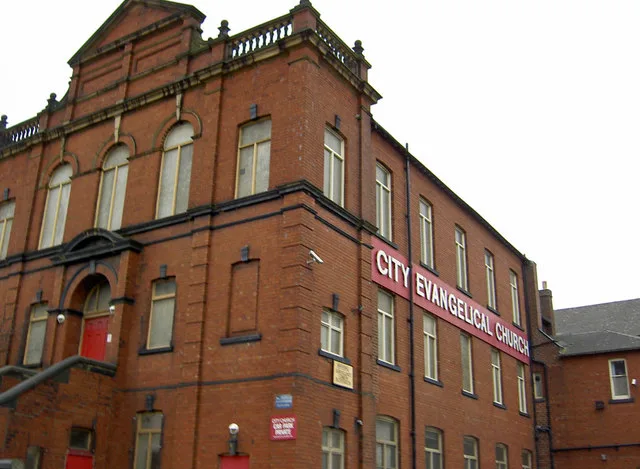
City Evangelical Church
City Evangelical Church — church in Leeds, West Yorkshire, England.
 📷 3
📷 3Theatres · Yorkshire & the Humber
Malvern Picture Palace
Malvern Picture Palace in England Yorkshire, United Kingdom.
 📷 5
📷 5Historic churches · Yorkshire & the Humber
Kashmir Muslims Welfare Associatian Leeds
Kashmir Muslims Welfare Associatian Leeds — a church in england-yorkshire, United Kingdom.
 📷 3
📷 3Historic houses · Yorkshire & the Humber
Joseph Priestley College
Joseph Priestley College — a Grade II*-listed historic house in england-yorkshire, United Kingdom.
Other cemeteries from this era
 📷 5
📷 5Cemeteries · London
Abney Park
Abney Park is a cemetery in the United Kingdom.
 📷 5
📷 5Cemeteries · London
Bells Hill Cemetery
Bells Hill Cemetery is a cemetery in the United Kingdom.
 📷 5
📷 5Cemeteries · London
Brockley and Ladywell Cemeteries
Brockley and Ladywell Cemeteries is a cemetery in the United Kingdom.
 📷 5
📷 5Cemeteries · London
Brompton Cemetery
Brompton Cemetery is a cemetery in the United Kingdom.
More cemeteries in this region
 📷 4
📷 4Cemeteries · Yorkshire & the Humber
Altofts Cemetery
Altofts Cemetery is a cemetery in the United Kingdom.
 📷 3
📷 3Cemeteries · Yorkshire & the Humber
Anlaby Tranby Lane Cemetery
Anlaby Tranby Lane Cemetery is a cemetery in the United Kingdom.
 📷 3
📷 3Cemeteries · Yorkshire & the Humber
Armley Hill Top Cemetery
Armley Hill Top Cemetery is a cemetery in the United Kingdom.
 📷 3
📷 3Cemeteries · Yorkshire & the Humber
Barmby on the Marsh Burial Ground
Barmby on the Marsh Burial Ground is a cemetery in the United Kingdom.
Frequently asked questions
- Where is Holbeck Cemetery?
- Holbeck Cemetery is in Yorkshire, United Kingdom (postcode LS11 8AF), in the parish of Leeds, unparished area.
- When was Holbeck Cemetery built?
- Built or established in 1857.
- How do I get to Holbeck Cemetery?
- The nearest railway station is Moor Road, about 1.4 km away. Drivers can navigate to postcode LS11 8AF.