Towns & cities · West Midlands
Hodnet
Hodnet — village and civil parish in Shropshire, England.

Wikimedia Commons contributors — see linked file page for photographer and licence licence
Plan your visit
- Typical visit
- 3 h–6 h
- Nearest railway station
- Prees · 9.2 km
- Free entry
- Family-friendly
- Dog-friendly
About
Hodnet is a town, city, village or settlement in the United Kingdom. Recent population estimates put it at around 1,456 people. Wikidata describes it as: "village and civil parish in Shropshire, England". Coordinates: 52.8538°, -2.5759°.
Photo gallery
From the Wikipedia article
Hodnet ( HOD-nit) is a village and civil parish in Shropshire, England. The town of Market Drayton lies 5.7 miles (9.2 km) north-east of the village. In 2011 the parish had a population of 1534.
Excerpt from Wikipedia under CC BY-SA 4.0. See the source article linked in Sources below.
Background
History
Evidence of a Bronze Age burial site was discovered during construction of the bypass in 2002. The Anglo-Saxon settlement, which had a chapel, was the centre of Odenet, a royal manor belonging to Edward the Confessor and held by Roger de Montgomery who supported William the Conqueror after 1066. Hodnet was recorded in the Domesday Book as Odenet. Baldwin de Hodenet built a motte and bailey castle in about 1082 possibly on a moated mound from earlier times. The timber castle was rebuilt in sandstone around 1196 but was burned down in 1264. In 1752 the estate passed from the Vernons, who had lived there for 250 years to the Hebers whose descendants still own the property. Hodnet Old Hall was…
Sourced from Wikipedia under CC BY-SA 4.0.
- Coordinates
- 52.8538, -2.5759
- District
- Shropshire
- Parish
- Hodnet
- Postcode
- TF9 3NL
- Parliamentary constituency
- The Wrekin
- Population
- 1,456
- Nearest railway station
- Prees — 9.2 km
- Official site
- www.neighbourhood.statistics.gov.uk
Sources
- wikidata: Q926751 (CC0)
- wikipedia: Hodnet (CC BY-SA 4.0)
- commons: Drayton Road, Hodnet - geograph.org.uk - 1441690.jpg (CC BY-SA 4.0)
Other places nearby
Loading nearby places…
Nearby
 📷 3
📷 3Historic churches · West Midlands
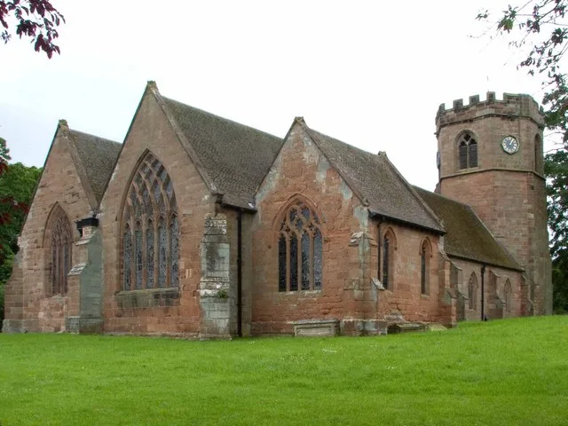
St Luke's Church, Hodnet
St Luke's Church, Hodnet — church in Hodnet, Shropshire, England, UK.
 📷 4
📷 4Memorials & monuments · West Midlands
The Portico
The Portico — a memorial in england-west-midlands, United Kingdom.
 📷 3
📷 3Gardens · West Midlands
Hodnet Hall
Hodnet Hall — country house and estate in Shropshire, England, UK.
 📷 3
📷 3Gardens · West Midlands
Wollerton Old Hall Garden
Wollerton Old Hall Garden — garden in Wollerton, Shropshire, England.
 📷 3
📷 3Historic houses · West Midlands
Animal pound 140m north west of Riverside, Wollerton
Animal pound 140m north west of Riverside, Wollerton — a Grade II*-listed historic house in england-west-midlands, United Kingdom.
 📷 3
📷 3Historic houses · North Wales
Hawkstone Hall
Hawkstone Hall — Grade I listed building in Shropshire, England, UK.
More towns in this region
 Flagship📷 3
Towns & cities · West Midlands
Adderbury
Adderbury — village and civil parish in Cherwell district, Oxfordshire, England.
 Flagship📷 3
Towns & cities · West Midlands
Admington
Admington — village in Warwickshire, England, UK.
 Flagship📷 3
Towns & cities · West Midlands
Aldington
Aldington — village in Worcestershire, United Kingdom.
 Flagship📷 5
Towns & cities · West Midlands
Anstey
Anstey — large village in Leicestershire, England.
Frequently asked questions
- Where is Hodnet?
- Hodnet is in the West Midlands, United Kingdom (postcode TF9 3NL), in the parish of Hodnet.
- Is Hodnet free to visit?
- Yes, Hodnet is free to enter.
- How do I get to Hodnet?
- Drivers can navigate to postcode TF9 3NL. It sits within the The Wrekin parliamentary constituency.