Other places · Scottish Islands
HMS Graph
HMS Graph in Inner Hebrides + Skye, United Kingdom.

Wikimedia Commons licence
Plan your visit
- Typical visit
- 1 h–2 h
About
HMS Graph is a place of interest in Inner Hebrides + Skye, United Kingdom — drawn from open-data sources for visitor reference. See the linked Wikipedia article for the full description.
Photo gallery
From the Wikipedia article
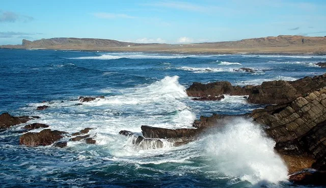
HMS Graph (pennant number P715) was a German Type VIIC U-boat captured and recommissioned by the British Royal Navy during World War II. Commissioned as U-570 in Nazi Germany's Kriegsmarine in mid-1941, she was attacked and captured on her first patrol. She provided the Royal Navy and United States Navy with useful information about German submarines. Refitted for use by the Allies, she carried out three combat patrols with a Royal Navy crew, becoming the only U-boat to see active service with both sides during the war. She was withdrawn from service in 1944 due to problems maintaining her. While being towed to the breakers for scrapping, she ran aground on the Isle of Islay, off the west coast of Scotland. Some of the wreckage was removed as scrap but some remains to the present day.
Excerpt from Wikipedia under CC BY-SA 4.0. See the source article linked in Sources below.
Background
Architecture
The submarine was built to the German Type VIIC design. She had a displacement of 769 t when surfaced, and 871 t when submerged. The boat was 67.10 m long, with a beam of 6.2 m, and a draught of 4.74 m. The diesel-electric propulsion system provided a maximum speed of 18.8 kn surfaced or 7.6 kn submerged. The U-570 had a fuel capacity of 109 LT which gave a range of 7500 nmi at 10 kn. The test depth of the submarine was 230 m. She also carried several machine guns. Blohm & Voss laid down U-570 at Hamburg on 21 May 1940. The submarine was launched on 20 March 1941.
Sourced from Wikipedia under CC BY-SA 4.0.
- Coordinates
- 55.8037, -6.4820
Sources
Other places nearby
Loading nearby places…
Nearby
Vineyards · Scottish Highlands
Islay, Am Burg, Coul
Islay, Am Burg, Coul — a UK vineyard in scotland highlands, producing English or Welsh wine from cool-climate grape varieties.
 📷 3
📷 3Mountains & hills · Scottish Highlands
Saligo Bay
Saligo Bay — bay in Argyll and Bute, Scotland, UK.
 📷 3
📷 3Beaches · Scottish Highlands
Tràigh Flèisgein Mhòr
Tràigh Flèisgein Mhòr is a beach in the United Kingdom.
 📷 3
📷 3Beaches · Scottish Highlands
Traigh Fleisgein Bheag
Traigh Fleisgein Bheag is a beach in the United Kingdom.
 📷 3
📷 3Mountains & hills · Scottish Highlands
Machir Bay
Machir Bay — bay in Argyll and Bute, Scotland, UK.
 📷 3
📷 3Beaches · Scottish Highlands
Traigh Machair
Traigh Machair is a beach in the United Kingdom.
More places in this region
.jpg?width=1200)
Other places · Scottish Islands
HMS Sturdy
HMS Sturdy in Scotland Islands, United Kingdom.
 📷 3
📷 3Other places · Scottish Islands
Inner Seas off the West Coast of Scotland
Inner Seas off the West Coast of Scotland in Scotland Islands, United Kingdom.

Other places · Scottish Islands
HMS Jason
HMS Jason in Scotland Islands, United Kingdom.
 📷 5
📷 5Other places · Scottish Islands
Ardhasaig
Ardhasaig in Scotland Islands, United Kingdom.
Frequently asked questions
- Where is HMS Graph?
- HMS Graph is in Scottish Islands, in the United Kingdom — coordinates 55.8037°, -6.4820°.