Mountains & hills · Mid Wales
High Vinnalls
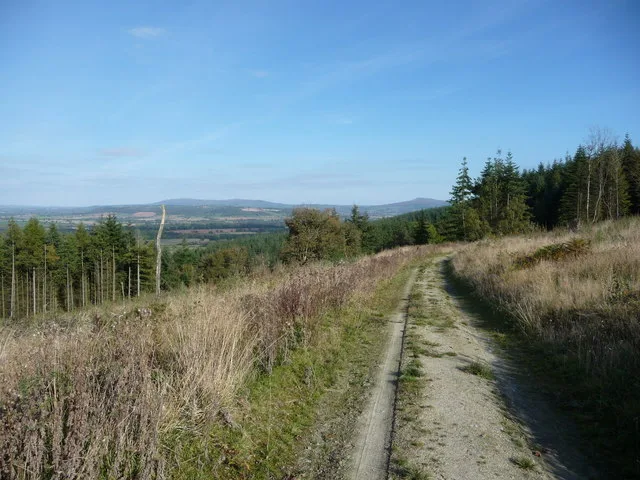
High Vinnalls — Named summit at 375 m.

Wikimedia Commons contributors — see linked file page for photographer and licence licence
Plan your visit
- Typical visit
- 3 h–8 h
- Best time of year
- Late spring – early autumn (May–Oct)
- Nearest railway station
- Ludlow · 4.4 km
- Free entry
- Dog-friendly
About
High Vinnalls is a named summit in the United Kingdom. Wikidata describes it as: "Named summit at 375 m.". Coordinates: 52.3472°, -2.7678°.
Photo gallery
Protected designations
- Site of Special Scientific Interest: Mortimer Forest SSSI
- Site of Special Scientific Interest: River Teme SSSI
- Area of Outstanding Natural Beauty: Shropshire Hills
Designations sourced from Natural England open data under OGL v3.
From the Wikipedia article
High Vinnalls is a hill in the English county of Herefordshire, though commonly considered a member of the Shropshire Hills. It is located in the parish of Pipe Aston, near the town of Ludlow, and is covered by Mortimer Forest (and ancient hunting forest). The Mortimer Trail runs for 30 miles (48 km) between Ludlow and Kington and passes over High Vinnalls. Before the Norman Conquest of 1066, High Vinnalls marked the western edge of the manor of Richard's Castle. The Mortimer family were then the Norman lords of the region for around 300 years. The High Vinnals is home to the Ludlow parkrun, which held its first event on February 13, 2016. That inaugural event had 139 participants and 18 volunteers. To date, after 399 events, there have been 8,897 different finishers and a total of 34,599 finishes. The course is slightly undulating and features the infamous "Dip of Doom." The parkrun takes place every Saturday at 9 a.m. It is free to participate, so please come and run, walk, or volunteer.
Excerpt from Wikipedia under CC BY-SA 4.0. See the source article linked in Sources below.
- Coordinates
- 52.3472, -2.7678
- District
- Herefordshire, County of
- Parish
- Richards Castle (Hereford)
- Postcode
- SY8 4ED
- Parliamentary constituency
- North Herefordshire
- Nearest railway station
- Ludlow — 4.4 km
Sources
- osm: n2897480630 (ODbL)
- wikipedia: High Vinnalls (CC BY-SA 4.0)
- commons: Summit road, High Vinnalls - geograph.org.uk - 1638014.jpg (CC BY-SA 4.0)
Featured in this guide
Other places nearby
Loading nearby places…
Nearby
 📷 3
📷 3Archaeological sites · Mid Wales
Mortimer Forest
Mortimer Forest — forest in Shropshire and Herefordshire, England.
 📷 3
📷 3Historic houses · Mid Wales
Aston Tump
Aston Tump — a historic house in wales-mid, United Kingdom.
 📷 5
📷 5Gardens · Mid Wales
Elan aqueduct
Elan aqueduct — a garden in wales-mid, United Kingdom.
 📷 3
📷 3Castles · Mid Wales
Richard's Castle
Richard's Castle — a castle in wales-mid, United Kingdom.
 📷 3
📷 3Historic churches · Mid Wales
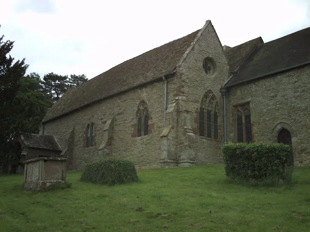
St Bartholomew's Church
St Bartholomew's Church — church in Richards Castle, Herefordshire, England, UK.
 📷 3
📷 3Memorials & monuments · Mid Wales
Tower about 10 metres east of Church of St Bartholomew
Tower about 10 metres east of Church of St Bartholomew — Grade I listed building-listed memorial in wales-mid, United Kingdom.
More mountains in this region
 📷 3
📷 3Mountains & hills · Mid Wales
Black Hill
Black Hill — Named summit at 640 m.
 📷 3
📷 3Mountains & hills · Mid Wales
Black Mixen
Black Mixen — Named summit at 650 m.
 📷 5
📷 5Mountains & hills · Mid Wales
Cadair Idris
Cadair Idris — Named summit at 893 m.
 📷 3
📷 3Mountains & hills · Mid Wales
Caer Caradoc
Caer Caradoc — Named summit at 459 m.
Frequently asked questions
- Where is High Vinnalls?
- High Vinnalls is in Mid Wales, United Kingdom (postcode SY8 4ED), in the parish of Richards Castle (Hereford).
- Is High Vinnalls a protected site?
- Yes — High Vinnalls is part of the Mortimer Forest SSSI Site of Special Scientific Interest and the River Teme SSSI Site of Special Scientific Interest.
- Is High Vinnalls free to visit?
- Yes, High Vinnalls is free to enter.
- How do I get to High Vinnalls?
- The nearest railway station is Ludlow, about 4.4 km away. Drivers can navigate to postcode SY8 4ED.