Towns & cities · West Midlands
Helmdon
Helmdon — village and civil parish in Northamptonshire, United Kingdom.

Wikimedia Commons contributors — see linked file page for photographer and licence licence
Plan your visit
- Typical visit
- 3 h–6 h
- Free entry
- Family-friendly
- Dog-friendly
About
Helmdon is a town, city, village or settlement in the United Kingdom. It covers approximately 1,555 km². Recent population estimates put it at around 893 people. Address: NN13. Wikidata describes it as: "village and civil parish in Northamptonshire, United Kingdom". Coordinates: 52.0890°, -1.1480°.
Photo gallery
From the Wikipedia article
Helmdon is a village and civil parish about 4 miles (6.4 km) north of Brackley in West Northamptonshire, England. The village is on the River Tove, which is flanked by meadows that separate the village into two. The parish includes the hamlets of Astwell and Falcutt and covers more than 1,550 acres (630 ha). The 2011 Census recorded a parish population of 899. The villages name means 'Helma's valley'. Alternatively, 'Helma (= helmet)' may be the name of a nearby hill. Early spellings also reflect confusion with Old English 'hamol' meaning, 'maimed'.
Excerpt from Wikipedia under CC BY-SA 4.0. See the source article linked in Sources below.
Background
Architecture
Helmdon Stone is a pale limestone of the Middle Jurassic Taynton Limestone Formation. It is a freestone, i.e. it can be sawn in any direction to make ashlar. The quarries were on the north side of the Tove Valley, on the low ridge just beyond the northern edge of the village. There were either side of the minor roads to Weston and Sulgrave, extending about 1000 yd east–west from just east of the footpath to Weston Farm to the boundary of what became the course of the Great Central Main Line. Stone may have been quarried in the parish since the late 13th century. Finely-carved stone used to build the Eleanor Cross at Hardingstone (started 1291) and to face the west front of the priory church…
Sourced from Wikipedia under CC BY-SA 4.0.
- Coordinates
- 52.0890, -1.1480
- District
- West Northamptonshire
- Parish
- Helmdon
- Postcode
- NN13
- Parliamentary constituency
- South Northamptonshire
- Population
- 893
- Official site
- www.helmdon.com
Sources
- wikidata: Q739758 (CC0)
- wikipedia: Helmdon (CC BY-SA 4.0)
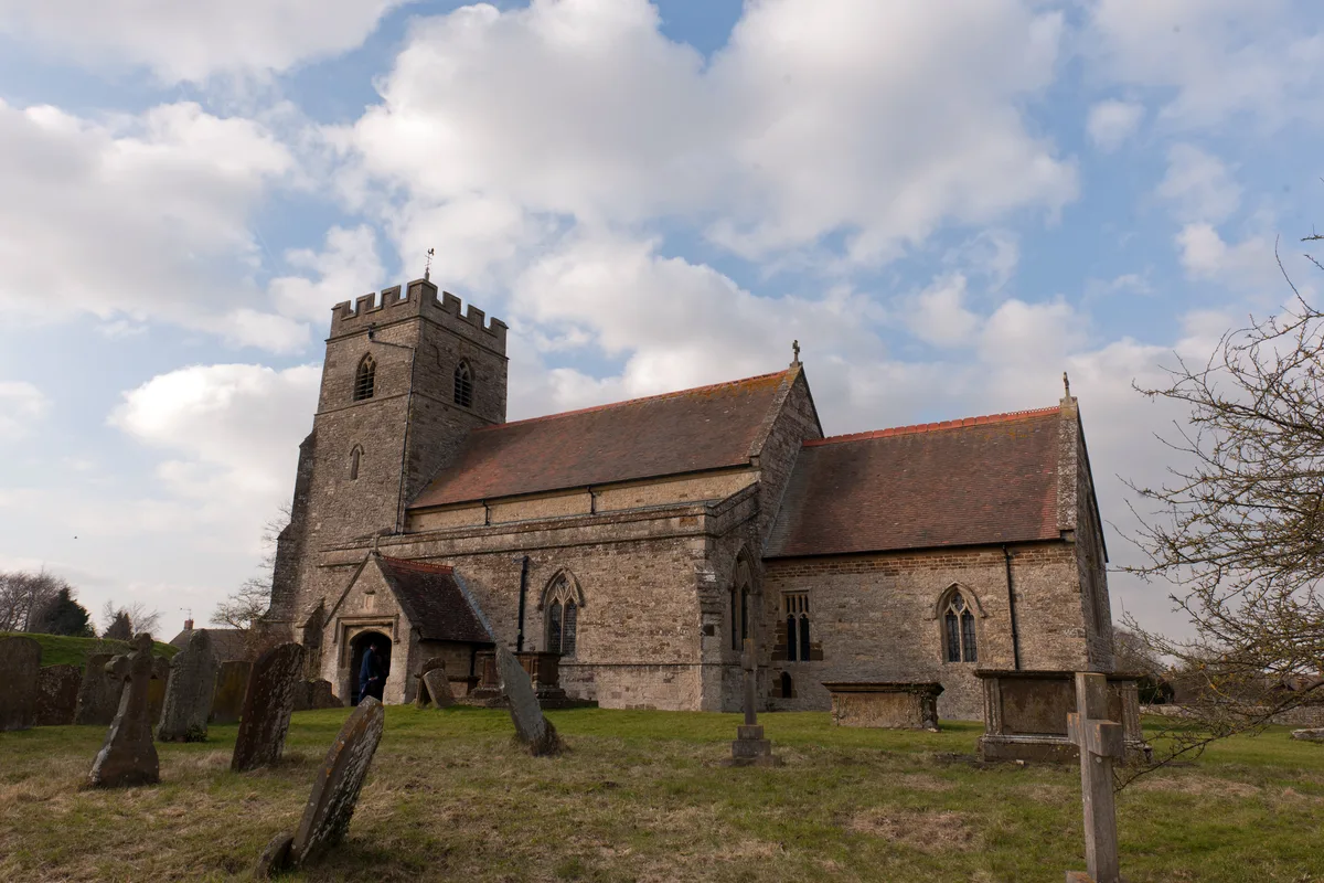
- commons: Helmdon Church - geograph.org.uk - 1338375.jpg (CC BY-SA 4.0)
Other places nearby
Loading nearby places…
Nearby
 📷 3
📷 3Natural landmarks · West Midlands
Tanks a Lot
Tanks a Lot — a other in england-west-midlands, United Kingdom.
 📷 3
📷 3Archaeological sites · West Midlands
Stuchbury
Stuchbury — a archaeological in england-west-midlands, United Kingdom.
 📷 3
📷 3Archaeological sites · West Midlands
Stuchbury monastic cell
Stuchbury monastic cell — a archaeological in england-west-midlands, United Kingdom.
 📷 3
📷 3Castles · West Midlands
Astwell Castle Farm (uninhabited portions)
Astwell Castle Farm (uninhabited portions) — scheduled monument-listed castle in england-west-midlands, United Kingdom.
 📷 3
📷 3Castles · West Midlands
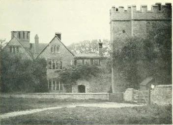
Astwell Castle
Astwell Castle — castle in Helmdon, West Northamptonshire, England, UK.
 Flagship📷 5
Towns & cities · West Midlands
Sulgrave
Sulgrave — village and civil parish in Northamptonshire, UK.
More towns in this region
 Flagship📷 3
Towns & cities · West Midlands
Adderbury
Adderbury — village and civil parish in Cherwell district, Oxfordshire, England.
 Flagship📷 3
Towns & cities · West Midlands
Admington
Admington — village in Warwickshire, England, UK.
 Flagship📷 3
Towns & cities · West Midlands
Aldington
Aldington — village in Worcestershire, United Kingdom.
 Flagship📷 5
Towns & cities · West Midlands
Anstey
Anstey — large village in Leicestershire, England.
Frequently asked questions
- Where is Helmdon?
- Helmdon is in the West Midlands, United Kingdom (postcode NN13), in the parish of Helmdon.
- Is Helmdon free to visit?
- Yes, Helmdon is free to enter.
- How do I get to Helmdon?
- Drivers can navigate to postcode NN13. It sits within the South Northamptonshire parliamentary constituency.