Towns & cities · South East England
Hazelbury Bryan
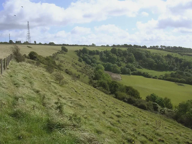
Hazelbury Bryan — village in Dorset, England, UK.

Wikimedia Commons contributors — see linked file page for photographer and licence licence
Plan your visit
- Typical visit
- 3 h–6 h
- Free entry
- Family-friendly
- Dog-friendly
About
Hazelbury Bryan is a town, city, village or settlement in the United Kingdom. Recent population estimates put it at around 484 people. Wikidata describes it as: "village in Dorset, England, UK". Coordinates: 50.8789°, -2.3632°.
Photo gallery
Protected designations
- Area of Outstanding Natural Beauty: Dorset
- Area of Outstanding Natural Beauty: Cranborne Chase & West Wiltshire Downs
Designations sourced from Natural England open data under OGL v3.
From the Wikipedia article
Hazelbury Bryan is a village and civil parish in the county of Dorset in southern England. It is situated in the Blackmore Vale, approximately five miles (eight kilometres) southwest of the small town of Sturminster Newton. The parish includes the hamlets of Droop, Kingston, Parkgate, Pidney, Pleck, Wonston and Woodrow. In the 2011 census the parish had 480 dwellings, 454 households and a population of 1,059. In 1201 the village name was spelled Hasebere. The name is derived from the Old English hæsel and bearu, meaning a hazel grove or wood, plus the manorial name of the Bryene or de Bryan family; Sir Guy de Bryan, of Woodsford Castle, gave his surname to the village in the 14th century when he married the daughter of the First Earl of Salisbury. The original settlement in the village is the hamlet of Droop, which is the location of the parish church. The church dates mostly from the 15th century, though it is perhaps the third building to have existed on the site. The other hamlets in the village are believed to have originated as a result of the Black Death twice afflicting the original settlement, and the villagers responding by burning it and rebuilding several smaller settlements on higher ground nearby. The geology of the parish consists of Oxford clay in the northwest, a band of Corallian limestone and sand running from southwest to northeast, and Kimmeridge clay in the southeast. Drainage consists of several small streams flowing northwest and north into the River Lydden and northeast into the River Stour. Hazelbury Bryan civil parish is the most populous parish within the electoral ward of Lydden Vale, which extends from Fifehead Neville parish in the north to Mappowder in the south and Glanvilles Wootton in the west. The population of the ward at the 2011 census was 1,967. Businesses there include The Antelope Pub and SPAR Red Barn. There is also Alec's Field, a park with a pavilion and a play park. The only buses that go to Hazelbury Bryan are a school…
Excerpt from Wikipedia under CC BY-SA 4.0. See the source article linked in Sources below.
- Coordinates
- 50.8789, -2.3632
- District
- Dorset
- Parish
- Hazelbury Bryan
- Postcode
- DT10 2DR
- Parliamentary constituency
- North Dorset
- Population
- 484
Sources
- wikidata: Q528437 (CC0)
- wikipedia: Hazelbury Bryan (CC BY-SA 4.0)
- commons: Hazelbury Bryan, parish church of St. Mary and St. James - geograph.org.uk - 506510.jpg (CC BY-SA 4.0)
Other places nearby
Loading nearby places…
Nearby
 📷 5
📷 5Memorials & monuments · South East England
Hazelbury Bryan War Memorial
Hazelbury Bryan War Memorial — Grade II listed building-listed memorial in england-south-east, United Kingdom.
 📷 5
📷 5Historic bridges · South East England
Kingstag Bridge
Kingstag Bridge — Grade II listed building-listed bridge in england-south-east, United Kingdom.
 📷 5
📷 5Towns & cities · South East England
Mappowder
Mappowder — village in Dorset, England, UK.
Vineyards · South East England
Small multivallate hillfort called Rawlsbury Camp
Small multivallate hillfort called Rawlsbury Camp — a UK vineyard in england south east, producing English or Welsh wine from cool-climate grape varieties.
 📷 5
📷 5Mountains & hills · South East England
Bulbarrow Hill
Bulbarrow Hill — Named summit at 275 m.
 📷 5
📷 5Towns & cities · South East England
Holwell
Holwell — village and civil parish in Dorset, England, UK.
More towns in this region
 Flagship📷 10
Towns & cities · South East England
Aldermaston
Aldermaston — village and civil parish in West Berkshire in England, UK.
 Flagship📷 10
Towns & cities · South East England
Aldingbourne
Aldingbourne — village and civil parish in Arun, West Sussex, UK.
 Flagship📷 10
Towns & cities · South East England
Aldington
Aldington — village and civil parish in the Ashford District of Kent, England.
 Flagship📷 10
Towns & cities · South East England
Aldworth
Aldworth — village and civil parish in the English county of Berkshire.
Frequently asked questions
- Where is Hazelbury Bryan?
- Hazelbury Bryan is in South-East England, United Kingdom (postcode DT10 2DR), in the parish of Hazelbury Bryan.
- Is Hazelbury Bryan a protected site?
- Yes — Hazelbury Bryan is part of the Dorset National Landscape (AONB) and the Cranborne Chase & West Wiltshire Downs National Landscape (AONB).
- Is Hazelbury Bryan free to visit?
- Yes, Hazelbury Bryan is free to enter.
- How do I get to Hazelbury Bryan?
- Drivers can navigate to postcode DT10 2DR. It sits within the North Dorset parliamentary constituency.