Museums · Yorkshire & the Humber
Hatfield, South Yorkshire
Hatfield is a town and civil parish in the City of Doncaster in South Yorkshire, England. It had a population of 17,236 at the 2011 Census. The town is located on the A18 road between Doncaster and S

Glyn Drury — CC BY-SA 2.0 via Wikimedia Commons licence
Plan your visit
- Typical visit
- 1.5 h–3 h
- Best time of year
- Year-round
- Family-friendly
- Limited wheelchair access
About
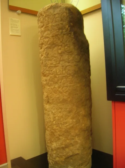
Hatfield is a town and civil parish in the City of Doncaster in South Yorkshire, England. It had a population of 17,236 at the 2011 Census. The town is located on the A18 road between Doncaster and Scunthorpe, and to the west of the M18 motorway. It shares a railway station with Stainforth on the line between Goole and Scunthorpe, and Doncaster. Recorded history in the parish extends as far back as 730, when Bede wrote about the Northumbrian King, Edwin, being killed in battle in the area.
Photo gallery
From the Wikipedia article
Hatfield is a town and civil parish in the City of Doncaster in South Yorkshire, England. It had a population of 17,236 at the 2011 Census. The town is located on the A18 road between Doncaster and Scunthorpe, and to the west of the M18 motorway. It shares a railway station with Stainforth on the line between Goole and Scunthorpe, and Doncaster. Recorded history in the parish extends as far back as 730, when Bede wrote about the Northumbrian King, Edwin, being killed in battle in the area.
Excerpt from Wikipedia under CC BY-SA 4.0. See the source article linked in Sources below.
Background
History
Hatfield (called Heathfield historically) is an ancient settlement and a palace of the Northumbrian Kingdom called Meicen, (or Meigen). On 12 October 633 AD, King Edwin was killed in the Battle of Hatfield Chase by Penda, King of Mercia. Penda was assisted in the battle by the Welsh under the leadership of Cadwallon ap Cadfan, Welsh (British) King of Gwynedd. Osric, a possible successor to Edwin, was also killed in the battle. Edwin's son Edfrith surrendered to Penda. It is thought that the battle gave rise to the name of Slay Pit Lane in Hatfield, where it is rumoured that the battle took place and the bodies of soldiers lay close by. Hatfield is mentioned in the Domesday Book as having a…
Sourced from Wikipedia under CC BY-SA 4.0.
- Coordinates
- 53.5800, -1.0000
- District
- Doncaster
- Parish
- Hatfield
- Postcode
- DN7 6QF
- Parliamentary constituency
- Doncaster East and the Isle of Axholme
Sources
- wikipedia: Hatfield, South Yorkshire (CC BY-SA 4.0)
Other places nearby
Loading nearby places…
Nearby
 📷 3
📷 3Historic houses · Yorkshire & the Humber
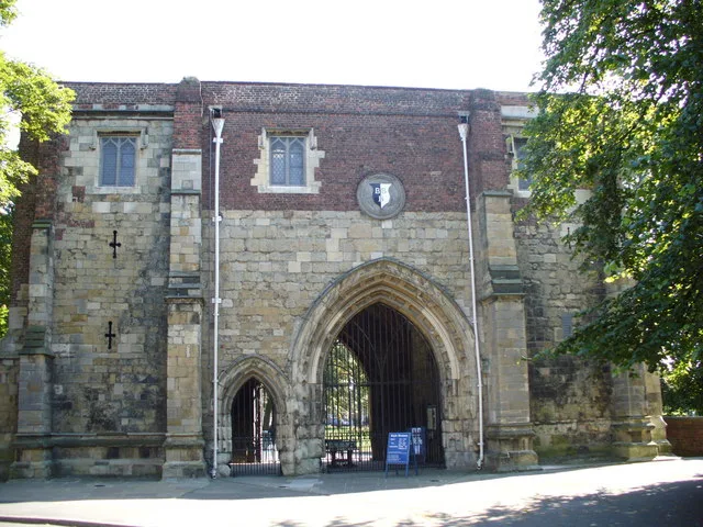
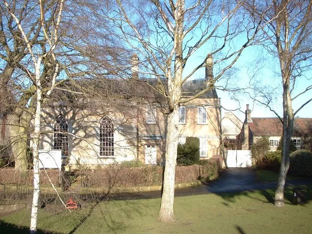
Hatfield Manor House
Hatfield Manor House — Grade I listed house in Hatfield, Doncaster, South Yorkshire, England, UK.
Campsites · Yorkshire & the Humber
Hatfield Outdoor Activity Centre
Hatfield Outdoor Activity Centre — a campsite in england yorkshire.
Caravan parks · Yorkshire & the Humber
Abbey Walk Mobile Home Park
Abbey Walk Mobile Home Park — a caravan park in england yorkshire.
 📷 3
📷 3Windmills · Yorkshire & the Humber
Lings Windmill
Lings Windmill is a windmill in the United Kingdom.
Caravan parks · Yorkshire & the Humber
Green Gates Caravn Site
Green Gates Caravn Site — a caravan park in england yorkshire.
Caravan parks · Yorkshire & the Humber
Whitegates Caravan Site
Whitegates Caravan Site — a caravan park in england yorkshire.
More museums in this region
 📷 3
📷 3Museums · Yorkshire & the Humber
Aldborough Roman Town
Aldborough Roman Town — Heritage Museum in Yorkshire, England, UK.
 📷 3
📷 3Museums · Yorkshire & the Humber
Bayle Museum
Bayle Museum — Local museum in Bridlington, England.
Museums · Yorkshire & the Humber
BD1 Gallery
BD1 Gallery — closed gallery in Bradford, West Yorkshire.
 📷 5
📷 5Museums · Yorkshire & the Humber
Beck Isle Museum
Beck Isle Museum — museum in Pickering, North Yorkshire, England, United Kingdom.
Frequently asked questions
- Where is Hatfield, South Yorkshire?
- Hatfield, South Yorkshire is in Yorkshire & the Humber, in the United Kingdom — coordinates 53.5800°, -1.0000°.
- Is Hatfield, South Yorkshire wheelchair accessible?
- Partially — OpenStreetMap notes limited wheelchair access at Hatfield, South Yorkshire. Check ahead for specific facilities.