Forts · East of England
Harwich Redoubt
Harwich Redoubt is a fort in the United Kingdom.
.jpg?width=1200)
Wikimedia Commons contributors — see linked file page for photographer and licence licence
.jpg)
Plan your visit
- Typical visit
- 45 min–1.5 h
- Nearest railway station
- Harwich Town · 0.3 km
- Family-friendly
About
Harwich Redoubt is a historic fort or fortified site in the United Kingdom. Coordinates: 51.9420°, 1.2890°. This entry is part of The Great Britain Guide, a free, ad-free, open-data tourist directory.
Photo gallery
Protected designations
- Area of Outstanding Natural Beauty: Suffolk Coast & Heaths
Designations sourced from Natural England open data under OGL v3.
From the Wikipedia article
Harwich Redoubt is a circular fort built in 1808 to defend the port of Harwich, Essex from Napoleonic invasion. The Harwich Society opens it to the public.
Excerpt from Wikipedia under CC BY-SA 4.0. See the source article linked in Sources below.
Background
Architecture
The Redoubt was built between 1808 and 1810 to protect the port of Harwich against the threat of Napoleonic invasion. It was part of the scheme proposed in 1805 that included the construction of 55 Martello Towers on the East Anglian coast, although 29 were actually built. Although similar in design to the earlier Dymchurch Redoubt and Eastbourne Redoubt, Harwich Redoubt differed in being designed to mount ten, rather than eleven guns. The redoubt was built on a hilltop just outside the town, giving an unrestricted field of fire across the estuaries of the River Stour and the River Orwell which form the entrance to the harbour, and allowed interlocking fire with the guns of Landguard Fort…
Description
Harwich Redoubt is built mainly from brick with stone details, and is circular in shape, about 61 m in diameter, with a central parade ground 26 m across. The ground floor consists of 18 casemates or vaulted chambers radiating from the parade ground. These casemates were used as barrack accommodation, stores, ablutions and latrines, and a cookhouse. Two of them form the magazine and shell store; hoists lifted ammunition from the lower level to the gun emplacements, which are on a terreplein or gun platform formed by the roof of the casemates, which has ten embrasures for cannon. The ditch is some 16 m wide and 7 m deep, with a brick counterscarp wall set a little lower than the level of the…
Sourced from Wikipedia under CC BY-SA 4.0.
- Coordinates
- 51.9420, 1.2890
- County
- Essex
- District
- Tendring
- Parish
- Harwich
- Postcode
- CO12 3NL
- Parliamentary constituency
- Harwich and North Essex
- Nearest railway station
- Harwich Town — 0.3 km
- Official site
- harwich-society.co.uk
Sources
- osm: w112316195 (ODbL)
- wikipedia: Harwich Redoubt (CC BY-SA 4.0)
- commons: Locals up in arms as alien spaceship lands on Harwich allotments (17315033826).jpg (CC BY-SA 4.0)
Other places nearby
Loading nearby places…
Nearby
 📷 3
📷 3Lighthouses · East of England
Harwich Low Lighthouse
Harwich Low Lighthouse — lighthouse in Harwich, Tendring, Essex, England, UK.
 📷 3
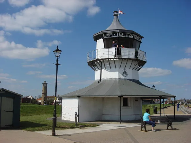
📷 3Museums · East of England
Maritime Museum
Maritime Museum — a museum in england-east, United Kingdom.
 📷 3
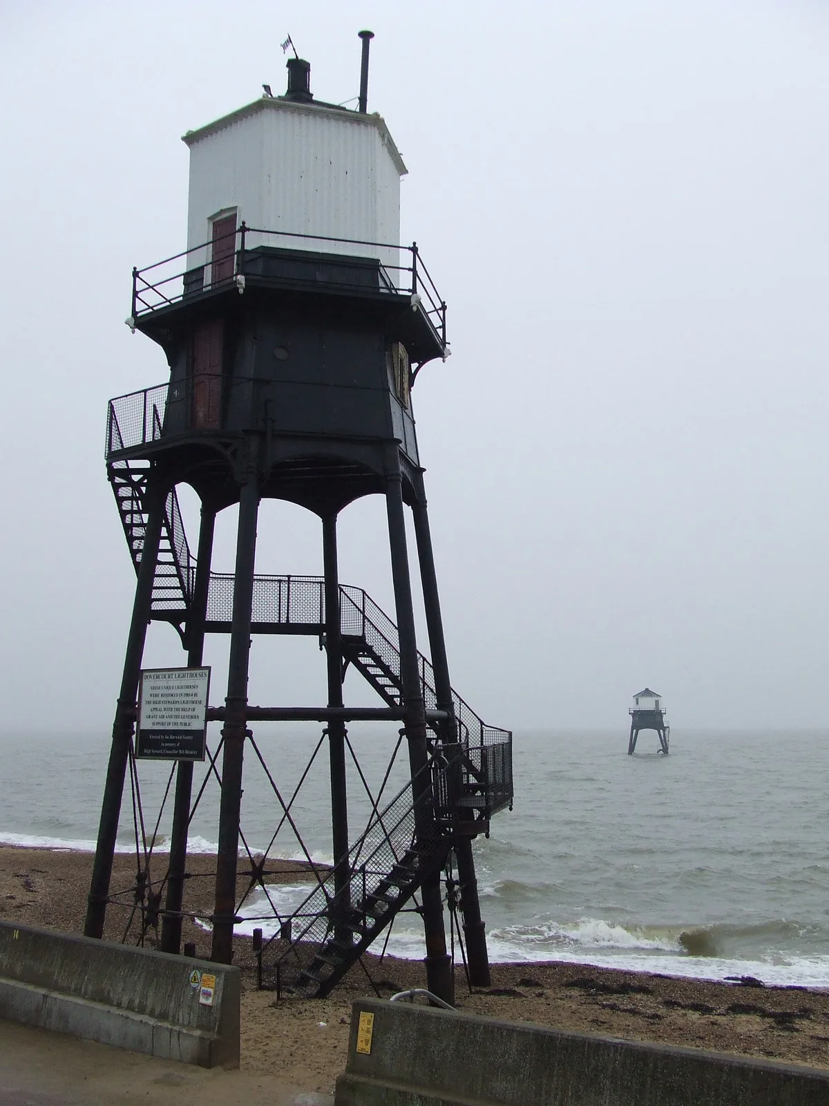
📷 3Lighthouses · East of England
Dovercourt Lighthouses
Dovercourt Lighthouses — lighthouses in England.
 📷 3
📷 3Museums · East of England
Harwich Museum
Harwich Museum — a museum in england-east, United Kingdom.
 📷 5
📷 5Museums · East of England
Harwich
Harwich — a museum in england-east, United Kingdom.
 📷 3
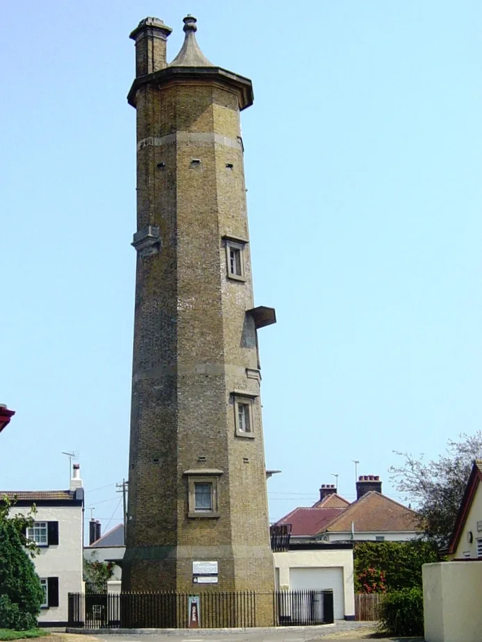
📷 3Lighthouses · East of England
Harwich High Lighthouse
Harwich High Lighthouse — lighthouse in Harwich, Essex, England, UK.
More forts in this region
Forts · East of England
Beacon Hill Fort
Beacon Hill Fort is a fort in the United Kingdom.
 📷 3
📷 3Forts · East of England
Landguard Fort
Landguard Fort is a fort in the United Kingdom.
.jpg?width=1200) 📷 3
📷 3Forts · East of England
The Battle of Maldon
The Battle of Maldon is a fort in the United Kingdom.
 📷 5
📷 5Forts · East of England
Obelisk On Opposite Side Of Road And Approximately 70 Metres South Of Woodham Mortimer Hall
Obelisk On Opposite Side Of Road And Approximately 70 Metres South Of Woodham Mortimer Hall — a martello broad in england-east, United Kingdom.
Frequently asked questions
- Where is Harwich Redoubt?
- Harwich Redoubt is in Essex, East of England, United Kingdom (postcode CO12 3NL), in the parish of Harwich.
- Is Harwich Redoubt a protected site?
- Yes — Harwich Redoubt is part of the Suffolk Coast & Heaths National Landscape (AONB).
- How do I get to Harwich Redoubt?
- The nearest railway station is Harwich Town, about 0.3 km away. Drivers can navigate to postcode CO12 3NL.