Mountains & hills · Scottish Lowlands
Harter Fell
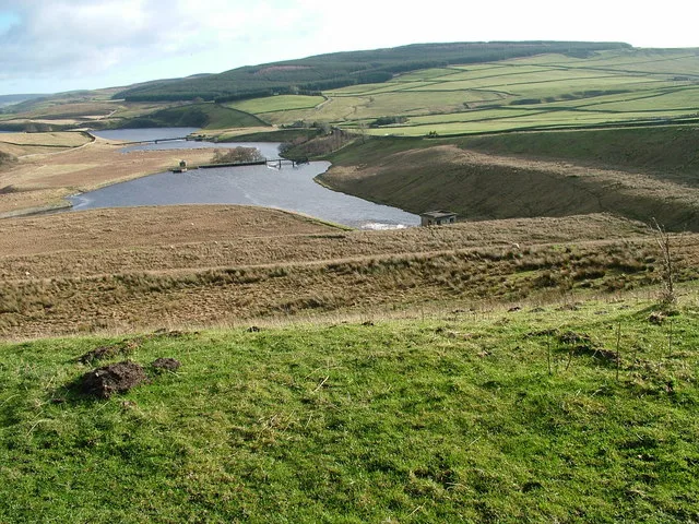
Harter Fell — Named summit at 480.7 m.

Wikimedia Commons contributors — see linked file page for photographer and licence licence
Plan your visit
- Typical visit
- 3 h–8 h
- Best time of year
- Late spring – early autumn (May–Oct)
- Free entry
- Dog-friendly
About
Harter Fell is a named summit in the Scottish Lowlands. The site is within the North Pennines National Landscape (AONB), and is a designated Site of Special Scientific Interest. It sits within the Bishop Auckland parliamentary constituency. Postcode area DL12.
Photo gallery
Protected designations
- Site of Special Scientific Interest: Lune Forest SSSI
- Site of Special Scientific Interest: Upper Teesdale SSSI
- Area of Outstanding Natural Beauty: North Pennines
Designations sourced from Natural England open data under OGL v3.
Place summary
Harter Fell is a mountain located in the Scottish Lowlands, within the parish of Lunedale. It is designated as a Site of Special Scientific Interest (SSSI) under both Lune Forest and Upper Teesdale, and is part of the North Pennines Area of Outstanding Natural Beauty (AONB).
AI-generated from the structured facts on this page (operator, designation, listing, era). Not a substitute for visiting.
- Coordinates
- 54.6092, -2.1133
- District
- County Durham
- Parish
- Lunedale
- Postcode
- DL12 0NU
- Parliamentary constituency
- Bishop Auckland
- Official site
- trigpointing.uk
Sources
- osm: n29537120 (ODbL)
- commons: Trig Point on Harter Fell - geograph.org.uk - 887429.jpg (CC BY-SA 4.0)
Other places nearby
Loading nearby places…
Nearby
 📷 4
📷 4Other places · North East England
Thringarth
Thringarth in England North East, United Kingdom.
 📷 4
📷 4Archaeological sites · North East England
Kirkcarrion
Kirkcarrion in England North East, United Kingdom.
 📷 3
📷 3Reservoirs & lochs · North East England
Rigg Farm and Stake Hill Meadows
Rigg Farm and Stake Hill Meadows in England North East, United Kingdom.
 📷 2
📷 2Reservoirs & lochs · North East England
West Park Meadows
West Park Meadows in England North East, United Kingdom.
 📷 4
📷 4Castles · North East England
Bowbank
Bowbank in England North East, United Kingdom.
 📷 5
📷 5Reservoirs & lochs · North East England
Grassholme Reservoir
Grassholme Reservoir — reservoir in County Durham, England, UK.
More mountains in this region
 📷 3
📷 3Mountains & hills · Scottish Lowlands
Andrewhinney Hill
Andrewhinney Hill — Named summit at 677 m.
 📷 3
📷 3Mountains & hills · Scottish Lowlands
Arbory Hill
Arbory Hill — Named summit at 429 m.
 📷 3
📷 3Mountains & hills · Scottish Lowlands
Auchenton Hill ( East Mount Lowther)
Auchenton Hill ( East Mount Lowther) — Named summit at 631 m.
 📷 3
📷 3Mountains & hills · Scottish Lowlands
Bakestall
Bakestall — Named summit at 673.5 m.
Frequently asked questions
- Where is Harter Fell?
- Harter Fell is in the Scottish Lowlands, United Kingdom (postcode DL12 0NU), in the parish of Lunedale.
- Is Harter Fell a protected site?
- Yes — Harter Fell is part of the Lune Forest SSSI Site of Special Scientific Interest and the Upper Teesdale SSSI Site of Special Scientific Interest.
- Is Harter Fell free to visit?
- Yes, Harter Fell is free to enter.
- How do I get to Harter Fell?
- Drivers can navigate to postcode DL12 0NU. It sits within the Bishop Auckland parliamentary constituency.