Towns & cities · East Midlands
Harlaxton
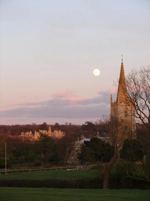
Harlaxton — village in Lincolnshire, UK.

Wikimedia Commons contributors — see linked file page for photographer and licence licence
Plan your visit
- Typical visit
- 3 h–6 h
- Nearest railway station
- Grantham · 3.9 km
- Free entry
- Family-friendly
- Dog-friendly
About
Harlaxton is a town, city, village or settlement in the United Kingdom. Recent population estimates put it at around 705 people. Address: NG31. Wikidata describes it as: "village in Lincolnshire, UK". Coordinates: 52.8841°, -0.6870°.
Photo gallery
From the Wikipedia article
Harlaxton is a village and civil parish in the South Kesteven district of Lincolnshire, England. It lies on the edge of the Vale of Belvoir and just off the A607, 2 miles (3 km) south-west from Grantham and 12 miles (19 km) north-east from Melton Mowbray.
Excerpt from Wikipedia under CC BY-SA 4.0. See the source article linked in Sources below.
Background
History
Aerial photography has revealed that Harlaxton was the site of a unique Neolithic long barrow enclosure that formed a cursus, believed to have been made of multiple rows of standing wooden columns. Dilwyn Jones has speculated that the form of the complex indicates that Harlaxton was an important inter-regional link during the Neolithic period. The village is mentioned in the 1086 Domesday Book as "Herlavestune". The name derives from the Old English Herelaf+tun, meaning "estate or farm of Herelaf". In 1740 a burial urn was uncovered in the village containing Roman coins. The history of Harlaxton village is tied to that of Harlaxton Manor. It was purchased and occupied by the De Ligne family…
Sourced from Wikipedia under CC BY-SA 4.0.
- Coordinates
- 52.8841, -0.6870
- County
- Lincolnshire
- District
- South Kesteven
- Parish
- Harlaxton
- Postcode
- NG31
- Parliamentary constituency
- Grantham and Bourne
- Population
- 705
- Nearest railway station
- Grantham — 3.9 km
- Official site
- www.neighbourhood.statistics.gov.uk
Sources
- wikidata: Q2089957 (CC0)
- wikipedia: Harlaxton (CC BY-SA 4.0)
- commons: Harlaxton Lincs St Peters.JPG (CC BY-SA 4.0)
Other places nearby
Loading nearby places…
Nearby
 📷 3
📷 3Historic houses · East Midlands
Harlaxton village cross
Harlaxton village cross — a Grade II*-listed historic house in england-east-midlands, United Kingdom.
 📷 4
📷 4Historic churches · East Midlands
St Mary and St Peter’s Church, Harlaxton
St Mary and St Peter’s Church, Harlaxton — church in Harlaxton, Lincolnshire, England, UK.
 📷 3
📷 3Historic bridges · East Midlands
Bridge 800 Metres North West Of Harlaxton Manor
Bridge 800 Metres North West Of Harlaxton Manor — Grade II* listed building-listed bridge in england-east-midlands, United Kingdom.
 📷 3
📷 3Public art & sculpture · East Midlands
Harlaxton Village Sign
Harlaxton Village Sign — a public art in england-east-midlands, United Kingdom.
 📷 3
📷 3Holy wells · East Midlands
Gatehouse 400 Metres North West Of Harlaxton Manor And Attached Boundary Walls
Gatehouse 400 Metres North West Of Harlaxton Manor And Attached Boundary Walls — wall in Harlaxton, South Kesteven, England, UK.
 📷 5
📷 5Historic houses · East Midlands
Harlaxton Manor
Harlaxton Manor — a Grade I-listed historic house in england-east-midlands, United Kingdom.
More towns in this region
 Flagship📷 3
Towns & cities · East Midlands
Aldborough
Aldborough — village in Norfolk, England, UK.
 Flagship📷 4
Towns & cities · East Midlands
Alderford
Alderford — village and civil parish in Norfolk, UK.
 Flagship📷 5
Towns & cities · East Midlands
Ashmanhaugh
Ashmanhaugh — village in Norfolk, England, UK.
 Flagship📷 3
Towns & cities · East Midlands
Attlebridge
Attlebridge — a village located in Broadland, United Kingdom.
Frequently asked questions
- Where is Harlaxton?
- Harlaxton is in Lincolnshire, the East Midlands, United Kingdom (postcode NG31), in the parish of Harlaxton.
- Is Harlaxton free to visit?
- Yes, Harlaxton is free to enter.
- How do I get to Harlaxton?
- The nearest railway station is Grantham, about 3.9 km away. Drivers can navigate to postcode NG31.