Towns & cities · South West England
Hallsands
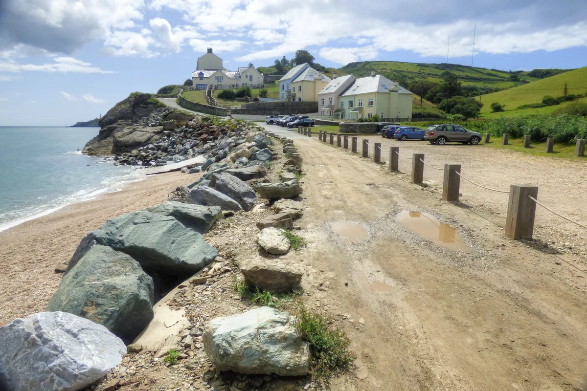
Hallsands — village in Devon, England, UK.

Wikimedia Commons contributors — see linked file page for photographer and licence licence
Plan your visit
- Typical visit
- 3 h–6 h
- Nearest railway station
- Kingsbridge Park Side · 9.5 km
- Free entry
- Family-friendly
- Dog-friendly
About
Hallsands is a town, city, village or settlement in the United Kingdom. Wikidata describes it as: "village in Devon, England, UK". Coordinates: 50.2369°, -3.6592°.
Photo gallery
Protected designations
- Site of Special Scientific Interest: Hallsands-Beesands SSSI
- Area of Outstanding Natural Beauty: South Devon
Designations sourced from Natural England open data under OGL v3.
From the Wikipedia article
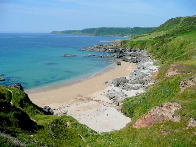
Hallsands is a village and beach in south Devon, England, in a precarious position between cliffs and the sea, between Beesands to the north and Start Point to the south.
Excerpt from Wikipedia under CC BY-SA 4.0. See the source article linked in Sources below.
Background
History
The early history of Hallsands is unknown, but a chapel has existed there since at least 1506. The village was at a cave known as Poke Hole, and probably was not inhabited before 1600. The village grew in size during the 18th and 19th centuries, and by 1891 it had 37 houses, a spring, a public house called the London Inn, and a population of 159. Most residents of Hallsands at that time depended on fishing for a living, particularly crab fishing on the nearby Skerries Bank. The village grew along a rocky ledge in front of cliffs, with a sea wall, and sand and shingle banks adding some protection from the harsh weather and storms. Immense numbers of pilchards were being caught. The nearest…
Visiting
The site of the old village at South Hallsands is closed off to the public, although South Hams District Council has built a viewing platform, which is accessed from the track below Prospect House Apartments (formerly Trout's Hotel).
Sourced from Wikipedia under CC BY-SA 4.0.
- Coordinates
- 50.2369, -3.6592
- County
- Devon
- District
- South Hams
- Parish
- Stokenham
- Postcode
- TQ7 2EY
- Parliamentary constituency
- South Devon
- Nearest railway station
- Kingsbridge Park Side — 9.5 km
Sources
- wikidata: Q647513 (CC0)
- wikipedia: Hallsands (CC BY-SA 4.0)
- commons: Ruins at Hallsands-10.jpg (CC BY-SA 4.0)
Other places nearby
Loading nearby places…
Nearby
 📷 5
📷 5Beaches · South West England
Hallsands Beach
Hallsands Beach — beach in Devon, United Kingdom.
 📷 5
📷 5Beaches · South West England
Hallsands
Hallsands is a beach in the United Kingdom.
 📷 3
📷 3Historic houses · South West England
The London Inn
The London Inn — a historic house in england-south-west, United Kingdom.
 📷 5
📷 5Beaches · South West England
Great Mattiscombe Sand
Great Mattiscombe Sand is a beach in the United Kingdom.
 📷 5
📷 5Beaches · South West England
Mattiscombe Sands
Mattiscombe Sands — beach in Devon, England.
 📷 3
📷 3Lighthouses · South West England
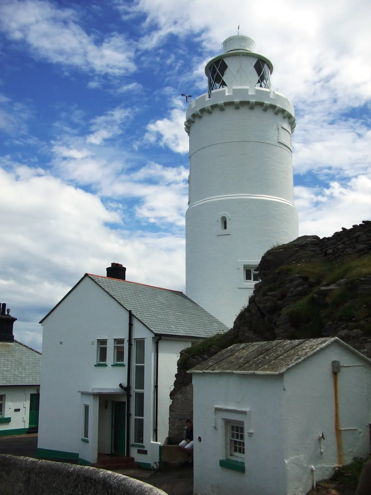
Start Point Lighthouse
Start Point Lighthouse — lighthouse in Stokenham, South Hams, Devon, England, UK.
More towns in this region
 Flagship📷 10
Towns & cities · South West England
All Saints
All Saints — village and civil parish in Devon, England, UK.
 Flagship📷 10
Towns & cities · South West England
Axmouth
Axmouth — village and civil parish in Devon, England, UK.
 ★ Iconic📷 10
Towns & cities · South West England
Beer
Beer — village and civil parish in Devon, UK.
 Flagship📷 10
Towns & cities · South West England
Branscombe
Branscombe — village and civil parish in Devon, UK.
Frequently asked questions
- Where is Hallsands?
- Hallsands is in Devon, South-West England, United Kingdom (postcode TQ7 2EY), in the parish of Stokenham.
- Is Hallsands a protected site?
- Yes — Hallsands is part of the Hallsands-Beesands SSSI Site of Special Scientific Interest and the South Devon National Landscape (AONB).
- Is Hallsands free to visit?
- Yes, Hallsands is free to enter.
- How do I get to Hallsands?
- Drivers can navigate to postcode TQ7 2EY. It sits within the South Devon parliamentary constituency.