Mountains & hills · North East England
Hallin Fell
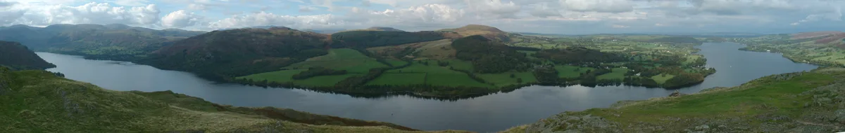
Hallin Fell — Named summit at 388 m.

Wikimedia Commons contributors — see linked file page for photographer and licence licence
Plan your visit
- Typical visit
- 3 h–8 h
- Best time of year
- Late spring – early autumn (May–Oct)
- Free entry
- Dog-friendly
About
Hallin Fell is a named summit in the United Kingdom. Wikidata describes it as: "Named summit at 388 m.". Coordinates: 54.5704°, -2.8785°.
Photo gallery
Protected designations
- Site of Special Scientific Interest: Hallinhag Wood SSSI
- Site of Special Scientific Interest: River Eden and Tributaries SSSI
Designations sourced from Natural England open data under OGL v3.
From the Wikipedia article
Hallin Fell is a hill in the English Lake District surrounded on three sides by Ullswater.
Excerpt from Wikipedia under CC BY-SA 4.0. See the source article linked in Sources below.
- Coordinates
- 54.5704, -2.8785
- District
- Westmorland and Furness
- Parish
- Martindale
- Postcode
- CA10 2NF
- Parliamentary constituency
- Westmorland and Lonsdale
Sources
- osm: n560045811 (ODbL)
- wikipedia: Hallin Fell (CC BY-SA 4.0)
- commons: Ullswater from Hallin Fell.jpg (CC BY-SA 4.0)
Other places nearby
Loading nearby places…
Nearby
 📷 5
📷 5Natural landmarks · North East England
Hallin Fell
Hallin Fell — mountain in United Kingdom.
 📷 3
📷 3Memorials & monuments · North East England
Poetry Stones
Poetry Stones — a memorial in england-north-east, United Kingdom.
 📷 3
📷 3Historic churches · North East England
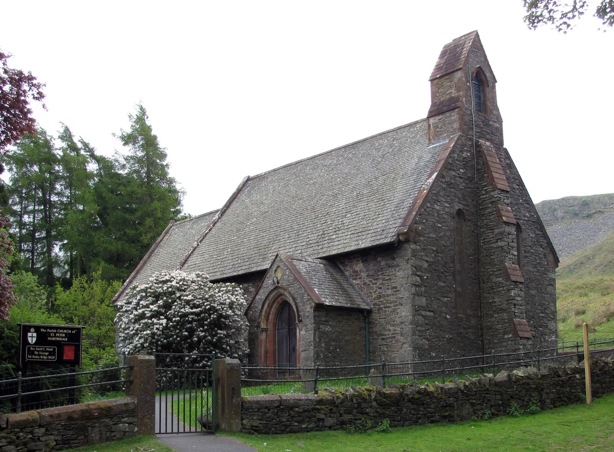
St Peter's Church, Martindale
St Peter's Church, Martindale — church in Martindale, Cumbria, United Kingdom.
 📷 4
📷 4Castles · North West England
Ullswater
Ullswater is a glacial lake in Cumbria, England. It is part of the Lake District and is the second largest lake in the region by both area and volume, after Windermere. The lake is about 7 miles (11 k
 📷 3
📷 3Piers · North East England
Howtown Pier
Howtown Pier is a pier in the United Kingdom.
 📷 3
📷 3Piers · North East England
Howtown Pier
Howtown Pier is a pier in the United Kingdom.
More mountains in this region
 📷 3
📷 3Mountains & hills · North East England
Angletarn Pikes
Angletarn Pikes — Named summit at 566 m.
 📷 3
📷 3Mountains & hills · North East England
Angletarn Pikes South Top
Angletarn Pikes South Top — Named summit at 563.6 m.
 📷 3
📷 3Mountains & hills · North East England
Ard Crags
Ard Crags — Named summit at 581 m.
 📷 3
📷 3Mountains & hills · North East England
Arnison Crag
Arnison Crag — Named summit at 433 m.
Frequently asked questions
- Where is Hallin Fell?
- Hallin Fell is in North-East England, United Kingdom (postcode CA10 2NF), in the parish of Martindale.
- Is Hallin Fell a protected site?
- Yes — Hallin Fell is part of the Hallinhag Wood SSSI Site of Special Scientific Interest and the River Eden and Tributaries SSSI Site of Special Scientific Interest.
- Is Hallin Fell free to visit?
- Yes, Hallin Fell is free to enter.
- How do I get to Hallin Fell?
- Drivers can navigate to postcode CA10 2NF. It sits within the Westmorland and Lonsdale parliamentary constituency.