Cemeteries · South East England
Hailsham Cemetery
Hailsham Cemetery is a cemetery in the United Kingdom.

Stephen Craven — CC BY-SA 2.0 via Wikimedia Commons licence
Plan your visit
- Typical visit
- 30 min–1 h
- Nearest railway station
- Polegate · 3.5 km
- Free entry
- Dog-friendly
About
Hailsham Cemetery is a named cemetery in the United Kingdom. Coordinates: 50.8525°, 0.2538°. This entry is part of The Great Britain Guide, a free, ad-free, open-data tourist directory.
Photo gallery
From the Wikipedia article
Hailsham is a town, a civil parish and the administrative centre of the Wealden district of East Sussex, England. It is mentioned in Domesday Book, where it is called Hamelesham in one part, yet mentioned in another part of the same book as ‘’’Tilux’’’, the land of Ricard de Tunbrige. The town of Hailsham has a history of industry and agriculture.
Excerpt from Wikipedia under CC BY-SA 4.0. See the source article linked in Sources below.
Background
History
The site of Hailsham has been inhabited since at least the Neolithic age. It was an Ancient British settlement that existed before the Romans invaded Kent and Sussex in 43 AD. The Anglo Saxons invaded Sussex in the year 477 AD. The Saxons are thought to have invaded at an original landing place at Selsey. According to the Anglo-Saxon Chronicle, in 491 AD they attacked and took the British stronghold of Anderida which was the fort that is believed to have been built by the Ancient British and the Romans at what is now Pevensey, just a few miles from Hailsham, thereby consolidating their conquest and forming the small kingdom of the South Saxons, or Sussex. In Roman and Saxon times, the…
Architecture
Many parts of Hailsham have been lost to redevelopment prior to preservation orders being introduced. The town retains a number of buildings which display evidence of antiquity. The houses are mainly Victorian in character with more modern residential developments around the original town centre.
Description
The civic parish of Hailsham is approximately 3 mi in breadth and 4 mi from north to south between its extreme points. Its boundary (going in a clockwise direction) runs from its most northerly limit, near Carter's Corner Place, in a southerly direction around Magham Down, over the Herstmonceux road and crosses the low-lying farmlands, passing close to New Bridge and on across Horse Eye Level to Rickney. It then turns westwards taking an irregular course over the Glynleigh Level, across the Cuckoo Trail (former railway line) to the main Eastbourne road (A22), continuing northwards along this for about three-quarters of a mile until it goes west and north again to take in some of the…
Sourced from Wikipedia under CC BY-SA 4.0.
- Coordinates
- 50.8525, 0.2538
- County
- East Sussex
- District
- Wealden
- Parish
- Hailsham
- Postcode
- BN27 3TN
- Parliamentary constituency
- Sussex Weald
- Nearest railway station
- Polegate — 3.5 km
- Official site
- www.hailsham-tc.gov.uk
Sources
Other places nearby
Loading nearby places…
Nearby
Caravan parks · South East England
The Homestead
The Homestead — a caravan park in england south east.
 📷 5
📷 5Theatres · South East England
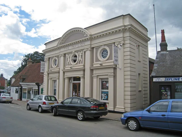
Hailsham Pavilion
Hailsham Pavilion — a cinema heritage in england-south-east, United Kingdom.
 📷 5
📷 5Theatres · South East England
The Pavilion
The Pavilion is a theatre in the United Kingdom.
 📷 5
📷 5Cemeteries · South East England
St Mary's Churchyard
St Mary's Churchyard is a cemetery in the United Kingdom.
 📷 5
📷 5Historic churches · South East England
The Parish Church of Saint Mary
The Parish Church of Saint Mary — church in Hailsham, East Sussex, England, UK.
 📷 5
📷 5Memorials & monuments · South East England
Hailsham War Memorial
Hailsham War Memorial — Grade II listed building-listed memorial in england-south-east, United Kingdom.
More cemeteries in this region
 📷 5
📷 5Cemeteries · South East England
All Saints Cemetery
All Saints Cemetery is a cemetery in the United Kingdom.
 📷 5
📷 5Cemeteries · South East England
Ann's Hill Cemetery
Ann's Hill Cemetery is a cemetery in the United Kingdom.
 📷 5
📷 5Cemeteries · South East England
Ann's Hill Cemetery
Ann's Hill Cemetery is a cemetery in the United Kingdom.
 📷 5
📷 5Cemeteries · South East England
Ash Cemetery
Ash Cemetery is a cemetery in the United Kingdom.
Frequently asked questions
- Where is Hailsham Cemetery?
- Hailsham Cemetery is in South East England, in the United Kingdom — coordinates 50.8525°, 0.2538°. The nearest railway station is Polegate, around 3.5 km away.
- Is Hailsham Cemetery free to visit?
- Yes — admission to Hailsham Cemetery is free.