Museums · Yorkshire & the Humber
Guiseley
Guiseley ( GHYZE-lee) is a small town in the metropolitan borough of the City of Leeds, West Yorkshire, England. Historically part of the West Riding of Yorkshire, it is situated south of Otley and Me

Ian S — CC BY-SA 2.0 via Wikimedia Commons licence
Plan your visit
- Typical visit
- 1.5 h–3 h
- Best time of year
- Year-round
- Family-friendly
- Limited wheelchair access
About
Guiseley ( GHYZE-lee) is a small town in the metropolitan borough of the City of Leeds, West Yorkshire, England. Historically part of the West Riding of Yorkshire, it is situated south of Otley and Menston and is now a north-western suburb of Leeds. It sits in the Guiseley and Rawdon ward of Leeds City Council and the Leeds North West parliamentary constituency. At the 2001 census, Guiseley with Rawdon had a population of over 21,000, increasing to 22,347 at the 2011 census. The A65 Otley Road, which passes through the town, is the main shopping street. Guiseley railway station has regular train services into Leeds, Bradford and Ilkley stations on the Wharfedale Line.
Photo gallery
From the Wikipedia article
Guiseley ( GHYZE-lee) is a small town in the metropolitan borough of the City of Leeds, West Yorkshire, England. Historically part of the West Riding of Yorkshire, it is situated south of Otley and Menston and is now a north-western suburb of Leeds. It sits in the Guiseley and Rawdon ward of Leeds City Council and the Leeds North West parliamentary constituency. At the 2001 census, Guiseley with Rawdon had a population of over 21,000, increasing to 22,347 at the 2011 census. The A65 Otley Road, which passes through the town, is the main shopping street. Guiseley railway station has regular train services into Leeds, Bradford and Ilkley stations on the Wharfedale Line.
Excerpt from Wikipedia under CC BY-SA 4.0. See the source article linked in Sources below.
Background
History
)]] There have been Stone Age and Bronze Age finds in Guiseley and a Roman road, Road 72b, ran nearby on Guiseley Moor. A Saxon settlement existed around a spring which is now called Guiseley Wells and provided drinking water. On 1 April 1937 the parish was abolished to form Aireborough, part also went to Ilkley. In 1931 the parish had a population of 5,607. In 1974 Aireborough was itself abolished and absorbed into the City of Leeds Metropolitan District in the new county of West Yorkshire.
Sourced from Wikipedia under CC BY-SA 4.0.
- Coordinates
- 53.8750, -1.7060
- District
- Leeds
- Parish
- Leeds, unparished area
- Postcode
- LS20 9BD
- Parliamentary constituency
- Leeds North West
Sources
- wikipedia: Guiseley (CC BY-SA 4.0)
Other places nearby
Loading nearby places…
Nearby
 📷 3
📷 3Memorials & monuments · Yorkshire & the Humber
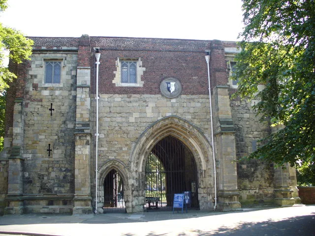
Lychgate to Church of St Oswald
Lychgate to Church of St Oswald — Grade II listed building-listed memorial in england-yorkshire, United Kingdom.
 📷 3
📷 3Memorials & monuments · Yorkshire & the Humber
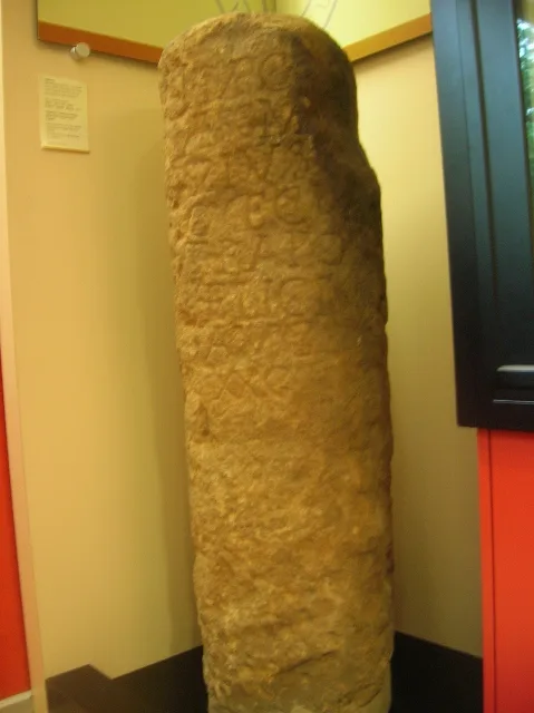
Guiseley Cross
Guiseley Cross — a memorial in england-yorkshire, United Kingdom.
 📷 3
📷 3Memorials & monuments · Yorkshire & the Humber
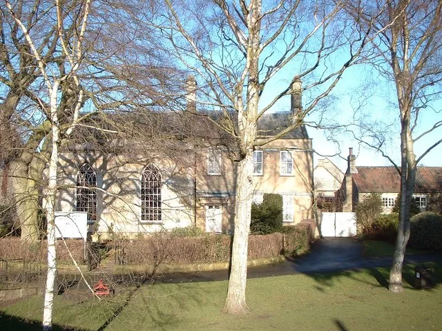
Guiseley Wells
Guiseley Wells — a memorial in england-yorkshire, United Kingdom.
.jpg?width=1200) 📷 3
📷 3Theatres · Yorkshire & the Humber
Guiseley Theatre
Guiseley Theatre is a theatre in the United Kingdom.
Cafés · Yorkshire & the Humber
Everybodys All Day Social
Everybodys All Day Social — a café in england yorkshire.
 📷 5
📷 5Museums · Yorkshire & the Humber
Yeadon, West Yorkshire
Yeadon, West Yorkshire — a museum in england-yorkshire, United Kingdom.
More museums in this region
 📷 3
📷 3Museums · Yorkshire & the Humber
Aldborough Roman Town
Aldborough Roman Town — Heritage Museum in Yorkshire, England, UK.
 📷 3
📷 3Museums · Yorkshire & the Humber
Bayle Museum
Bayle Museum — Local museum in Bridlington, England.
Museums · Yorkshire & the Humber
BD1 Gallery
BD1 Gallery — closed gallery in Bradford, West Yorkshire.
 📷 5
📷 5Museums · Yorkshire & the Humber
Beck Isle Museum
Beck Isle Museum — museum in Pickering, North Yorkshire, England, United Kingdom.
Frequently asked questions
- Where is Guiseley?
- Guiseley is in Yorkshire & the Humber, in the United Kingdom — coordinates 53.8750°, -1.7060°.
- Is Guiseley wheelchair accessible?
- Partially — OpenStreetMap notes limited wheelchair access at Guiseley. Check ahead for specific facilities.