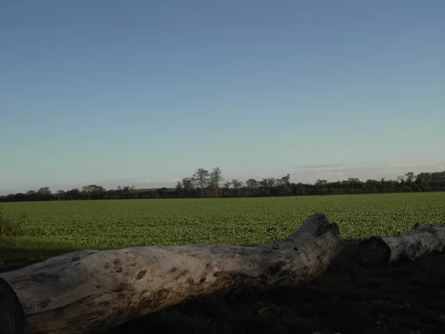
Hill forts · Yorkshire & the Humber
Grubstones
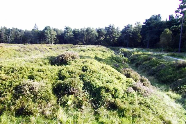
Grubstones — stone circle in West Yorkshire, England, UK.

Wikimedia Commons contributors — see linked file page for photographer and licence licence
Plan your visit
- Typical visit
- 1 h–2 h
- Nearest railway station
- Burley-in-Wharfedale · 2.9 km
- Free entry
- Dog-friendly
About
Grubstones is a hill fort in the United Kingdom. Heritage designation: scheduled monument. Wikidata describes it as: "stone circle in West Yorkshire, England, UK". Coordinates: 53.8984°, -1.7940°.
Photo gallery
Protected designations
- Site of Special Scientific Interest: South Pennine Moors SSSI
- National Nature Reserve: BRADFORD PENNINE GATEWAY
Designations sourced from Natural England open data under OGL v3.
From the Wikipedia article
The Grubstones (grid reference SE136447) is a stone circle on Burley Moor in West Yorkshire, England. It is believed to be either an embanked stone circle or a ring cairn.
Excerpt from Wikipedia under CC BY-SA 4.0. See the source article linked in Sources below.
Background
Description
The circle has a diameter of about 10 m. One third of the circle on the south side has been destroyed by shooting butts. Four large loose stones in the interior may have come from this break. The interior was excavated circa 1846 which revealed a cremation, accompanied by a flint spearhead. In the 20th century there was additional damage in the form of a subrectangular earthwork mound said to be an "orgone accumulator". Orgone is supposed to be a vital energy or life force which informs the universe, and which can be collected and stored in an orgone accumulator for subsequent use in the treatment of illness.
Sourced from Wikipedia under CC BY-SA 4.0.
- Coordinates
- 53.8984, -1.7940
- District
- Bradford
- Parish
- Burley
- Postcode
- LS29 7BG
- Parliamentary constituency
- Shipley
- Nearest railway station
- Burley-in-Wharfedale — 2.9 km
- Official site
- www.megalithic.co.uk
Sources
- wikidata: Q14949373 (CC0)
- wikipedia: Grubstones (CC BY-SA 4.0)
- commons: Grobstones Stone Circle, Burley Moor - geograph.org.uk - 44791.jpg (CC BY-SA 4.0)
Other places nearby
Loading nearby places…
Nearby
 📷 3
📷 3Archaeological sites · Yorkshire & the Humber
Grubstones Circle
Grubstones Circle — a archaeological in england-yorkshire, United Kingdom.
 📷 3
📷 3Archaeological sites · Yorkshire & the Humber
Skirtful of Stones
Skirtful of Stones — a archaeological in england-yorkshire, United Kingdom.
 📷 3
📷 3Archaeological sites · Yorkshire & the Humber
Little Skirtful of Stones
Little Skirtful of Stones — a archaeological in england-yorkshire, United Kingdom.
📷 3Archaeological sites · Yorkshire & the Humber
Carr Barrows
Carr Barrows — a archaeological in england-yorkshire, United Kingdom.
 📷 3
📷 3Memorials & monuments · Yorkshire & the Humber
Lanshaw Lass
Lanshaw Lass — a memorial in england-yorkshire, United Kingdom.
 📷 3
📷 3Archaeological sites · Yorkshire & the Humber
Trial Holes
Trial Holes — a archaeological in england-yorkshire, United Kingdom.
More places in this region
 📷 3
📷 3Hill forts · Yorkshire & the Humber
Aberford Dykes
Aberford Dykes — series of archaeological earthworks.
 📷 3
📷 3Hill forts · Yorkshire & the Humber
Cataractonium
Cataractonium — Roman fort and settlement in Catterick, located in North Yorkshire, England.
 📷 3
📷 3Hill forts · Yorkshire & the Humber
Cawthorne Camp
Cawthorne Camp — archaeological site in Cropton, Ryedale, England, UK.
 📷 3
📷 3Hill forts · Yorkshire & the Humber
Danes Graves
Danes Graves — archaeological site in Nafferton, East Riding of Yorkshire, England, UK.
Frequently asked questions
- Where is Grubstones?
- Grubstones is in Yorkshire, United Kingdom (postcode LS29 7BG), in the parish of Burley.
- Is Grubstones a listed building?
- Grubstones is officially recognised as scheduled monument listed.
- Is Grubstones a protected site?
- Yes — Grubstones is part of the South Pennine Moors SSSI Site of Special Scientific Interest and the BRADFORD PENNINE GATEWAY National Nature Reserve.
- Is Grubstones free to visit?
- Yes, Grubstones is free to enter.
- How do I get to Grubstones?
- The nearest railway station is Burley-in-Wharfedale, about 2.9 km away. Drivers can navigate to postcode LS29 7BG.