Towns & cities · South East England
Grittleton
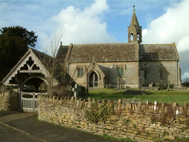
Grittleton — village and civil parish in Wiltshire, United Kingdom.

Wikimedia Commons contributors — see linked file page for photographer and licence licence
Plan your visit
- Typical visit
- 3 h–6 h
- Nearest railway station
- Chippenham · 8.7 km
- Free entry
- Family-friendly
- Dog-friendly
About
Grittleton is a town, city, village or settlement in the United Kingdom. Recent population estimates put it at around 459 people. Address: SN14. Wikidata describes it as: "village and civil parish in Wiltshire, United Kingdom". Coordinates: 51.5187°, -2.2032°.
Photo gallery
Protected designations
- Area of Outstanding Natural Beauty: Cotswolds
Designations sourced from Natural England open data under OGL v3.
From the Wikipedia article
Grittleton is a village and civil parish in Wiltshire, England, 6 miles (10 km) northwest of Chippenham. The parish includes the hamlets of Foscote, Leigh Delamere, Littleton Drew and Sevington, and part of the hamlet of The Gibb. The Gauze Brook, a small tributary of the Avon, rises near Littleton Drew and flows east across the parish. The M4 motorway was opened in 1971 across the south of the parish, passing close to The Gibb, Foscote, Sevington and Leigh Delamere.
Excerpt from Wikipedia under CC BY-SA 4.0. See the source article linked in Sources below.
Background
History
The Fosse Way Roman road crosses the parish from north to southwest. The Domesday Book of 1086 recorded settlements of 23 households at Gretelintone, 15 at Sevamentone (Sevington) and 16 at Liteltone (Littleton Drew). The Grittleton estate was bought in 1828 by Joseph Neeld, a London lawyer who had inherited a considerable sum. Over time he replaced the manor house with a much larger building, and built lodges and extensive stables. His philanthropy in the parish included the rebuilding of the near-derelict church at Leigh Delamere and construction of a row of six almshouses nearby; farms were improved and houses were built for estate workers, together with a small private school at…
Sourced from Wikipedia under CC BY-SA 4.0.
- Coordinates
- 51.5187, -2.2032
- District
- Wiltshire
- Parish
- Grittleton
- Postcode
- SN14
- Parliamentary constituency
- South Cotswolds
- Population
- 459
- Nearest railway station
- Chippenham — 8.7 km
- Official site
- www.grittleton.info
Sources
- wikidata: Q781293 (CC0)
- wikipedia: Grittleton (CC BY-SA 4.0)
- commons: Grittleton village2 19y07.JPG (CC BY-SA 4.0)
Other places nearby
Loading nearby places…
Nearby
 📷 5
📷 5Memorials & monuments · South East England
Bennett Monument In Churchyard About 2 Metres North Of East End Of North Aisle Of Church Of St Mary
Bennett Monument In Churchyard About 2 Metres North Of East End Of North Aisle Of Church Of St Mary — Grade II listed building-listed memorial in england-south-east, United Kingdom.
 📷 5
📷 5Historic houses · South East England
Grittleton House
Grittleton House — school in Jacobean manor house, Wiltshire, England, UK.
 📷 5
📷 5Historic churches · South East England
Grittleton Strict Baptist Chapel
Grittleton Strict Baptist Chapel — church in Grittleton, Wiltshire, England, UK.
 📷 5
📷 5Historic churches · South East England
St Margaret of Antioch Church, Leigh Delamere
St Margaret of Antioch Church, Leigh Delamere — church in Grittleton, UK.
 📷 5
📷 5Memorials & monuments · South East England
Two Unidentified Monuments South Of Chancel Of Church Of St Margaret
Two Unidentified Monuments South Of Chancel Of Church Of St Margaret — Grade II listed building-listed memorial in england-south-east, United Kingdom.
 📷 5
📷 5Historic churches · South East England
Stone cross in churchyard, Littleton Drew
Stone cross in churchyard, Littleton Drew — a Grade II*-listed church in england-south-east, United Kingdom.
More towns in this region
 Flagship📷 10
Towns & cities · South East England
Aldermaston
Aldermaston — village and civil parish in West Berkshire in England, UK.
 Flagship📷 10
Towns & cities · South East England
Aldingbourne
Aldingbourne — village and civil parish in Arun, West Sussex, UK.
 Flagship📷 10
Towns & cities · South East England
Aldington
Aldington — village and civil parish in the Ashford District of Kent, England.
 Flagship📷 10
Towns & cities · South East England
Aldworth
Aldworth — village and civil parish in the English county of Berkshire.
Frequently asked questions
- Where is Grittleton?
- Grittleton is in South-East England, United Kingdom (postcode SN14), in the parish of Grittleton.
- Is Grittleton a protected site?
- Yes — Grittleton is part of the Cotswolds National Landscape (AONB).
- Is Grittleton free to visit?
- Yes, Grittleton is free to enter.
- How do I get to Grittleton?
- Drivers can navigate to postcode SN14. It sits within the South Cotswolds parliamentary constituency.