Towns & cities · Northern Ireland
Greyabbey
Greyabbey — village in County Down, Northern Ireland, UK.
.jpg?width=1200)
Wikimedia Commons contributors — see linked file page for photographer and licence licence
.jpg)
Plan your visit
- Typical visit
- 3 h–6 h
- Nearest railway station
- Drumawhey Junction · 8.8 km
- Free entry
- Family-friendly
- Dog-friendly
About
Greyabbey is a town, city, village or settlement in the United Kingdom. Recent population estimates put it at around 939 people. Wikidata describes it as: "village in County Down, Northern Ireland, UK". Coordinates: 54.5350°, -5.5600°.
Photo gallery
From the Wikipedia article
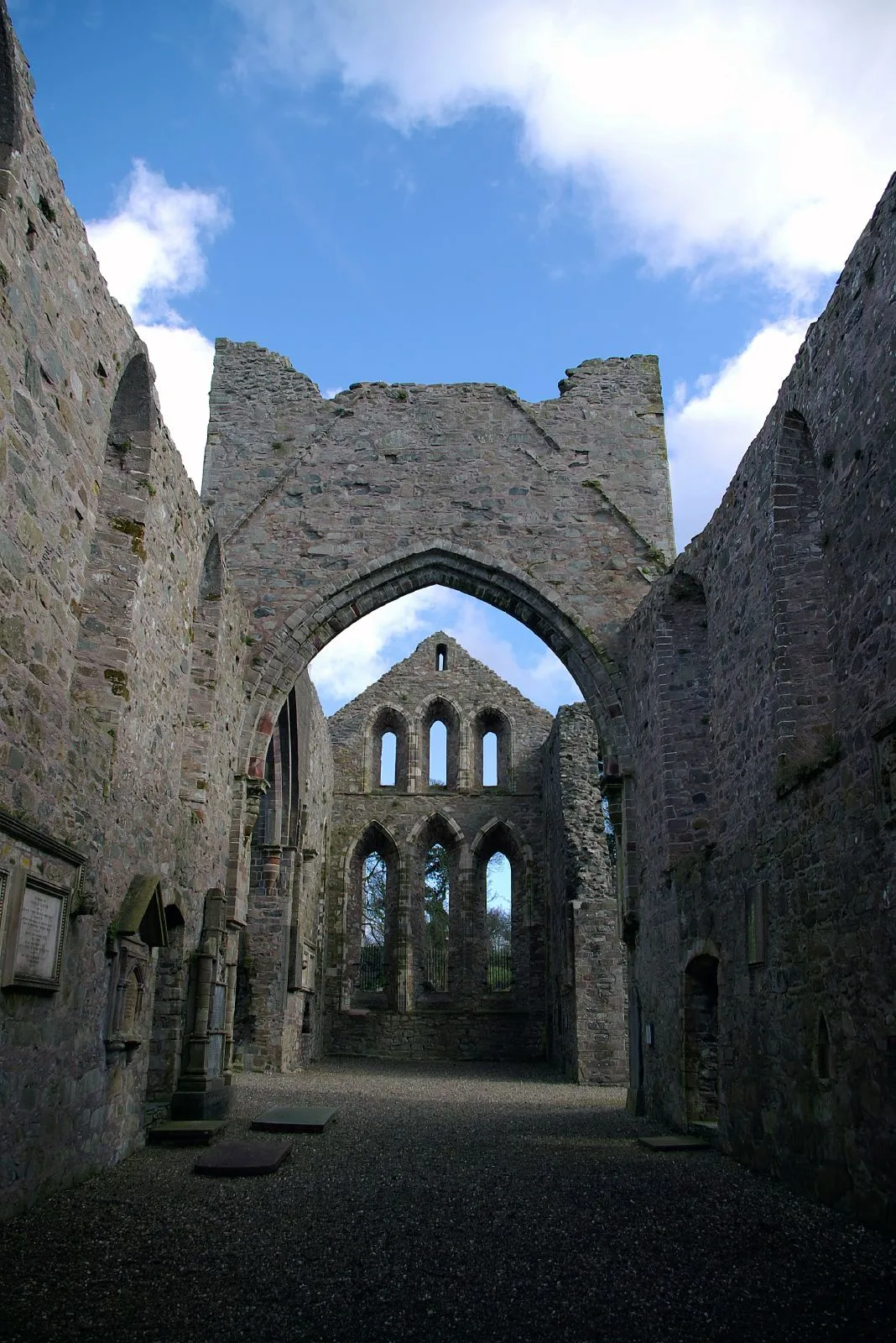
Greyabbey or Grey Abbey (Irish: Mainistir Liath, meaning 'grey monastery') is a small village, townland (of 208 acres) and civil parish located on the eastern shores of Strangford Lough, on the Ards Peninsula in County Down, Northern Ireland. It lies 7 miles (11 km) south of Newtownards. Both townland and civil parish are situated in the historic barony of Ards Lower. It is within the Ards and North Down Borough. It had a population of 939 people in the 2011 Census. Greyabbey is often associated with the antiques trade, there being several specialist antique shops in the village, as well as some interesting Georgian and Victorian buildings. Of particular note is Mount Stewart Estate (National Trust) as well as a traditional coaching inn.
Excerpt from Wikipedia under CC BY-SA 4.0. See the source article linked in Sources below.
Background
History
The village (and townland) derives its name from the Grey Abbey, a Cistercian abbey-monastery located on the eastern side of the village, dating from 1193. It was founded by Affreca, daughter of Godred Olafsson, King of the Isles, and wife of John de Courcy, Anglo-Norman conqueror of part of the province of Ulster. Tradition says that Affreca founded the abbey in thanksgiving for a safe landing after a perilous journey at sea. The abbey was colonised with monks from Holmcultram in Cumberland, with which it maintained close ties in the early years. The construction of the stone church began almost immediately. In 1222, and again in 1237, abbots of Grey Abbey went on to become abbots of…
Sourced from Wikipedia under CC BY-SA 4.0.
- Coordinates
- 54.5350, -5.5600
- District
- Ards and North Down
- Postcode
- BT22 2NE
- Parliamentary constituency
- Strangford
- Population
- 939
- Nearest railway station
- Drumawhey Junction — 8.8 km
Sources
- wikidata: Q135049 (CC0)
- wikipedia: Greyabbey (CC BY-SA 4.0)
- commons: Grey Abbey (314914).jpg (CC BY-SA 4.0)
Other places nearby
Loading nearby places…
Nearby
 📷 5
📷 5Abbeys & priories · Northern Ireland
Grey Abbey
Grey Abbey — ruined Cistercian monastery in Co. Down, Northern Ireland.
 📷 5
📷 5Cathedrals · Northern Ireland
Grey Abbey
Grey Abbey is a cathedral in the United Kingdom.
 📷 3
📷 3Castles · Northern Ireland
Grey Abbey House
Grey Abbey House — a castle in northern-ireland, United Kingdom.
 📷 5
📷 5Follies · Northern Ireland
The Temple of the Winds
The Temple of the Winds — a temple folly in northern-ireland, United Kingdom.
 📷 5
📷 5Archaeological sites · Northern Ireland
Ring Ditch
Ring Ditch — a archaeological in northern-ireland, United Kingdom.
 📷 4
📷 4Natural landmarks · Northern Ireland
Ballyboley
Ballyboley in Northern Ireland, United Kingdom.
More towns in this region
 Flagship📷 5
Towns & cities · Northern Ireland
Bangor
Bangor — city in Northern Ireland, United Kingdom.
 Flagship📷 5
Towns & cities · Northern Ireland
Belfast
Belfast — capital city of Northern Ireland.
 Flagship📷 3
Towns & cities · Northern Ireland
Derry
Derry — city in Northern Ireland.
 Flagship📷 5
Towns & cities · Northern Ireland
Lisburn
Lisburn — city in Northern Ireland.
Frequently asked questions
- Where is Greyabbey?
- Greyabbey is in Northern Ireland, United Kingdom (postcode BT22 2NE).
- Is Greyabbey free to visit?
- Yes, Greyabbey is free to enter.
- How do I get to Greyabbey?
- Drivers can navigate to postcode BT22 2NE. It sits within the Strangford parliamentary constituency.