Natural landmarks · North West England
Great Stickle
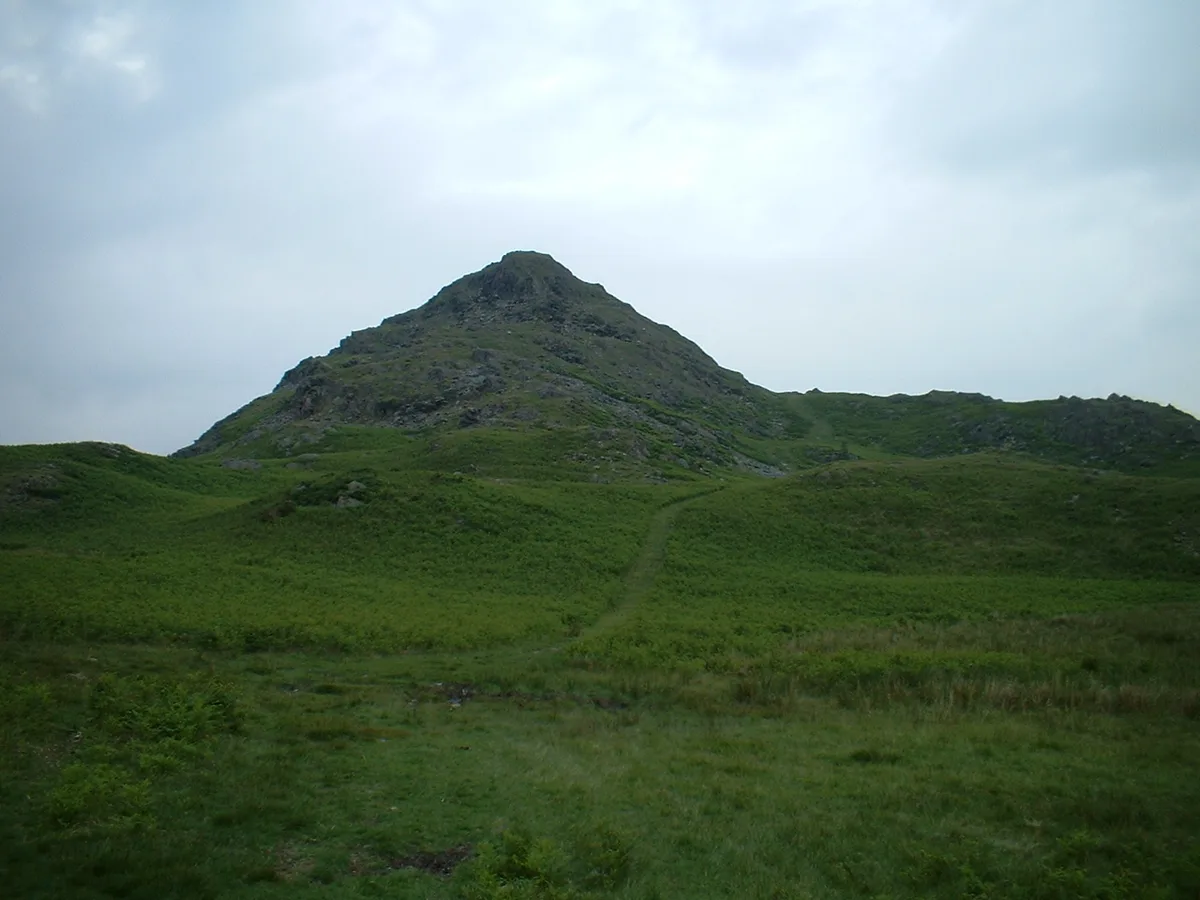
Great Stickle — mountain in United Kingdom.

Wikimedia Commons licence
Plan your visit
- Typical visit
- 1 h–2 h
- Nearest railway station
- Foxfield · 6.2 km
- Free entry
- Dog-friendly
About
Great Stickle is a named natural landmark in the United Kingdom. Wikidata describes it as: "mountain in United Kingdom". Coordinates: 54.3142°, -3.2122°.
Photo gallery
Protected designations
- Site of Special Scientific Interest: Duddon Valley Woodlands SSSI
Designations sourced from Natural England open data under OGL v3.
From the Wikipedia article
Great Stickle is a fell located in the southern Lake District of England with an altitude of 305 m (1,001 ft). Alfred Wainwright included it in the Stickle Pike chapter of his "The Outlying Fells of Lakeland" (but stated the height incorrectly as 990 ft; the 2011 2nd edition has the correct figure). Geographically the fell is located on the southern ridge of Stickle Pike and is located between the lower Duddon Valley (west) and the valley of Dunnerdale Beck (east). A "stickle" is a hill with a prominent rocky top. The fell is rugged in appearance with several craggy outcrops that are found especially on its summit and its southern slopes which descend to the hamlet of Broughton Mills. It is generally climbed in combination with Stickle Pike, the ridge between the two summits offering an interesting traverse and excellent views to the Furness Peninsula and the southern fells.
Excerpt from Wikipedia under CC BY-SA 4.0. See the source article linked in Sources below.
- Coordinates
- 54.3142, -3.2122
- District
- Westmorland and Furness
- Parish
- Dunnerdale-with-Seathwaite
- Postcode
- LA20 6AZ
- Parliamentary constituency
- Barrow and Furness
- Nearest railway station
- Foxfield — 6.2 km
Sources
- wikidata: Q5600037 (CC0)
- wikipedia: Great Stickle (CC BY-SA 4.0)
Other places nearby
Loading nearby places…
Nearby
 📷 3
📷 3Natural landmarks · North West England
Stickle Pike
Stickle Pike — mountain in the United Kingdom.
 📷 3
📷 3Mountains & hills · North West England
Stickle Pike
Stickle Pike — Named summit at 375 m.
 📷 4
📷 4Historic houses · North West England
Blacksmiths Arms
Blacksmiths Arms — a Grade II*-listed historic house in england-north-west, United Kingdom.
 📷 3
📷 3Historic bridges · North West England
Ulpha Bridge (That Part In Dunnerdale With Seathwaite Cp)
Ulpha Bridge (That Part In Dunnerdale With Seathwaite Cp) — Grade II listed building-listed bridge in england-north-west, United Kingdom.
 📷 3
📷 3Historic bridges · North West England
Bridge On Old Coach Road
Bridge On Old Coach Road — Grade II listed building-listed bridge in england-north-west, United Kingdom.
 📷 3
📷 3Historic bridges · North West England
Rawfold Bridge
Rawfold Bridge — Grade II listed building-listed bridge in england-north-west, United Kingdom.
More natural landmarks in this region
 ★ Iconic📷 4
Natural landmarks · North West England
Coniston Water
Lake District lake — Swallows and Amazons setting and Donald Campbell water-speed history.
 📷 3
📷 3Natural landmarks · North West England
Elter Water
Elter Water — lake in the United Kingdom.
 📷 3
📷 3Natural landmarks · North West England
Esthwaite Water
Esthwaite Water — lake in the United Kingdom.
 Flagship📷 5
Natural landmarks · North West England
Semerwater
Semerwater — lake in North Yorkshire, England, UK.
Frequently asked questions
- Where is Great Stickle?
- Great Stickle is in North-West England, United Kingdom (postcode LA20 6AZ), in the parish of Dunnerdale-with-Seathwaite.
- Is Great Stickle a protected site?
- Yes — Great Stickle is part of the Duddon Valley Woodlands SSSI Site of Special Scientific Interest.
- Is Great Stickle free to visit?
- Yes, Great Stickle is free to enter.
- How do I get to Great Stickle?
- The nearest railway station is Foxfield, about 6.2 km away. Drivers can navigate to postcode LA20 6AZ.