Natural landmarks · North East England
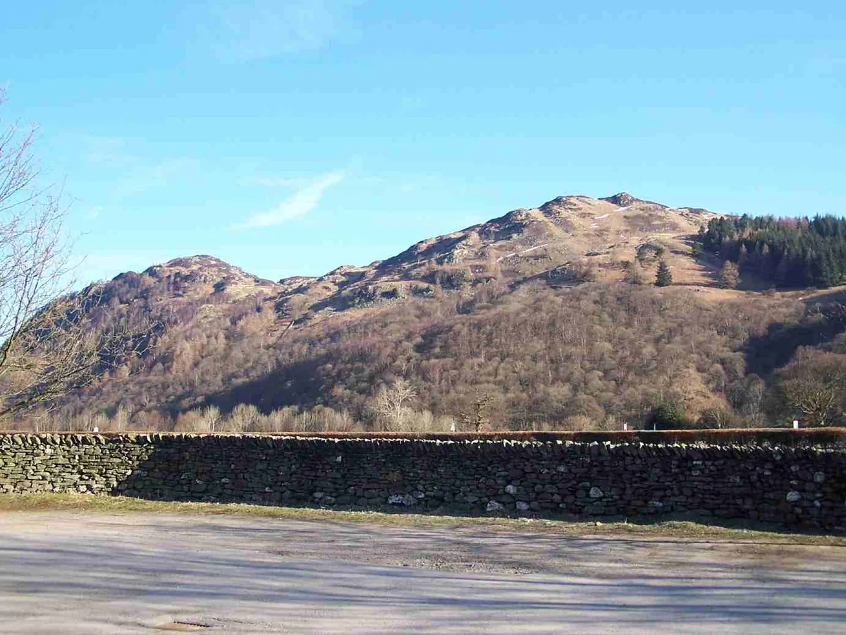
Grange Fell
Grange Fell — mountain in United Kingdom.

Wikimedia Commons contributors — see linked file page for photographer and licence licence
Plan your visit
- Typical visit
- 1 h–2 h
- Nearest railway station
- Threlkeld Quarry · 9.1 km
- Free entry
- Dog-friendly
About
Grange Fell is a named natural landmark in the United Kingdom. Wikidata describes it as: "mountain in United Kingdom". Coordinates: 54.5444°, -3.1325°.
Photo gallery
Protected designations
- Site of Special Scientific Interest: River Derwent and Tributaries SSSI
- Site of Special Scientific Interest: Armboth Fells SSSI
- Site of Special Scientific Interest: Lodore - Troutdale Woods SSSI
- National Nature Reserve: BORROWDALE RAINFOREST
Designations sourced from Natural England open data under OGL v3.
From the Wikipedia article
Grange Fell is a small fell in the English Lake District in the county of Cumbria, situated in the Borrowdale valley overlooking the villages of Grange in Borrowdale and Rosthwaite.
Excerpt from Wikipedia under CC BY-SA 4.0. See the source article linked in Sources below.
Background
History
Grange Fell is owned by the National Trust and was one of its first acquisitions in the Lake District in 1910; the fell was purchased by public subscription as a memorial to King Edward VII at the bequest of the King's sister Princess Louise, who then was President of the Trust. The magnificent viewpoint of King's How was named after the King as a memorial, and a commemorative slate plaque is situated just below the summit. It reads:
Sourced from Wikipedia under CC BY-SA 4.0.
- Coordinates
- 54.5444, -3.1325
- District
- Cumberland
- Parish
- Borrowdale
- Postcode
- CA12 5UW
- Parliamentary constituency
- Penrith and Solway
- Nearest railway station
- Threlkeld Quarry — 9.1 km
Sources
- wikidata: Q5595648 (CC0)
- wikipedia: Grange Fell (CC BY-SA 4.0)
- commons: Grange Fell from Rosthwaite.JPG (CC BY-SA 4.0)
Other places nearby
Loading nearby places…
Nearby
Vineyards · North East England
Reecastle Crag hillfort
Reecastle Crag hillfort — a UK vineyard in england north east, producing English or Welsh wine from cool-climate grape varieties.
 📷 3
📷 3Mountains & hills · North East England
Brund Fell (summit)
Brund Fell (summit) — Named summit at 417.2 m.
 📷 3
📷 3Mountains & hills · North East England
Grange Fell (Wainwright)
Grange Fell (Wainwright) — Named summit at 415 m.
 📷 3
📷 3Historic bridges · North East England
Grange Bridge
Grange Bridge — Grade II listed building-listed bridge in england-north-east, United Kingdom.
Cafés · North East England
Grange Bridge Cottage
Grange Bridge Cottage — a café in england north east.
 📷 3
📷 3Natural landmarks · North East England
Lodore Falls
Lodore Falls — a other in england-north-east, United Kingdom.
More natural landmarks in this region
 Flagship📷 5
Natural landmarks · North East England
Brothers Water
Brothers Water — lake in Cumbria, England, UK.
 📷 5
📷 5Natural landmarks · North East England
Angle Tarn
Angle Tarn — lake near Patterdale, Cumbria, England, United Kingdom.
 📷 3
📷 3Natural landmarks · North East England
Angletarn Pikes
Angletarn Pikes — mountain in United Kingdom.
 📷 3
📷 3Natural landmarks · North East England
Ard Crags
Ard Crags — mountain in United Kingdom.
Frequently asked questions
- Where is Grange Fell?
- Grange Fell is in North-East England, United Kingdom (postcode CA12 5UW), in the parish of Borrowdale.
- Is Grange Fell a protected site?
- Yes — Grange Fell is part of the River Derwent and Tributaries SSSI Site of Special Scientific Interest and the Armboth Fells SSSI Site of Special Scientific Interest.
- Is Grange Fell free to visit?
- Yes, Grange Fell is free to enter.
- How do I get to Grange Fell?
- Drivers can navigate to postcode CA12 5UW. It sits within the Penrith and Solway parliamentary constituency.