Museums · Yorkshire & the Humber
Golcar
Golcar (pronounced ) is a village on a hillside crest above the Colne Valley in the Kirklees district, in West Yorkshire, England, 3 miles (5 km) west of Huddersfield, and just north of the River Coln

Betty Longbottom — CC BY-SA 2.0 via Wikimedia Commons licence
Plan your visit
- Typical visit
- 1.5 h–3 h
- Best time of year
- Year-round
- Family-friendly
- Limited wheelchair access
About
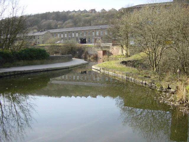
Golcar (pronounced ) is a village on a hillside crest above the Colne Valley in the Kirklees district, in West Yorkshire, England, 3 miles (5 km) west of Huddersfield, and just north of the River Colne and the Huddersfield Narrow Canal. The 2021 population census lists the village as having 18,725 permanent residents. The main transport access is from the A62 (Manchester Road), through Milnsbridge in the valley bottom or via Scapegoat Hill from the A640 (New Hey Road) at the top of the hill. The township of Golcar consists of Bolster Moor, Golcar, Wellhouse, Pole Moor and Scapegoat Hill.
Photo gallery
From the Wikipedia article
Golcar (pronounced ) is a village on a hillside crest above the Colne Valley in the Kirklees district, in West Yorkshire, England, 3 miles (5 km) west of Huddersfield, and just north of the River Colne and the Huddersfield Narrow Canal. The 2021 population census lists the village as having 18,725 permanent residents. The main transport access is from the A62 (Manchester Road), through Milnsbridge in the valley bottom or via Scapegoat Hill from the A640 (New Hey Road) at the top of the hill. The township of Golcar consists of Bolster Moor, Golcar, Wellhouse, Pole Moor and Scapegoat Hill.
Excerpt from Wikipedia under CC BY-SA 4.0. See the source article linked in Sources below.
Background
History
Named after St Guthlac, who preached in the area during the 8th century, its name is recorded in the Domesday Book of 1086 as Goullakarres. During the Industrial Revolution Golcar became an important centre for weaving. Pharmacologist James Burrows grew up in the area. The village has been a site of extensive dialect research. It was a site in the English Survey of English Dialects, and later a site in the Atlas Linguarum Europae. Golcar was formerly a township and chapelry; in 1866 Golcar became a separate civil parish, and in 1894 Golcar became an urban district. On 1 April 1937 the district was abolished to form Colne Valley Urban District, part also went to the County Borough of…
Sourced from Wikipedia under CC BY-SA 4.0.
- Coordinates
- 53.6378, -1.8457
- District
- Kirklees
- Parish
- Kirklees, unparished area
- Postcode
- HD7 4AR
- Parliamentary constituency
- Colne Valley
- Official site
- observatory.kirklees.gov.uk
Sources
- wikipedia: Golcar (CC BY-SA 4.0)
Other places nearby
Loading nearby places…
Nearby
 📷 3
📷 3Aqueducts · Yorkshire & the Humber
Calder And Hebble Navigation Scarbottom Aqueduct Huddersfield Narrow Canal Scarbottom Aqueduct
Calder And Hebble Navigation Scarbottom Aqueduct Huddersfield Narrow Canal Scarbottom Aqueduct — aqueduct in Kirklees, West Yorkshire, England, UK.
 📷 5
📷 5Historic houses · Yorkshire & the Humber
Scar Lane drill hall, Milnsbridge
Scar Lane drill hall, Milnsbridge — a other in england-yorkshire, United Kingdom.
 📷 3
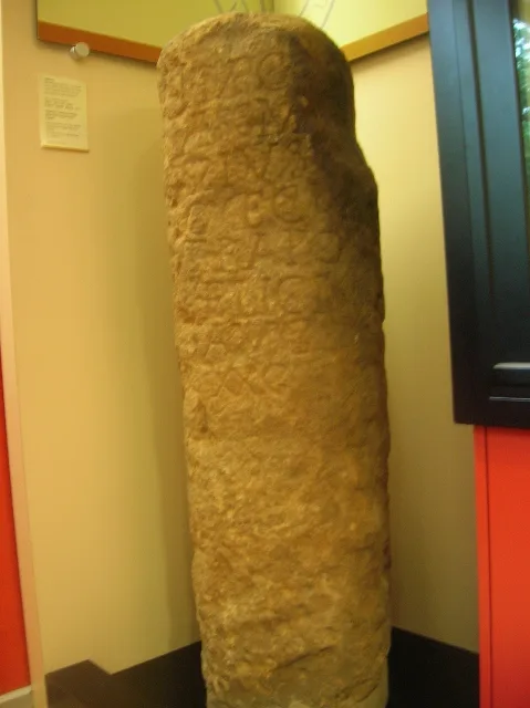
📷 3Museums · Yorkshire & the Humber
Colne Valley Museum
Colne Valley Museum — a museum in england-yorkshire, United Kingdom.
 📷 3
📷 3Historic bridges · Yorkshire & the Humber
Scarwood Bridge
Scarwood Bridge is a historic bridge in the United Kingdom.
 📷 3
📷 3Historic bridges · Yorkshire & the Humber
Huddersfield Narrow Canal; Golcar Brook Bridge
Huddersfield Narrow Canal; Golcar Brook Bridge — Grade II listed building-listed bridge in england-yorkshire, United Kingdom.
 📷 3
📷 3Mills · Yorkshire & the Humber
Parkwood Mill
Parkwood Mill — mill in Kirklees, West Yorkshire, England, UK.
More museums in this region
 📷 3
📷 3Museums · Yorkshire & the Humber
Aldborough Roman Town
Aldborough Roman Town — Heritage Museum in Yorkshire, England, UK.
 📷 3
📷 3Museums · Yorkshire & the Humber
Bayle Museum
Bayle Museum — Local museum in Bridlington, England.
Museums · Yorkshire & the Humber
BD1 Gallery
BD1 Gallery — closed gallery in Bradford, West Yorkshire.
 📷 5
📷 5Museums · Yorkshire & the Humber
Beck Isle Museum
Beck Isle Museum — museum in Pickering, North Yorkshire, England, United Kingdom.
Frequently asked questions
- Where is Golcar?
- Golcar is in Yorkshire & the Humber, in the United Kingdom — coordinates 53.6378°, -1.8457°.
- Is Golcar wheelchair accessible?
- Partially — OpenStreetMap notes limited wheelchair access at Golcar. Check ahead for specific facilities.