Natural landmarks · North West England
Goat's Water
Goat's Water — lake in the United Kingdom.

Wikimedia Commons contributors — see linked file page for photographer and licence licence
Plan your visit
- Typical visit
- 1 h–2 h
- Nearest railway station
- Dalegarth · 9.7 km
- Free entry
- Dog-friendly
About
Goat's Water is a named natural landmark in the United Kingdom. Wikidata describes it as: "lake in the United Kingdom". Coordinates: 54.3694°, -3.1314°.
Photo gallery
From the Wikipedia article
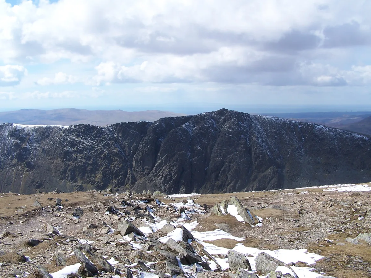
Goat's Water is a small accessible tarn in the English Lake District, located between Dow Crag and The Old Man of Coniston to the Duddon Valley, near the town of Coniston. The tarn is a 2 mile walk from the car park above Coniston village. The tarn is a popular summer walking / hiking and rock climbing point and also a popular remote fly fishing location with the water holding a number of small native wild brown trout.
Excerpt from Wikipedia under CC BY-SA 4.0. See the source article linked in Sources below.
- Coordinates
- 54.3694, -3.1314
- Address
- Lake District, Cumbria
- Nearest railway station
- Dalegarth — 9.7 km
Sources
- wikidata: Q5575263 (CC0)
- wikipedia: Goat's Water (CC BY-SA 4.0)
- commons: Goat's Water - geograph.org.uk - 1373114.jpg (CC BY-SA 4.0)
Other places nearby
Loading nearby places…
Nearby
Climbing & bouldering crags · North West England
Dow Crag
Dow Crag — a climbing crag in england north west.
 📷 3
📷 3Mountains & hills · North West England
Dow Crag
Dow Crag — Named summit at 778 m.
 📷 3
📷 3Natural landmarks · North West England
Dow Crag
Dow Crag — mountain in United Kingdom.
 📷 3
📷 3Mountains & hills · North West England
Buck Pike
Buck Pike — Named summit at 744 m.
 📷 3
📷 3Natural landmarks · North West England
Buck Pike
Buck Pike — mountain in United Kingdom.
 📷 3
📷 3Mountains & hills · North West England
Old Man of Coniston
Old Man of Coniston — Named summit at 802.4 m.
More natural landmarks in this region
 ★ Iconic📷 4
Natural landmarks · North West England
Coniston Water
Lake District lake — Swallows and Amazons setting and Donald Campbell water-speed history.
 📷 3
📷 3Natural landmarks · North West England
Elter Water
Elter Water — lake in the United Kingdom.
 📷 3
📷 3Natural landmarks · North West England
Esthwaite Water
Esthwaite Water — lake in the United Kingdom.
 Flagship📷 5
Natural landmarks · North West England
Semerwater
Semerwater — lake in North Yorkshire, England, UK.
Frequently asked questions
- Where is Goat's Water?
- Goat's Water is in North West England, in the United Kingdom — coordinates 54.3694°, -3.1314°. The nearest railway station is Dalegarth, around 9.7 km away.
- Is Goat's Water free to visit?
- Yes — admission to Goat's Water is free.