Mountains & hills · Scottish Highlands
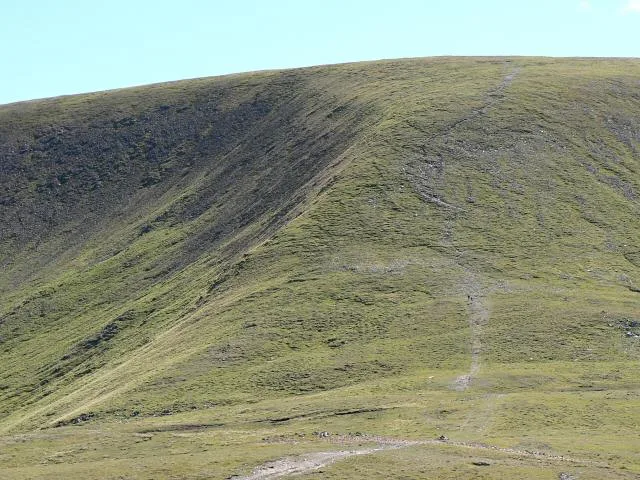
Glas Maol
Also known as: An Glas-mheall
Glas Maol — Named summit at 1068 m.

Wikimedia Commons contributors — see linked file page for photographer and licence licence
Plan your visit
- Typical visit
- 3 h–8 h
- Best time of year
- Late spring – early autumn (May–Oct)
- Free entry
- Dog-friendly
About
Glas Maol is a named summit in the United Kingdom. Also known as: An Glas-mheall. Wikidata describes it as: "Named summit at 1068 m.". Coordinates: 56.8731°, -3.3683°.
Photo gallery
From the Wikipedia article
Glas Maol (Scottish Gaelic: A' Ghlas-Mheall) is a mountain in the Mounth, in the southeastern part of the Highlands of Scotland. The broad, flat summit is divided between the council area of Aberdeenshire, Angus and Perth and Kinross, though the highest point lies wholly within Angus; indeed Glas Maol is the highest point in that council area. Glas Maol is both a Munro and a Marilyn. The western slopes of Glas Maol form part of the Glenshee Ski Centre ski area. The most common route of ascent goes through the slopes, starting from the highest point of the A93 road, the Cairnwell pass. This is the highest public road in Scotland; hence only around 400 m of ascent is involved. Glas Maol is often climbed in conjunction with Creag Leacach to the south or Cairn of Claise to the north. The broad ridge linking these peaks is topped by a dry-stone dyke, which approximately corresponds to the border of the Angus council area.
Excerpt from Wikipedia under CC BY-SA 4.0. See the source article linked in Sources below.
- Coordinates
- 56.8731, -3.3683
- Address
- Mounth, Scotland
- Official site
- www.walkhighlands.co.uk
Sources
- osm: n304813800 (ODbL)
- wikipedia: Glas Maol (CC BY-SA 4.0)
- commons: Glas maol.jpg (CC BY-SA 4.0)
Other places nearby
Loading nearby places…
Nearby
 📷 3
📷 3Natural landmarks · Scottish Highlands
Glas Maol
Glas Maol — 1068m high mountain in Scotland.
 📷 3
📷 3Battlefields & battle sites · Scottish Highlands
Caenlochan Forest
Caenlochan Forest in Scotland Highlands, United Kingdom.
 📷 3
📷 3Mountains & hills · Scottish Highlands
Little Glas Maol
Little Glas Maol — a mountain in scotland-highlands, United Kingdom.
 📷 3
📷 3Mountains & hills · Scottish Highlands
Monega Hill
Monega Hill — a mountain in scotland-highlands, United Kingdom.
 📷 3
📷 3Natural landmarks · Scottish Highlands
Caenlochan
Caenlochan in Scotland Islands, United Kingdom.
 📷 3
📷 3Historic houses · Scottish Highlands
Anti Tank Blocks
Anti Tank Blocks — a historic house in scotland-highlands, United Kingdom.
More mountains in this region
 📷 3
📷 3Mountains & hills · Scottish Highlands
A' Bhuidheanach Bheag
A' Bhuidheanach Bheag — Named summit at 936 m.
 📷 3
📷 3Mountains & hills · Scottish Highlands
A' Chailleach
A' Chailleach — Named summit at 997 m.
 📷 3
📷 3Mountains & hills · Scottish Highlands
A' Chailleach
A' Chailleach — Named summit at 930 m.
 📷 3
📷 3Mountains & hills · Scottish Highlands
A' Chaoirnich
A' Chaoirnich — Named summit at 875 m.
Frequently asked questions
- Where is Glas Maol?
- Glas Maol is in Scottish Highlands, in the United Kingdom — coordinates 56.8731°, -3.3683°.
- Is Glas Maol free to visit?
- Yes — admission to Glas Maol is free.