Natural landmarks · Scottish Highlands
Glamaig
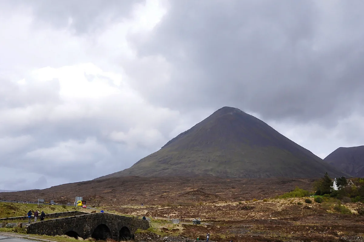
Glamaig — mountain on the Isle of Skye, in Highland, Scotland, UK.

Wikimedia Commons contributors — see linked file page for photographer and licence licence
Plan your visit
- Typical visit
- 1 h–2 h
- Free entry
- Dog-friendly
About
Glamaig is a named natural landmark in the United Kingdom. Wikidata describes it as: "mountain on the Isle of Skye, in Highland, Scotland, UK". Coordinates: 57.2936°, -6.1279°.
Photo gallery
From the Wikipedia article
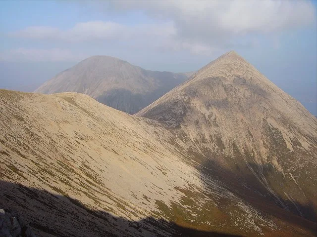
Glamaig (Scottish Gaelic: Glàmaig) is the northernmost of the Red Hills on the Isle of Skye in Scotland. It lies immediately east of Sligachan. It is one of only two Corbetts on Skye. From many angles the hill resembles a perfect cone of scree, though it is linked to the rest of the Red Hills by way of a bealach, the Bealach na Sgàirde (Pass of the Scree). In 1889, a Gurkha named Harkabir Tharpa scaled Glamaig in 37 minutes; his total time for the round trip, starting and finishing at sea level in the bar of the Sligachan Inn was 55 minutes. Legend has it that he ran it in bare feet, and his record stood until the 1980s, despite being attempted by Olympians such as Chris Brasher in the 1950s. From Sligachan one route of ascent (whether running or hillwalking) is simply to head up the scree aiming for the summit - this climb is very arduous, due to the unrelenting gradient and the slipperiness of the scree. Descent may be made by way of ascent; alternatively one may continue along the Red Cuillin ridge to take in other peaks to the south. A slightly less arduous (but longer) climb approaches the mountain from its eastern end at Sconser. Climb first to the secondary summit, An Coileach (The Cockerel), then follow the whaleback ridge to the primary summit, Sgurr Mhàiri (Mary's Peak). Once An Coileach is reached at 673 metres (2,208 ft), the more-or-less level ridge allows some respite from the gradient, with a gentler ascent of the final 102 metres (335 ft) to Sgurr Mhàiri. From the summit there are excellent views of both the Black Cuillin and the Isle of Raasay.
Excerpt from Wikipedia under CC BY-SA 4.0. See the source article linked in Sources below.
- Coordinates
- 57.2936, -6.1279
- Address
- Skye, Scotland
Sources
- wikidata: Q2365368 (CC0)
- wikipedia: Glamaig (CC BY-SA 4.0)
- commons: Schotland Glamaig bij Sligachan 13-05-2010 16-33-36.JPG (CC BY-SA 4.0)
Other places nearby
Loading nearby places…
Nearby
 📷 3
📷 3Mountains & hills · Scottish Highlands
Sgùrr Mhàiri
Sgùrr Mhàiri — Named summit at 775 m.
 📷 3
📷 3Mountains & hills · Scottish Highlands
Beinn Dearg Mhòr
Beinn Dearg Mhòr — Named summit at 731 m.
 📷 3
📷 3Mountains & hills · Scottish Highlands
Loch Sligachan
Loch Sligachan — bay in Highland, Scotland, UK.
 📷 4
📷 4Piers · Scottish Islands
Sconser
Sconser in Scotland Islands, United Kingdom.
Hostels · Scottish Highlands
Sligachan Bunkhouse
Sligachan Bunkhouse — a hostel in scotland highlands.
 📷 3
📷 3Memorials & monuments · Scottish Highlands
Collie and Mackenzie memorial
Collie and Mackenzie memorial — a memorial in scotland-highlands, United Kingdom.
More natural landmarks in this region
 Flagship📷 3
Natural landmarks · Scottish Highlands
Dunalastair Water
Dunalastair Water — lake in Perth and Kinross, Scotland, UK, on the River Tummel.
 Flagship📷 3
Natural landmarks · Scottish Highlands
Loch Arkaig
Loch Arkaig — lake in Highland, Scotland, UK, outflows east to River Arkaig.
 Flagship📷 3
Natural landmarks · Scottish Highlands
Loch Assynt
Loch Assynt — lake in Highland, Scotland, UK, outflows to the River Inver and Loch na Garbh Uidhe.
 Flagship📷 3
Natural landmarks · Scottish Highlands
Loch Awe
Loch Awe — lake in Argyll and Bute, Scotland, UK, outflows to the River Awe.
Frequently asked questions
- Where is Glamaig?
- Glamaig is in Scottish Highlands, in the United Kingdom — coordinates 57.2936°, -6.1279°.
- Is Glamaig free to visit?
- Yes — admission to Glamaig is free.