Towns & cities · West Midlands
Gayton
Gayton — village and civil parish in Northamptonshire, England.

Wikimedia Commons contributors — see linked file page for photographer and licence licence
Plan your visit
- Typical visit
- 3 h–6 h
- Nearest railway station
- Northampton · 7.4 km
- Free entry
- Family-friendly
- Dog-friendly
About
Gayton is a town, city, village or settlement in the United Kingdom. It covers approximately 703 km². Recent population estimates put it at around 512 people. Address: NN7. Wikidata describes it as: "village and civil parish in Northamptonshire, England". Coordinates: 52.1850°, -0.9740°.
Photo gallery
From the Wikipedia article
Gayton is a rural village and civil parish in West Northamptonshire, England, 5 miles (8 km) south-west of Northampton town centre. The village is situated on a hill close to the larger villages of Bugbrooke, Milton Malsor and Blisworth, with a linked public footpath network. At the 2011 Census, the population of the parish was 544.
Excerpt from Wikipedia under CC BY-SA 4.0. See the source article linked in Sources below.
Background
History
The village's name is probably derived from Old English meaning "Gaega's farm/settlement". The first record of the name was in 1162. Sited near Watling Street, the ancient way from the ports of Kent to Wroxeter, Gayton was not recorded in the Domesday Book survey of 1086 but was probably the unnamed settlement in the Hundred of Towcester held by the knight Sigar of Chocques, who came from the village of that name near Béthune in the north of France. By 1162 it had passed to his relation Robert V of Béthune, being inherited in turn by his eldest son Robert VI, by his second son William II, by William's eldest son Daniel and then by Daniel's younger brother. This was Robert VII, who in 1242…
Sourced from Wikipedia under CC BY-SA 4.0.
- Coordinates
- 52.1850, -0.9740
- District
- West Northamptonshire
- Parish
- Gayton
- Postcode
- NN7
- Parliamentary constituency
- South Northamptonshire
- Population
- 512
- Nearest railway station
- Northampton — 7.4 km
Sources
- wikidata: Q727475 (CC0)
- wikipedia: Gayton, Northamptonshire (CC BY-SA 4.0)
- commons: Gayton Church - geograph.org.uk - 294701.jpg (CC BY-SA 4.0)
Other places nearby
Loading nearby places…
Nearby
 📷 3
📷 3Stately homes · West Midlands
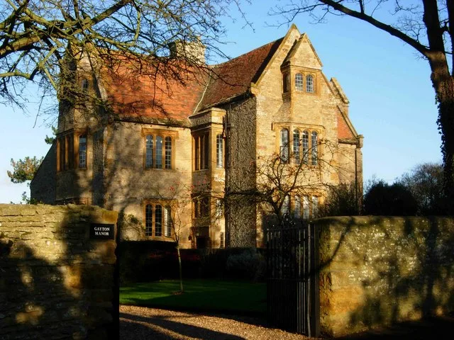
Gayton Manor House
Gayton Manor House — Grade I listed manor house in South Northamptonshire, England, UK.
Caravan parks · West Midlands
The Limes Caravan Park
The Limes Caravan Park — a caravan park in england west midlands.
 📷 3
📷 3Historic bridges · West Midlands
Bridge Number 45
Bridge Number 45 — Grade II listed building-listed bridge in england-west-midlands, United Kingdom.
 📷 3
📷 3Historic bridges · West Midlands
Bridge Number 43
Bridge Number 43 — Grade II listed building-listed bridge in england-west-midlands, United Kingdom.
 📷 3
📷 3Historic bridges · West Midlands
Bridge Number 47
Bridge Number 47 — Grade II listed building-listed bridge in england-west-midlands, United Kingdom.
 📷 3
📷 3Historic bridges · West Midlands
Bridge Number 42
Bridge Number 42 — Grade II listed building-listed bridge in england-west-midlands, United Kingdom.
More towns in this region
 Flagship📷 3
Towns & cities · West Midlands
Adderbury
Adderbury — village and civil parish in Cherwell district, Oxfordshire, England.
 Flagship📷 3
Towns & cities · West Midlands
Admington
Admington — village in Warwickshire, England, UK.
 Flagship📷 3
Towns & cities · West Midlands
Aldington
Aldington — village in Worcestershire, United Kingdom.
 Flagship📷 5
Towns & cities · West Midlands
Anstey
Anstey — large village in Leicestershire, England.
Frequently asked questions
- Where is Gayton?
- Gayton is in the West Midlands, United Kingdom (postcode NN7), in the parish of Gayton.
- Is Gayton free to visit?
- Yes, Gayton is free to enter.
- How do I get to Gayton?
- The nearest railway station is Northampton, about 7.4 km away. Drivers can navigate to postcode NN7.