Museums · Yorkshire & the Humber
Garforth
Garforth () is a town in the metropolitan borough of the City of Leeds, Yorkshire. It sits in the Garforth and Swillington ward of Leeds City Council and the Leeds East parliamentary constituency. As

Betty Longbottom — CC BY-SA 2.0 via Wikimedia Commons licence
Plan your visit
- Typical visit
- 1.5 h–3 h
- Best time of year
- Year-round
- Family-friendly
- Limited wheelchair access
About
Garforth () is a town in the metropolitan borough of the City of Leeds, Yorkshire. It sits in the Garforth and Swillington ward of Leeds City Council and the Leeds East parliamentary constituency. As of 2011, the population of Garforth was 14,957, having decreased since the last census. It is 6.5 miles (10.5 km) east of Central Leeds, 16 miles (26 km) south-west of York and 10 miles (16 km) north of Wakefield. It is mostly an Un-Parished area, like much of Greater Leeds.
Photo gallery
From the Wikipedia article
Garforth () is a town in the metropolitan borough of the City of Leeds, Yorkshire. It sits in the Garforth and Swillington ward of Leeds City Council and the Leeds East parliamentary constituency. As of 2011, the population of Garforth was 14,957, having decreased since the last census. It is 6.5 miles (10.5 km) east of Central Leeds, 16 miles (26 km) south-west of York and 10 miles (16 km) north of Wakefield. It is mostly an Un-Parished area, like much of Greater Leeds.
Excerpt from Wikipedia under CC BY-SA 4.0. See the source article linked in Sources below.
Background
History
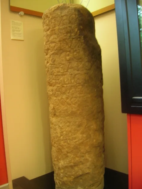
Garforth owes its size to expansion in the seventeenth and eighteenth centuries during which the local land-owning Gascoigne family ran several coalmines in the area. The surrounding settlements of Micklefield, Kippax, Swillington, Methley and Allerton Bywater Great and Little Preston are all villages that prospered and grew as a result of the coal industry. Nowadays manufacturing and motor-vehicle repair account for more than a third of the workforce in the area. More recent expansion can also be traced to a combination of overall economic success in Leeds, and that Garforth is served by transport links. The A1 and M1 are minutes away, and both have recently been linked by an extension of…
Sourced from Wikipedia under CC BY-SA 4.0.
- Coordinates
- 53.7920, -1.3880
- District
- Leeds
- Parish
- Leeds, unparished area
- Postcode
- LS25 1DU
- Parliamentary constituency
- Leeds East
Sources
- wikipedia: Garforth (CC BY-SA 4.0)
Other places nearby
Loading nearby places…
Nearby
 📷 5
📷 5Natural landmarks · Yorkshire & the Humber
Masters Performing Arts College
Masters Performing Arts College — a school heritage in england-yorkshire, United Kingdom.
📷 5Natural landmarks · Yorkshire & the Humber
SLP College
SLP College — a school heritage in england-yorkshire, United Kingdom.
 📷 3
📷 3Historic bridges · Yorkshire & the Humber
Cranshaw Woods Bridge
Cranshaw Woods Bridge is a historic bridge in the United Kingdom.
 📷 3
📷 3Wildlife reserves · Yorkshire & the Humber
Roach Lime Hills
Roach Lime Hills — site of special scientific interest in West Yorkshire.
Cinemas · Yorkshire & the Humber
Odeon
Odeon — a cinema in england yorkshire.
 📷 5
📷 5Museums · Yorkshire & the Humber
Kippax, West Yorkshire
Kippax, West Yorkshire — a museum in england-yorkshire, United Kingdom.
More museums in this region
 📷 3
📷 3Museums · Yorkshire & the Humber
Aldborough Roman Town
Aldborough Roman Town — Heritage Museum in Yorkshire, England, UK.
 📷 3
📷 3Museums · Yorkshire & the Humber
Bayle Museum
Bayle Museum — Local museum in Bridlington, England.
Museums · Yorkshire & the Humber
BD1 Gallery
BD1 Gallery — closed gallery in Bradford, West Yorkshire.
 📷 5
📷 5Museums · Yorkshire & the Humber
Beck Isle Museum
Beck Isle Museum — museum in Pickering, North Yorkshire, England, United Kingdom.
Frequently asked questions
- Where is Garforth?
- Garforth is in Yorkshire & the Humber, in the United Kingdom — coordinates 53.7920°, -1.3880°.
- Is Garforth wheelchair accessible?
- Partially — OpenStreetMap notes limited wheelchair access at Garforth. Check ahead for specific facilities.