Islands · Scottish Highlands
Garbh Eileach
Garbh Eileach — island in Argyll and Bute, Scotland, UK.

Wikimedia Commons contributors — see linked file page for photographer and licence licence
Plan your visit
- Typical visit
- 4 h–12 h
- Free entry
- Dog-friendly
About
Garbh Eileach is a island in the United Kingdom. Wikidata describes it as: "island in Argyll and Bute, Scotland, UK". Coordinates: 56.2385°, -5.7697°.
Photo gallery
From the Wikipedia article
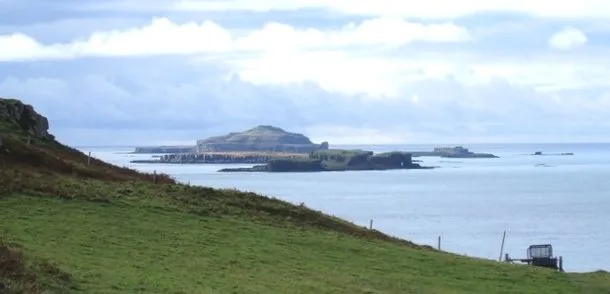
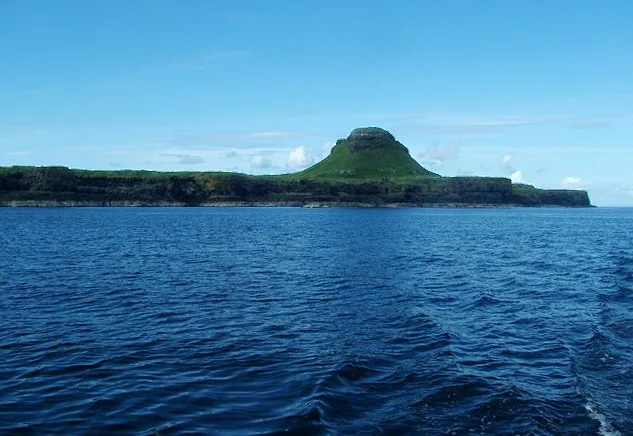
Garbh Eileach is an uninhabited island in the Inner Hebrides of the west coast of Scotland that lies in the Firth of Lorn between Mull and Argyll. With an area of 142 ha (351 acres) it is the largest of the Garvellachs and reaches a maximum elevation of 110 m (361 ft) above sea level. The name is Gaelic for "the rough rocks". The Anglicised version of the name gives the whole group of islands its name of the Garvellachs (Scottish Gaelic: Na Garbh Eileacha). The archipelago is part of the Scarba, Lunga and the Garvellachs National Scenic Area, one of 40 such areas in Scotland. A 2024 study by researchers at University College London regarding the relationship of some of its bedrock to the Sturtian glaciation suggests the archipelago "may be the only place on Earth to have a detailed record of how the Earth entered one of the most catastrophic periods in its history." There are scattered birchwoods and a small herd of red deer on Garbh Eileach.
Excerpt from Wikipedia under CC BY-SA 4.0. See the source article linked in Sources below.
Background
History
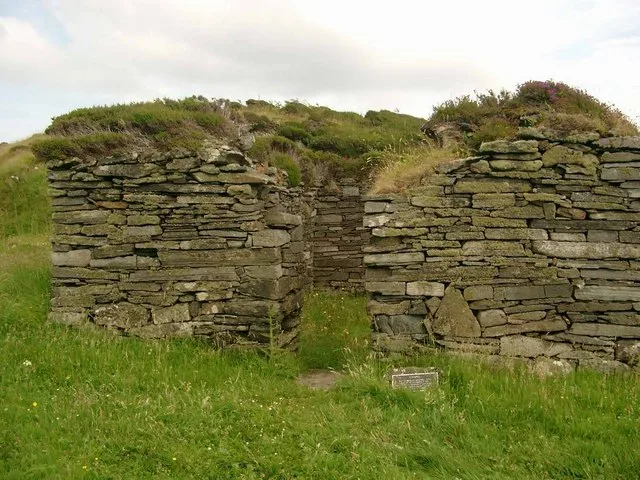
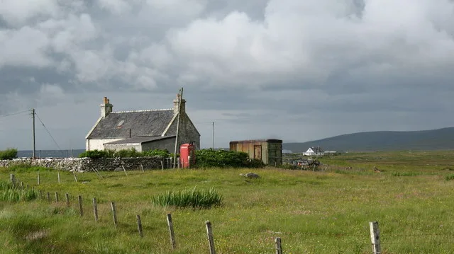
date, there are the ruins of a much later house and byre with a corn-drying kiln a short distance away, probably erected in the late 18th or 19th century. Garbh Eileach had a population of thirty-two adults in the late 17th century but only four houses were occupied by 1861, and from then on it is likely that only the shepherd's cottage near the landing-place remained habitable. This stone bothy is available for "occasional use" but not permanent occupation.
Sourced from Wikipedia under CC BY-SA 4.0.
- Coordinates
- 56.2385, -5.7697
Sources
- wikidata: Q217062 (CC0)
- wikipedia: Garbh Eileach (CC BY-SA 4.0)
- commons: Bothy on Garbh Eileach.jpg (CC BY-SA 4.0)
Other places nearby
Loading nearby places…
Nearby
 📷 3
📷 3Archaeological sites · Scottish Highlands
Rubha Mor, dun site
Rubha Mor, dun site — a archaeological in scotland-highlands, United Kingdom.
 📷 5
📷 5Islands · Scottish Islands
Garvellachs
Garvellachs in Scotland Islands, United Kingdom.
 📷 3
📷 3Islands · Scottish Highlands
A' Chùli
A' Chùli — island in Argyll and Bute, Scotland, UK.
 📷 5
📷 5Islands · Scottish Highlands
Dùn Chonnuill
Dùn Chonnuill — island in Argyll and Bute, Scotland, UK.
 Flagship📷 5
Islands · Scottish Highlands
Eileach an Naoimh
Eileach an Naoimh — uninhabited island, Garvellachs, Scotland.
 📷 5
📷 5Islands · Scottish Highlands
Eilean Dubh Mòr
Eilean Dubh Mòr — island in Argyll and Bute, Scotland, UK.
More places in this region
 📷 5
📷 5Islands · Scottish Highlands
Bac Beag
Bac Beag — Scottish island, part of the Treshnish Isles in the Inner Hebrides.
 📷 5
📷 5Islands · Scottish Highlands
Bac Mòr
Bac Mòr — island in Argyll and Bute, Scotland, UK, one of the Treshnish Isles.
 Flagship📷 3
Islands · Scottish Highlands
Baleshare
Baleshare — flat tidal island in the Outer Hebrides, Scotland, UK.
 Flagship📷 5
Islands · Scottish Highlands
Barra
Barra — island in Outer Hebrides, Scotland, UK.
Frequently asked questions
- Where is Garbh Eileach?
- Garbh Eileach is in Scottish Highlands, in the United Kingdom — coordinates 56.2385°, -5.7697°.
- Is Garbh Eileach free to visit?
- Yes — admission to Garbh Eileach is free.