Gardens · London
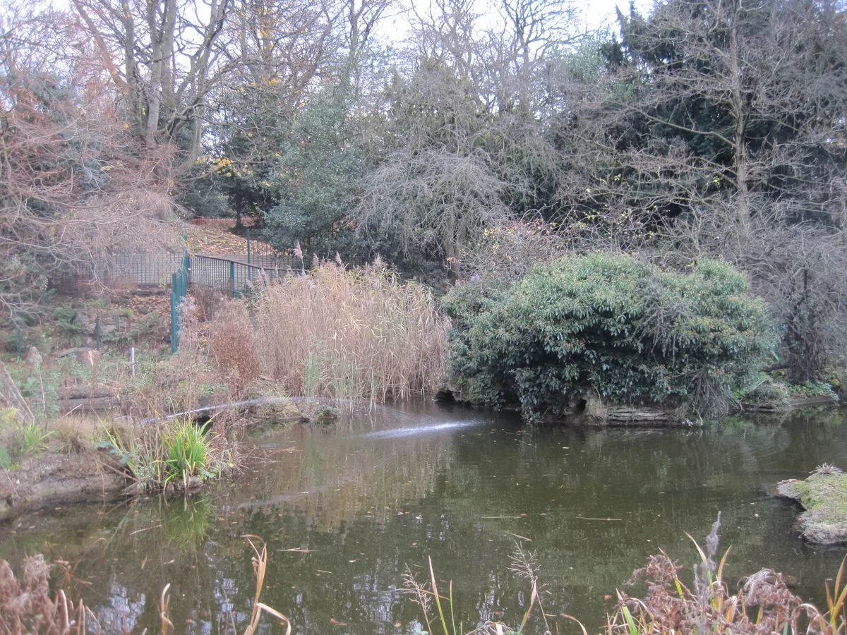
Fryent Country Park
Fryent Country Park — large greenspace in London.

Wikimedia Commons contributors — see linked file page for photographer and licence licence
Plan your visit
- Typical visit
- 1 h–2.5 h
- Best time of year
- Spring & summer (Apr–Sep)
- Nearest railway station
- Kingsbury · 0.9 km
- Dog-friendly
About
Fryent Country Park is a public garden in the United Kingdom. Wikidata describes it as: "large greenspace in London". Coordinates: 51.5775°, -0.2725°.
Photo gallery
From the Wikipedia article
Fryent Country Park, together with Barn Hill Open Space, is a large park situated in the north of the London Borough of Brent. It covers 103 hectares (254 acres) of rolling fields and small woods. Fryent was also a ward of the London Borough of Brent. Its population at the 2011 Census was 13,445.
Excerpt from Wikipedia under CC BY-SA 4.0. See the source article linked in Sources below.
Background
History
Barn Hill, called Bardonhill in 1547, was landscaped by Humphry Repton in 1792 as part of a local landowner's country park. The Fryent Park hay meadows are small remnants of two manors, one originally in the ownership of King Edward the Confessor.
Visiting
The park is bisected by the A4140 Fryent Way that links Kingsbury with Wembley, and which leads south-east towards the North Circular Road. A car park is available halfway down this road. The nearest underground is at Kingsbury Station on the Jubilee line, while the Barn Hill Open Area, or at least the summit of it, is nearer to Wembley Park and Preston Road stations. The 206 bus terminates on the south side of the park and other bus routes run to the east (Church Lane), north (Kingsbury Road) and west (Preston Hill). The Capital Ring footpath crosses the site. However, the road Fryent Way, linking Kingsbury Circle and Salmon Street, has no bus service.
Sourced from Wikipedia under CC BY-SA 4.0.
- Coordinates
- 51.5775, -0.2725
- District
- Brent
- Parish
- Brent, unparished area
- Postcode
- NW9 8YA
- Parliamentary constituency
- Brent East
- Nearest railway station
- Kingsbury — 0.9 km
Sources
- wikidata: Q5506595 (CC0)
- wikipedia: Fryent Country Park (CC BY-SA 4.0)
- commons: Fryent Country Park view north.JPG (CC BY-SA 4.0)
Other places nearby
Loading nearby places…
Nearby
 📷 5
📷 5Viewpoints · London
Gotford's Hill
Gotford's Hill is a viewpoint in the United Kingdom.
 📷 5
📷 5Wildlife reserves · London
Masons Field
Masons Field — Local Nature Reserve in London Borough of Brent.
 📷 5
📷 5Historic churches · London
Kingsbury Buddhist Temple - Sri Saddhatissa International Buddhist Centre
Kingsbury Buddhist Temple - Sri Saddhatissa International Buddhist Centre — a church in england-london, United Kingdom.
 📷 5
📷 5Theatres · London
Odeon Kingsbury
Odeon Kingsbury in England London, United Kingdom.
 📷 5
📷 5Parks · London
Roe Green Park
Roe Green Park — park in Kingsbury, London.
 📷 5
📷 5Memorials & monuments · London
Shree Swaminarayan Mandir Kingsbury
Shree Swaminarayan Mandir Kingsbury is a memorial in the United Kingdom.
More gardens in this region
 Flagship📷 10
Gardens · London
Avenue House Grounds
Avenue House Grounds — garden in London Borough of Barnet, United Kingdom.
 Flagship📷 10
Gardens · London
Frogmore Estate
Frogmore Estate — private gardens within the grounds of the Home Park, adjoining Windsor Castle in Berkshire, England, UK.
 📷 10
📷 10Gardens · London
St. Johns Memorial Garden
St. Johns Memorial Garden is a garden in the United Kingdom.
 Flagship📷 10
Gardens · London
Stoke Poges Memorial Gardens
Stoke Poges Memorial Gardens — garden in Stoke Poges, Buckinghamshire, England, UK.
Frequently asked questions
- Where is Fryent Country Park?
- Fryent Country Park is in London, in the United Kingdom — coordinates 51.5775°, -0.2725°. The nearest railway station is Kingsbury, around 0.9 km away.