Archaeological sites · Scottish Highlands
Forest of Birse
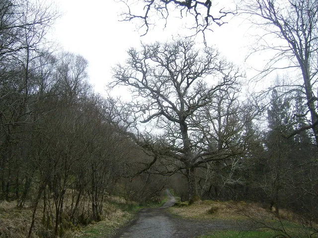
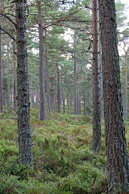
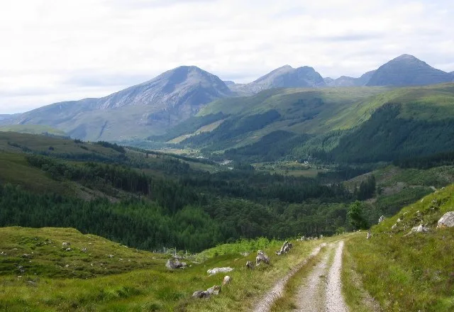
Forest of Birse — forest in Aberdeenshire, Scotland, UK.

Wikimedia Commons contributors — see linked file page for photographer and licence licence
Plan your visit
- Typical visit
- 45 min–1.5 h
- Free entry
- Dog-friendly
About
Forest of Birse is an archaeological site in the United Kingdom. Wikidata describes it as: "forest in Aberdeenshire, Scotland, UK". Coordinates: 57.0000°, -2.7700°.
Photo gallery
From the Wikipedia article
The Forest of Birse is a remote upland area in the upper catchment of the Water of Feugh, which forms the south-western portion of the Parish of Birse, Aberdeenshire, Scotland. It also forms the western part of the community of Finzean, but has a separate, complex history of landownership relating to its status as a commonty, which has involved a large number of disputes since the 16th century. In more recent decades, the forest has been a popular destination for people from Aberdeen taking picnics, as it is the closest area of Highland scenery to the city.
Excerpt from Wikipedia under CC BY-SA 4.0. See the source article linked in Sources below.
Background
History
The earliest inhabitants of the forest were mesolithic hunter-gatherers about 8000 years ago. However, the first evidence of settlement comes from the Bronze Age, about 3000 years ago, in the form of field systems, clearance cairns and hut circles, of which there are several good examples in the Forest of Birse. At this time, cereal crops were probably grown on areas that are now covered with heather. At the beginning of the Iron Age there was a climatic deterioration and these farms were probably abandoned at that time and gradually reclaimed by nature. The Forest of Birse remained uninhabited from then until the 17th century. By the 10th century AD, the Forest of Birse (along with the…
Description
The eastern boundary of the Forest of Birse is marked by the Finlets and Laird's burns; two minor tributaries of the Feugh (itself a tributary of the River Dee) which join the river about 1 kilometre upstream from Woodend. Otherwise the boundary generally follows the watershed of the Feugh, which runs along the tops of the following hills (clockwise from the south): Baudnacauner, Cock Hill, Hill of Cammie, Mudlee Bracks, Tampie, Gannoch, Hill of St, Colm, Craigmahandle, Hill of Duchery, Brackenstake, Lamahip and Corybeg. The Forest of Birse extends to approximately 35 square kilometres, and reaches its highest point at Gannoch (731 m). The underlying bedrock of the Forest of Birse is…
Sourced from Wikipedia under CC BY-SA 4.0.
- Coordinates
- 57.0000, -2.7700
Sources
- wikidata: Q5469157 (CC0)
- wikipedia: Forest of Birse (CC BY-SA 4.0)
- commons: Forest of Birse1.jpg (CC BY-SA 4.0)
Other places nearby
Loading nearby places…
Nearby
 📷 5
📷 5Historic churches · Scottish Highlands
Forest Of Birse Church
Forest Of Birse Church — category C listed building-listed church in scotland-highlands, United Kingdom.
 📷 5
📷 5Castles · Scottish Highlands
Birse Castle
Birse Castle is located in the Forest of Birse, Aberdeenshire, Scotland. Originally a square tower house, it was rebuilt in the first decade of the 20th century into an L-plan structure. The 1930 addi
 📷 3
📷 3Memorials & monuments · Scottish Highlands
Joseph Robert Heaven Memorial
Joseph Robert Heaven Memorial — a memorial in scotland-highlands, United Kingdom.
 📷 3
📷 3Memorials & monuments · Scottish Highlands
JRK Memorial
JRK Memorial — a memorial in scotland-highlands, United Kingdom.
 📷 3
📷 3Mountains & hills · Scottish Highlands
Gannoch
Gannoch — a mountain in scotland-highlands, United Kingdom.
 📷 2
📷 2Memorials & monuments · Scottish Highlands
Cunliffe Ball
Cunliffe Ball — a memorial in scotland-highlands, United Kingdom.
More archaeological sites in this region
 📷 5
📷 5Archaeological sites · Scottish Highlands
Ariundle Oakwood National Nature Reserve
Ariundle Oakwood National Nature Reserve — forested nature reserve in Highland, Scotland, UK.
 📷 3
📷 3Archaeological sites · Scottish Highlands
Abernethy Forest
Abernethy Forest — forest in Highland, Scotland, UK.
 📷 3
📷 3Archaeological sites · Scottish Highlands
Abriachan Forest
Abriachan Forest — Forest near Abriachan village in Scotland.
 📷 3
📷 3Archaeological sites · Scottish Highlands
Achnashellach Forest
Achnashellach Forest is a archaeological site in the United Kingdom.
Frequently asked questions
- Where is Forest of Birse?
- Forest of Birse is in Scottish Highlands, in the United Kingdom — coordinates 57.0000°, -2.7700°.
- Is Forest of Birse free to visit?
- Yes — admission to Forest of Birse is free.