Towns & cities · London
Fordham
Fordham — village and civil parish in the English county of Norfolk.

Wikimedia Commons contributors — see linked file page for photographer and licence licence
Plan your visit
- Typical visit
- 3 h–6 h
- Nearest railway station
- Downham Market · 3.8 km
- Free entry
- Family-friendly
- Dog-friendly
About
Fordham is a town, city, village or settlement in the United Kingdom. It covers approximately 9 km². Recent population estimates put it at around 65 people. Address: PE38. Wikidata describes it as: "village and civil parish in the English county of Norfolk". Coordinates: 52.5712°, 0.3831°.
Photo gallery
From the Wikipedia article
Fordham is a small village and civil parish in the English county of Norfolk. Fordham is located 2.2 miles (3.5 km) north of Downham Market and 39 miles (63 km) west of Norwich, located along the A10 between London and King's Lynn and close to the confluence of the River Wissey and River Great Ouse.
Excerpt from Wikipedia under CC BY-SA 4.0. See the source article linked in Sources below.
Background
History
Fordham's name is of Anglo-Saxon origin and derives from the Old English for a village or homestead close to a ford, likely across the River Great Ouse. The parish of Fordham has been the site of discovery for several significant Bronze Age artefacts, including a hammer, a decorated sword and a socketed axehead. In the Domesday Book, Fordham is listed as a settlement of 22 households in the hundred of Clackclose. In 1086, the village was divided between the East Anglian estates of St Benedict's Abbey, Ralph Baynard, Henry de Ferrers, Reginald, son of Ivo and the Abbey of St Etheldreda, Ely. Snore Hall dates from the Medieval period and was originally built as a timber-framed, fortified…
Sourced from Wikipedia under CC BY-SA 4.0.
- Coordinates
- 52.5712, 0.3831
- County
- Norfolk
- District
- King's Lynn and West Norfolk
- Parish
- Fordham
- Postcode
- PE38
- Parliamentary constituency
- South West Norfolk
- Population
- 65
- Nearest railway station
- Downham Market — 3.8 km
Sources
- wikidata: Q607157 (CC0)
- wikipedia: Fordham, Norfolk (CC BY-SA 4.0)
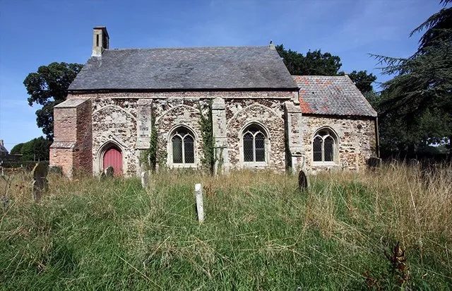
- commons: St Mary, Fordham, Norfolk - geograph.org.uk - 1449351.jpg (CC BY-SA 4.0)
Other places nearby
Loading nearby places…
Nearby
 📷 5
📷 5Historic churches · London
St Mary's Church, Fordham
St Mary's Church, Fordham — church in Fordham, UK.
 📷 5
📷 5Public art & sculpture · London
Hilgay Village Sign
Hilgay Village Sign — a public art in england-london, United Kingdom.
 📷 5
📷 5Natural landmarks · London
Kett's Oak
Kett's Oak — a other in england-london, United Kingdom.
📷 5Memorials & monuments · London
Hilgay War Memorial
Hilgay War Memorial — Grade II listed building-listed memorial in england-london, United Kingdom.
.jpg?width=1200) 📷 5
📷 5Historic houses · London
Ryston Hall
Ryston Hall — country house in Norfolk, England, UK.
 📷 5
📷 5Mills · London
Denver Windmill
Denver Windmill — mill in Denver, King's Lynn and West Norfolk, England, UK.
More towns in this region
 Flagship📷 10
Towns & cities · London
Aldenham
Aldenham — village and civil parish in Hertfordshire, England.
 Flagship📷 10
Towns & cities · London
Ashdon
Ashdon — village and civil parish in Essex, UK.
 Flagship📷 10
Towns & cities · London
Betchworth
Betchworth — village and civil parish in the Mole Valley district of Surrey, England.
 Flagship📷 10
Towns & cities · London
Boxley
Boxley — village and civil parish in Maidstone District, Kent, England, UK.
Frequently asked questions
- Where is Fordham?
- Fordham is in Norfolk, London, United Kingdom (postcode PE38), in the parish of Fordham.
- Is Fordham free to visit?
- Yes, Fordham is free to enter.
- How do I get to Fordham?
- The nearest railway station is Downham Market, about 3.8 km away. Drivers can navigate to postcode PE38.