Archaeological sites · Scottish Highlands
Fetteresso Forest
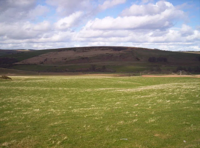
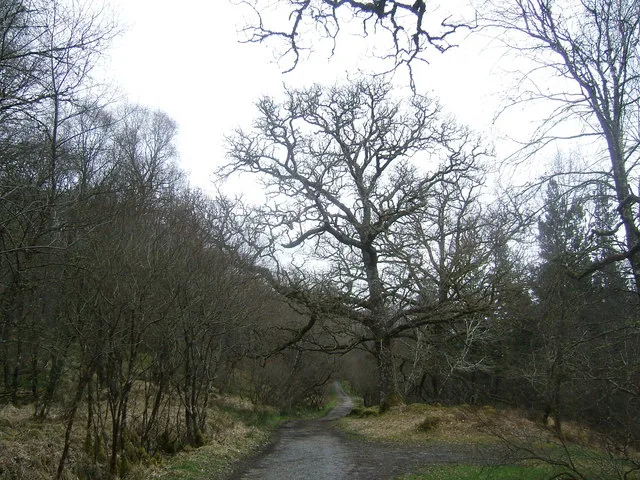
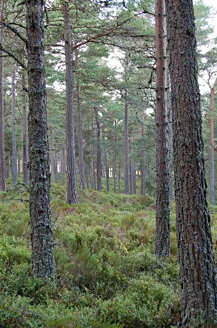
Fetteresso Forest — forest in Aberdeenshire, Scotland.

Alan Findlay — CC BY-SA 2.0 via Wikimedia Commons licence
Plan your visit
- Typical visit
- 45 min–1.5 h
- Nearest railway station
- Milton of Crathes · 9.4 km
- Free entry
- Dog-friendly
About
Fetteresso Forest is an archaeological site in the United Kingdom. Wikidata describes it as: "forest in Aberdeenshire, Scotland". Coordinates: 56.9740°, -2.3970°.
Photo gallery
From the Wikipedia article
The Fetteresso Forest is a woodland that is principally coniferous situated in the Mounth range of the Grampian Mountains in Aberdeenshire, Scotland. The forest has a number of prominent mountain peaks including the Hill of Blacklodge and Craiginour peak. A good overlook for viewing the forest from the north side lies on an unnamed tarmac road which leads north from the Slug Road to the Raedykes Roman site. The Cowie Water flows through and drains much of the forest. To the north of the easternmost part of the forest is the archaeological site Raedykes Roman Camp, as well as Cowton Burn. The Slug Road runs along much of the northeast perimeter of Fetteresso Forest. Notable features in this vicinity include Dunnottar Castle, Fetteresso Castle, Bogjurgan Hill and Muchalls Castle.
Excerpt from Wikipedia under CC BY-SA 4.0. See the source article linked in Sources below.
- Coordinates
- 56.9740, -2.3970
- Nearest railway station
- Milton of Crathes — 9.4 km
Sources
- wikidata: Q5445977 (CC0)
- wikipedia: Fetteresso Forest (CC BY-SA 4.0)
Other places nearby
Loading nearby places…
Nearby
 📷 3
📷 3Natural landmarks · Scottish Highlands
Cairn Mon Earn
Cairn Mon Earn — mountain in Aberdeenshire, Scotland, UK.
 📷 3
📷 3Mountains & hills · Scottish Highlands
Droop Hill
Droop Hill — Named summit at 223 m.
 📷 3
📷 3Stone circles · Scottish Highlands
Nine Stanes Stone Circle
Nine Stanes Stone Circle — a stone circle in scotland-highlands, United Kingdom.
 📷 3
📷 3Natural landmarks · Scottish Highlands
Droop Hill
Droop Hill — mountain in Aberdeenshire, Scotland, UK.
 📷 5
📷 5Historic bridges · Scottish Highlands
Bridge of Blairydryne
Bridge of Blairydryne — category B listed building-listed bridge in scotland-highlands, United Kingdom.
 📷 3
📷 3Memorials & monuments · Scottish Highlands
Rickarton War Memorial
Rickarton War Memorial — a memorial in scotland-highlands, United Kingdom.
More archaeological sites in this region
 📷 5
📷 5Archaeological sites · Scottish Highlands
Ariundle Oakwood National Nature Reserve
Ariundle Oakwood National Nature Reserve — forested nature reserve in Highland, Scotland, UK.
 📷 3
📷 3Archaeological sites · Scottish Highlands
Abernethy Forest
Abernethy Forest — forest in Highland, Scotland, UK.
 📷 3
📷 3Archaeological sites · Scottish Highlands
Abriachan Forest
Abriachan Forest — Forest near Abriachan village in Scotland.
 📷 3
📷 3Archaeological sites · Scottish Highlands
Achnashellach Forest
Achnashellach Forest is a archaeological site in the United Kingdom.
Frequently asked questions
- Where is Fetteresso Forest?
- Fetteresso Forest is in Scottish Highlands, in the United Kingdom — coordinates 56.9740°, -2.3970°. The nearest railway station is Milton of Crathes, around 9.4 km away.
- Is Fetteresso Forest free to visit?
- Yes — admission to Fetteresso Forest is free.