Natural landmarks · Scottish Lowlands
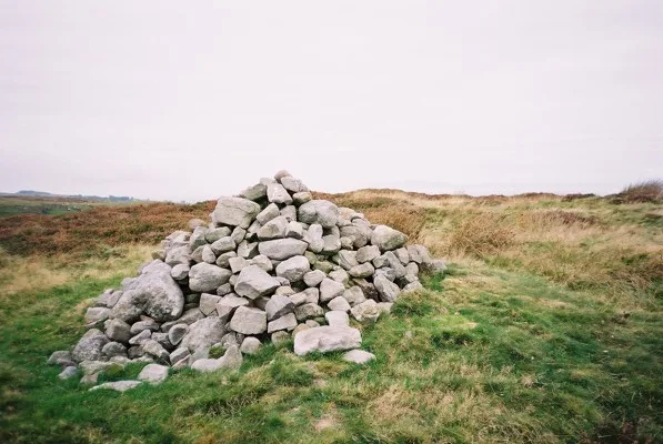
Faulds Brow
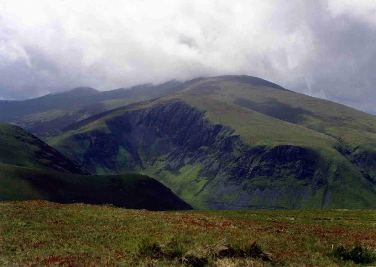
Faulds Brow — mountain in United Kingdom.

Wikimedia Commons contributors — see linked file page for photographer and licence licence
Plan your visit
- Typical visit
- 1 h–2 h
- Nearest railway station
- Wigton · 9.3 km
- Free entry
- Dog-friendly
About
Faulds Brow is a named natural landmark in the United Kingdom. Wikidata describes it as: "mountain in United Kingdom". Coordinates: 54.7568°, -3.0907°.
Photo gallery
Protected designations
- Area of Outstanding Natural Beauty: Solway Coast
Designations sourced from Natural England open data under OGL v3.
From the Wikipedia article
Faulds Brow is a small rise in the English Lake District, northwest of the village of Caldbeck in Cumbria. It is the subject of a chapter of Wainwright's book The Outlying Fells of Lakeland. but its summit, at 344 metres (1,129 ft), is only slightly raised above the surrounding land. From a major road just to the south, the summit can be reached in minutes, with minimal effort. Nevertheless, the summit has wide views to High Pike to the south, and to the Solway Firth and beyond to Scotland to the north. Wainwright's recommended route, "to make a worthwhile walk", is an anticlockwise circuit from Caldbeck, mostly on minor roads. The fell is largely covered by heather, and there is a small abandoned quarry just to the east of the summit. Prominently seen from the summit are two broadcasting antennas to the north, which lie just outside the Lake District National Park boundary, which passes just north of Faulds Brow.
Excerpt from Wikipedia under CC BY-SA 4.0. See the source article linked in Sources below.
- Coordinates
- 54.7568, -3.0907
- District
- Cumberland
- Parish
- Caldbeck
- Postcode
- CA7 8EG
- Parliamentary constituency
- Penrith and Solway
- Nearest railway station
- Wigton — 9.3 km
Sources
- wikidata: Q5438107 (CC0)
- wikipedia: Faulds Brow (CC BY-SA 4.0)
- commons: Faulds Brow - geograph.org.uk - 73696.jpg (CC BY-SA 4.0)
Other places nearby
Loading nearby places…
Nearby
 📷 3
📷 3Mountains & hills · Scottish Lowlands
Faulds Brow
Faulds Brow — Named summit at 344 m.
 📷 3
📷 3Historic bridges · Scottish Lowlands
Whelpo Bridge
Whelpo Bridge is a historic bridge in the United Kingdom.
 📷 3
📷 3Watermills · Scottish Lowlands
The Howk Bobbin Mill
The Howk Bobbin Mill is a watermill in the United Kingdom.
 📷 4
📷 4Historic pubs · Scottish Lowlands
Oddfellows Arms
Oddfellows Arms — Historic pub — listed building or notable heritage status.
Hostels · Scottish Lowlands
Caldbeck Glamping Barns & Bothy
Caldbeck Glamping Barns & Bothy — a hostel in scotland lowlands.
Caravan parks · Scottish Lowlands
Clea Hall Holiday Park
Clea Hall Holiday Park — a caravan park in scotland lowlands.
More natural landmarks in this region
 Flagship📷 3
Natural landmarks · Scottish Lowlands
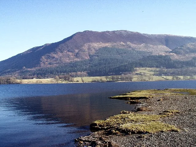
Bassenthwaite Lake
Bassenthwaite Lake — lake in Cumbria, England, UK.
 Flagship📷 3
Natural landmarks · Scottish Lowlands
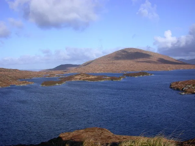
Loch Enoch
Loch Enoch — lake in Dumfries and Galloway, Scotland, UK.
 📷 5
📷 5Natural landmarks · Scottish Lowlands
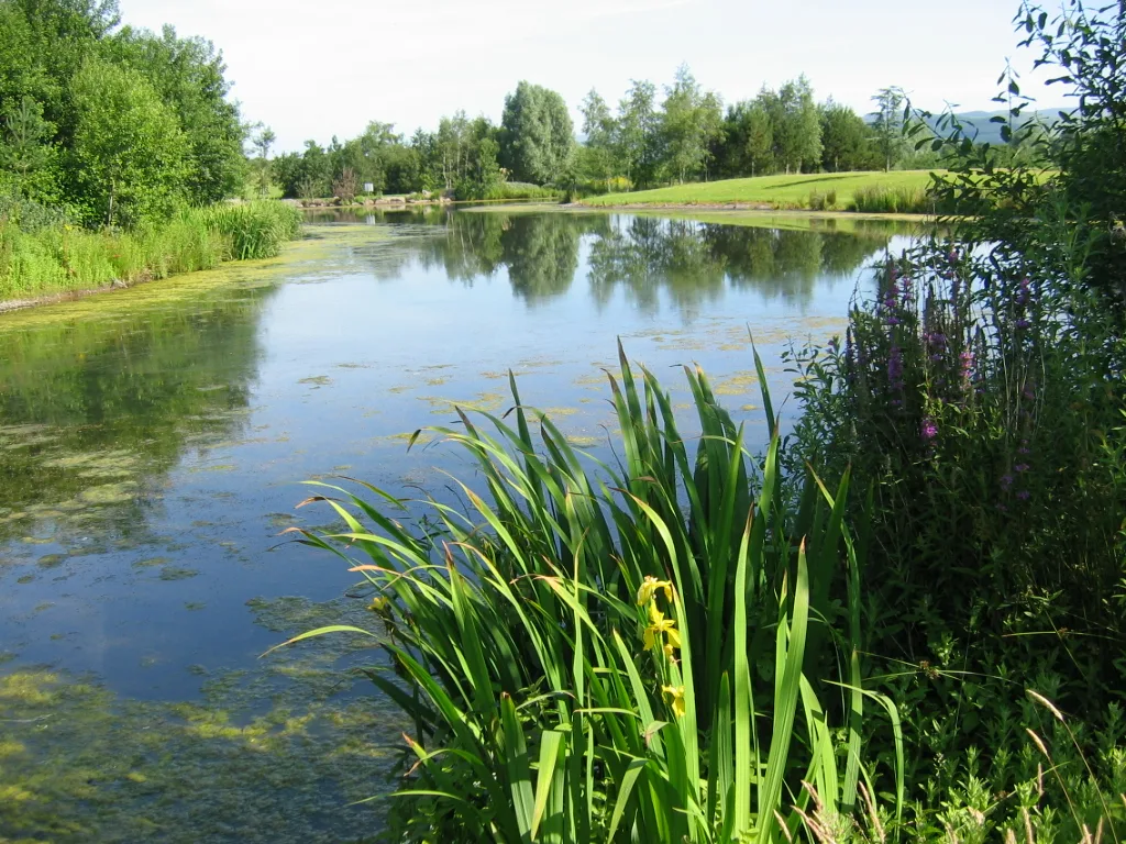
Annandale Water
Annandale Water — lake in Dumfries and Galloway, Scotland, UK.
 📷 3
📷 3Natural landmarks · Scottish Lowlands
Bakestall
Bakestall — mountain in United Kingdom.
Frequently asked questions
- Where is Faulds Brow?
- Faulds Brow is in the Scottish Lowlands, United Kingdom (postcode CA7 8EG), in the parish of Caldbeck.
- Is Faulds Brow a protected site?
- Yes — Faulds Brow is part of the Solway Coast National Landscape (AONB).
- Is Faulds Brow free to visit?
- Yes, Faulds Brow is free to enter.
- How do I get to Faulds Brow?
- Drivers can navigate to postcode CA7 8EG. It sits within the Penrith and Solway parliamentary constituency.