Towns & cities · South East England
Farnham Common
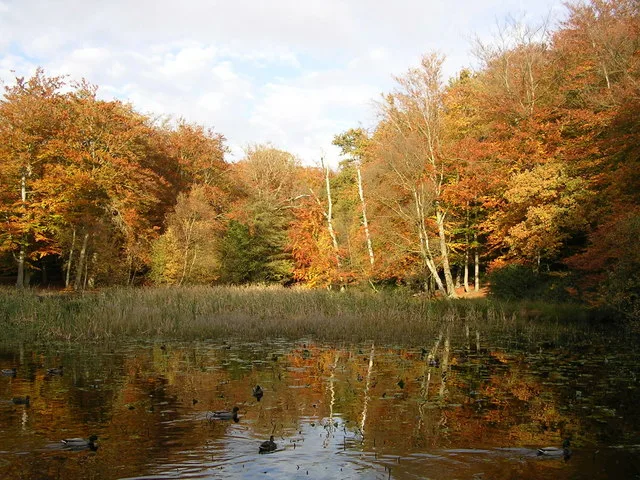
Farnham Common — village in Buckinghamshire, United Kingdom.
Wikimedia Commons contributors — see linked file page for photographer and licence licence
Plan your visit
- Typical visit
- 3 h–6 h
- Nearest railway station
- Burnham · 4.2 km
- Free entry
- Family-friendly
- Dog-friendly
About
Farnham Common is a town, city, village or settlement in the United Kingdom. Address: SL2. Wikidata describes it as: "village in Buckinghamshire, United Kingdom". Coordinates: 51.5558°, -0.6153°.
Photo gallery
Protected designations
- Area of Outstanding Natural Beauty: Chilterns
Designations sourced from Natural England open data under OGL v3.
From the Wikipedia article
Farnham Common is a village in southern Buckinghamshire, England, 3 miles north of Slough and 3 miles south of Beaconsfield, on the A355 road. It adjoins the ancient woodland Burnham Beeches, has an area of 2.5 miles and a population of around 6,000. It is in the civil parish Farnham Royal.
Excerpt from Wikipedia under CC BY-SA 4.0. See the source article linked in Sources below.
Background
History
Farnham Royal was the main village with its church of St Mary's, shops, cottages and village pump situated in the centre junction of the cross roads. Farnham Common was known as 'Up End', being the common land of the parish where the livestock was grazed at certain times of the year. As this common area became more populated it became known as Farnham Common. Farnham Common is on the border of Burnham Beeches, the well known Beech forest owned by the City of London Corporation, having been given to the people of London as a place in the country for their recreation and pleasure. In the 1920s it was very common for coach loads of Londoners to come down for the day at weekends having tea at…
Sourced from Wikipedia under CC BY-SA 4.0.
- Coordinates
- 51.5558, -0.6153
- District
- Buckinghamshire
- Parish
- Farnham Royal
- Postcode
- SL2
- Parliamentary constituency
- Beaconsfield
- Nearest railway station
- Burnham — 4.2 km
Sources
- wikidata: Q612624 (CC0)
- wikipedia: Farnham Common (CC BY-SA 4.0)
- commons: Junction of Kingsway and Beaconsfield Rd, Farnham Common - geograph.org.uk - 5565987.jpg (CC BY-SA 4.0)
Other places nearby
Loading nearby places…
Nearby
 📷 5
📷 5Natural landmarks · South East England
Caldicott School
Caldicott School — a school heritage in england-south-east, United Kingdom.
 📷 5
📷 5Wildlife reserves · South East England
Burnham Beeches
Burnham Beeches — nature reserve in Buckinghamshire, England.
 📷 5
📷 5Battlefields & battle sites · South East England
Burnham Beeches
Burnham Beeches in England South East, United Kingdom.
 📷 5
📷 5Forests & woodlands · South East England
Burnham Beeches
Burnham Beeches is a forest or woodland in the United Kingdom.
 📷 5
📷 5Natural landmarks · South East England
The Cage Pollard
The Cage Pollard — a other in england-south-east, United Kingdom.
 📷 5
📷 5Natural landmarks · South East England
Druid's Oak
Druid's Oak — a other in england-south-east, United Kingdom.
More towns in this region
 Flagship📷 10
Towns & cities · South East England
Aldermaston
Aldermaston — village and civil parish in West Berkshire in England, UK.
 Flagship📷 10
Towns & cities · South East England
Aldingbourne
Aldingbourne — village and civil parish in Arun, West Sussex, UK.
 Flagship📷 10
Towns & cities · South East England
Aldington
Aldington — village and civil parish in the Ashford District of Kent, England.
 Flagship📷 10
Towns & cities · South East England
Aldworth
Aldworth — village and civil parish in the English county of Berkshire.
Frequently asked questions
- Where is Farnham Common?
- Farnham Common is in South-East England, United Kingdom (postcode SL2), in the parish of Farnham Royal.
- Is Farnham Common a protected site?
- Yes — Farnham Common is part of the Chilterns National Landscape (AONB).
- Is Farnham Common free to visit?
- Yes, Farnham Common is free to enter.
- How do I get to Farnham Common?
- The nearest railway station is Burnham, about 4.2 km away. Drivers can navigate to postcode SL2.