Mountains & hills · South Wales
Fan Brycheiniog
Also known as: Fan Foel
Fan Brycheiniog — Named summit at 802 m.

Wikimedia Commons contributors — see linked file page for photographer and licence licence
Plan your visit
- Typical visit
- 3 h–8 h
- Best time of year
- Late spring – early autumn (May–Oct)
- Free entry
- Dog-friendly
About
Fan Brycheiniog is a named summit in the United Kingdom. Also known as: Fan Foel. Wikidata describes it as: "Named summit at 802 m.". Coordinates: 51.8822°, -3.7082°.
Photo gallery
From the Wikipedia article
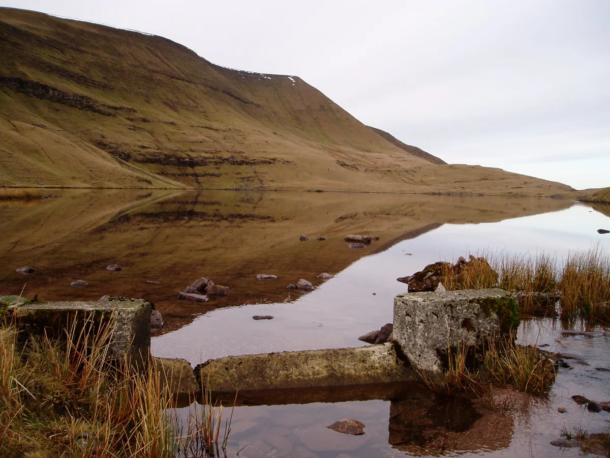
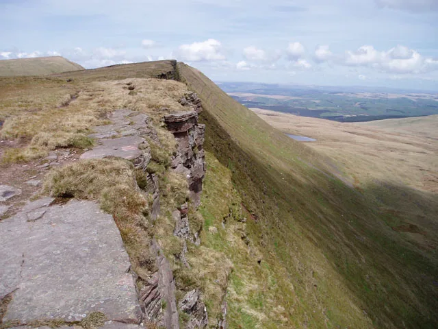
Fan Brycheiniog is the highest peak at a height of 802.5 metres (2,633 ft) (above sea level) in the Black Mountain (Y Mynydd Du) region of the Brecon Beacons National Park in southern Wales. There is a trig point at the peak and on the edge of the escarpment, and nearby, a stone shelter with an inner seat. It lies just inside the historic county of Brecknockshire (now part of the Powys council area) which gives the mountain its Welsh name. A subsidiary top (Fan Foel), less than a kilometre from the summit along the ridge to the northwest, is the highest point (county top) of the neighbouring county of Carmarthenshire. Fan Brycheiniog is also within the Fforest Fawr Geopark designated in 2005 in recognition of the area's geological heritage. The views of the moorland and open country to the north are spectacular when the weather is clear, and reveals the isolation of the range, especially when compared with the more popular Pen y Fan range to the east.
Excerpt from Wikipedia under CC BY-SA 4.0. See the source article linked in Sources below.
Background
Visiting
The Beacons Way, a waymarked long distance footpath heading southwest from Llanddeusant passes along the summit ridge before descending to the southern end of the lake Llyn y Fan Fawr to the east of the summit, en route to Abercraf in the southeast. The path crosses several peat bogs, but there are stone pavements in many places to protect the walker from the wet conditions. There is a stone staircase of regular downward gradient across the escarpment to the lake below. It is easily followed, and is dry underfoot when the weather is clear. The path leads on to Picws Du and Waun Lefrith above the smaller glacial lake of Llyn y Fan Fach. These two lakes are notable as two of the few natural…
Sourced from Wikipedia under CC BY-SA 4.0.
- Coordinates
- 51.8822, -3.7082
- Address
- Powys, Wales
Sources
- osm: n1537151387 (ODbL)
- wikipedia: Fan Brycheiniog (CC BY-SA 4.0)
- commons: Bannaubrych.JPG (CC BY-SA 4.0)
Other places nearby
Loading nearby places…
Nearby
 📷 3
📷 3Mountains & hills · South Wales
Twr y Fan Foel
Twr y Fan Foel — a mountain in wales-south, United Kingdom, 803 m.
 📷 3
📷 3Historic houses · South Wales
Gwal y Cadno
Gwal y Cadno — a historic house in wales-south, United Kingdom.
 📷 3
📷 3Natural landmarks · South Wales
Llyn y Fan Fawr
Llyn y Fan Fawr — lake in Powys, Wales.
 📷 3
📷 3Mountains & hills · South Wales
Fan Foel
Fan Foel — a mountain in wales-south, United Kingdom, 781 m.
 📷 3
📷 3Mountains & hills · South Wales
Fan Hir
Fan Hir — Named summit at 761 m.
 📷 3
📷 3Natural landmarks · South Wales
Fan Hir
Fan Hir — mountain (760m) in Powys.
More mountains in this region
 Flagship📷 3
Mountains & hills · South Wales
Milford Haven Waterway
Milford Haven Waterway — ria, or flooded valley, in Pembrokeshire, south-west Wales, UK.
 📷 5
📷 5Mountains & hills · South Wales
Ogof Ffynnon Ddu
Ogof Ffynnon Ddu — cave in the Upper Swansea Valley in South Wales.
 📷 3
📷 3Mountains & hills · South Wales
Abereiddi Bay
Abereiddi Bay — bay in the United Kingdom.
 📷 3
📷 3Mountains & hills · South Wales
Allt Lwyd
Allt Lwyd — Named summit at 653 m.
Frequently asked questions
- Where is Fan Brycheiniog?
- Fan Brycheiniog is in South Wales, in the United Kingdom — coordinates 51.8822°, -3.7082°.
- Is Fan Brycheiniog free to visit?
- Yes — admission to Fan Brycheiniog is free.