Castles · North West England
Failsworth
Failsworth () is a town in the Metropolitan Borough of Oldham, Greater Manchester, England, 4 miles (6.4 km) north-east of Manchester and 3 miles (4.8 km) south-west of Oldham. The M60 ring-road motor

David Hillas — CC BY-SA 2.0 via Wikimedia Commons licence
Plan your visit
- Typical visit
- 1.5 h–3 h
- Family-friendly
- Limited wheelchair access
About
Failsworth () is a town in the Metropolitan Borough of Oldham, Greater Manchester, England, 4 miles (6.4 km) north-east of Manchester and 3 miles (4.8 km) south-west of Oldham. The M60 ring-road motorway skirts it to the east. The population at the 2011 census was 20,680. Historically in Lancashire, Failsworth until the 19th century was a farming township linked ecclesiastically with Manchester. Inhabitants supplemented their farming income with domestic hand-loom weaving. The humid climate and abundant labour and coal led to weaving of textiles as a Lancashire Mill Town with redbrick cotton mills. A current landmark is the Failsworth Pole. Daisy Nook is a country park on the southern edge.
Photo gallery
From the Wikipedia article
Failsworth () is a town in the Metropolitan Borough of Oldham, Greater Manchester, England, 4 miles (6.4 km) north-east of Manchester and 3 miles (4.8 km) south-west of Oldham. The M60 ring-road motorway skirts it to the east. The population at the 2011 census was 20,680. Historically in Lancashire, Failsworth until the 19th century was a farming township linked ecclesiastically with Manchester. Inhabitants supplemented their farming income with domestic hand-loom weaving. The humid climate and abundant labour and coal led to weaving of textiles as a Lancashire Mill Town with redbrick cotton mills. A current landmark is the Failsworth Pole. Daisy Nook is a country park on the southern edge.
Excerpt from Wikipedia under CC BY-SA 4.0. See the source article linked in Sources below.
Background
History
]] Early settlement rested on a road that runs today between Manchester and Yorkshire. This Roman secondary road formed part of a network from Manchester up north, probably to Tadcaster near York. The section that ran through Failsworth is still known as Roman Road. It was built above marshland and laid on brushwood with a hard surface. Roman Road has also been known as "Street", a Saxon term meaning "metalled road", indicating that it was also used that later period. By 1663, 50 households were registered.
Sourced from Wikipedia under CC BY-SA 4.0.
- Coordinates
- 53.5102, -2.1575
- District
- Oldham
- Parish
- Oldham, unparished area
- Postcode
- M35 9QY
- Parliamentary constituency
- Manchester Central
Sources
- wikipedia: Failsworth (CC BY-SA 4.0)
Other places nearby
Loading nearby places…
Nearby
 📷 3
📷 3Memorials & monuments · North West England
Failsworth War Memorial
Failsworth War Memorial — Grade II listed building-listed memorial in england-north-west, United Kingdom.
 📷 3
📷 3Historic churches · North West England
St Wilfrid and St Ann's Church, Newton Heath
St Wilfrid and St Ann's Church, Newton Heath — church in Manchester, UK.
 📷 5
📷 5Natural landmarks · North West England
Kaskenmoor School
Kaskenmoor School — a school heritage in england-north-west, United Kingdom.
 📷 3
📷 3Historic bridges · North West England
Roman Road
Roman Road is a historic bridge in the United Kingdom.
 📷 5
📷 5Natural landmarks · North West England
South Chadderton School
South Chadderton School — a school heritage in england-north-west, United Kingdom.
📷 5Natural landmarks · North West England
Collective Spirit
Collective Spirit — a school heritage in england-north-west, United Kingdom.
More castles in this region
 📷 5
📷 5Castles · North West England
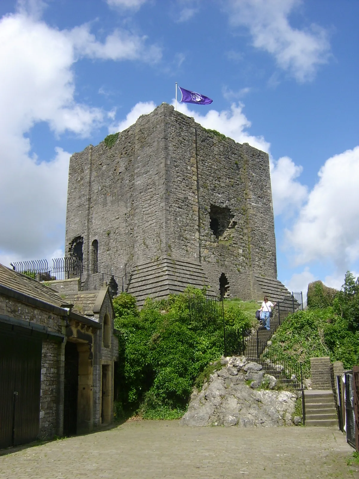
Clitheroe Castle
Clitheroe Castle — castle in Lancashire, England, UK.
 📷 3
📷 3Castles · North West England
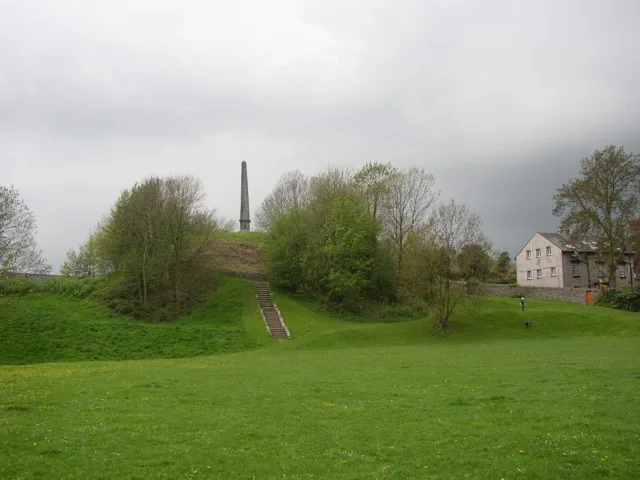
Castle Howe
Castle Howe — Castle in Cumbria, England.
 📷 3
📷 3Castles · North West England
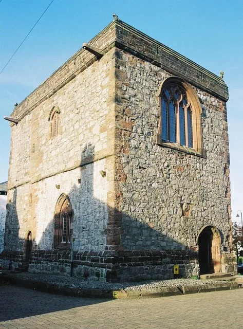
Dalton Castle
Dalton Castle — Grade I listed local museum in Dalton Town with Newton, Westmorland and Furness, Cumbria , England, UK.
 📷 5
📷 5Castles · North West England
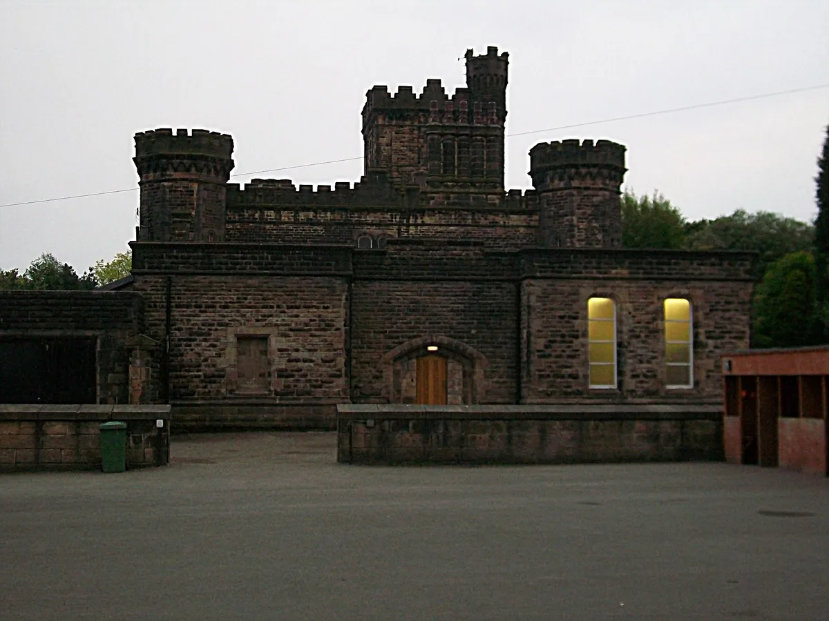
Dobroyd Castle
Dobroyd Castle — castle in Todmorden, West Yorkshire, England, UK.
Frequently asked questions
- Where is Failsworth?
- Failsworth is in North-West England, United Kingdom (postcode M35 9QY), in the parish of Oldham, unparished area.
- Does Failsworth charge admission?
- Failsworth typically charges admission. Check the official site for current ticket prices and opening hours.
- How do I get to Failsworth?
- Drivers can navigate to postcode M35 9QY. It sits within the Manchester Central parliamentary constituency.