Museums · North Wales
Eastham, Merseyside
Eastham is a village and an electoral ward of the Metropolitan Borough of Wirral, in Merseyside, England. Historically (until 1974), it was part of Cheshire. It is situated on the Wirral Peninsula, to

David Dixon — CC BY-SA 2.0 via Wikimedia Commons licence
Plan your visit
- Typical visit
- 1.5 h–3 h
- Best time of year
- Year-round
- Family-friendly
- Limited wheelchair access
About
Eastham is a village and an electoral ward of the Metropolitan Borough of Wirral, in Merseyside, England. Historically (until 1974), it was part of Cheshire. It is situated on the Wirral Peninsula, to the south of Bromborough and to the east of Willaston. At the 2001 census, it had a population of 12,250, although the total ward population for the village stood at 13,637 In 2011, the villages population was not measured separately but a review was carried out for the ward. The total population had risen to 13,882.
Photo gallery
From the Wikipedia article
Eastham is a village and an electoral ward of the Metropolitan Borough of Wirral, in Merseyside, England. Historically (until 1974), it was part of Cheshire. It is situated on the Wirral Peninsula, to the south of Bromborough and to the east of Willaston. At the 2001 census, it had a population of 12,250, although the total ward population for the village stood at 13,637 In 2011, the villages population was not measured separately but a review was carried out for the ward. The total population had risen to 13,882.
Excerpt from Wikipedia under CC BY-SA 4.0. See the source article linked in Sources below.
Background
History
Eastham is cited as one of the oldest villages on the Wirral Peninsula and has been inhabited since Anglo-Saxon times. The name derives from its location: ham ("home") situated to the east of Willaston, which was then the principal settlement. The original village is clustered around St. Mary's Church, whose churchyard contains an ancient yew tree. Much of the surrounding land was once owned by the powerful Stanley family. Since the Middle Ages, a ferry service operated across the River Mersey between Eastham and Liverpool, the early ferries being run by monks from the Abbey of St. Werburgh. By the late 1700s, up to 40 coaches each day arrived at a newly built pier, carrying passengers and…
Visiting
As well as Eastham Country Park and Woods, the Lowfields, close to Eastham Rake Station, is the start of a guided walk suggested by Wirral Metropolitan Borough Council, following Dibbinsdale Brook and leads onto the Wirral Way. Dibbinsdale is a local nature reserve and Dibbinsdale Brook and Clatter Brook run through the Brookhurst area of Eastham and into Bromborough. There is also a private golf club, Eastham Lodge, a mature parkland course with views across the River Mersey. Near to the village centre is a small public area called Torr Park, Which is home to the village cricket club. It was founded by the Stanley family as an area for recreation. In the present day the park offers tennis…
Sourced from Wikipedia under CC BY-SA 4.0.
- Coordinates
- 53.3130, -2.9620
- District
- Wirral
- Parish
- Wirral, unparished area
- Postcode
- CH62 0AH
- Parliamentary constituency
- Ellesmere Port and Bromborough
- Official site
- boulter.com
Sources
- wikipedia: Eastham, Merseyside (CC BY-SA 4.0)
Other places nearby
Loading nearby places…
Nearby
 📷 3
📷 3Historic churches · North Wales
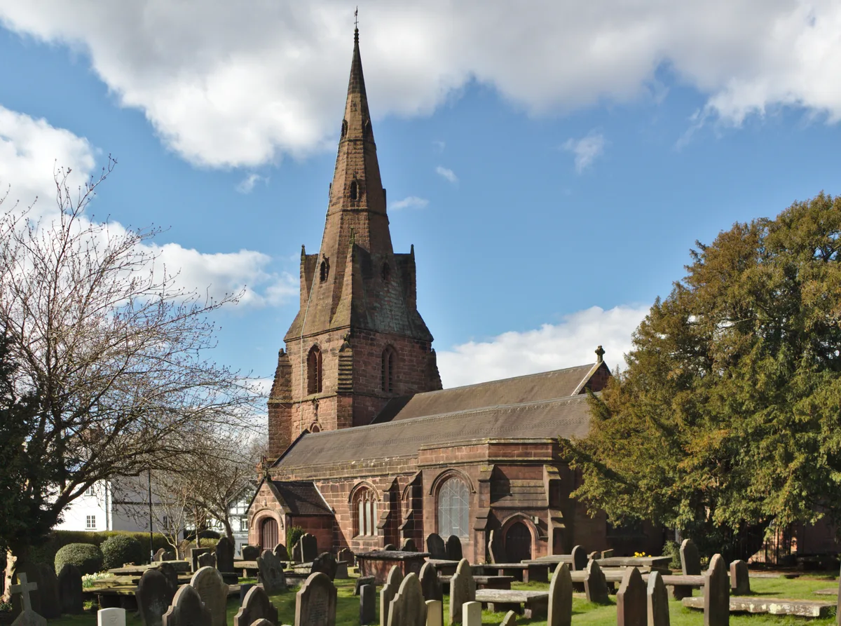
St Mary's Church, Eastham
St Mary's Church, Eastham — church in Eastham, Merseyside, England, UK.
 📷 5
📷 5Historic churches · North Wales
St Mary's Primary School, Eastham
St Mary's Primary School, Eastham — a school heritage in wales-north, United Kingdom.
📷 3Memorials & monuments · North Wales
Eastham War Memorial
Eastham War Memorial — Grade II listed building-listed memorial in wales-north, United Kingdom.
 📷 3
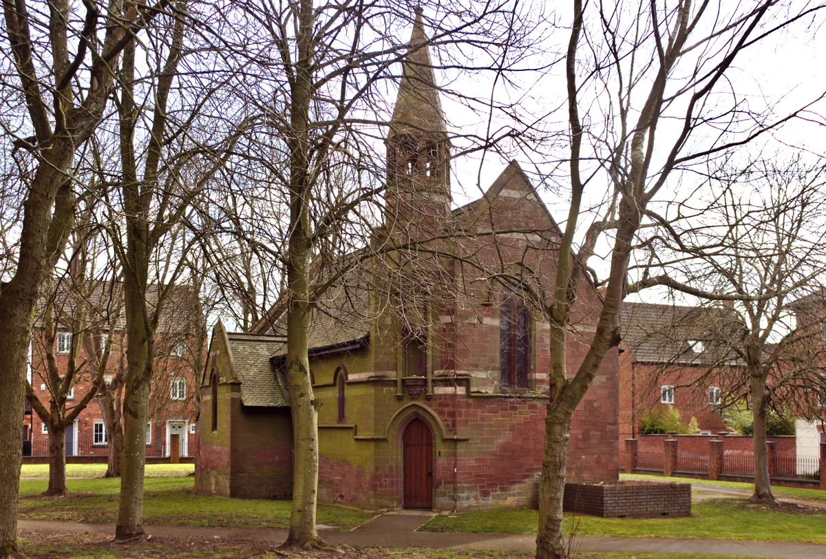
📷 3Historic churches · North Wales
Chapel of the Good Shepherd, Carlett Park
Chapel of the Good Shepherd, Carlett Park — Grade II listed church in Eastham, Wirral, Merseyside, England, UK.
 📷 3
📷 3Cemeteries · North Wales
Mayfields Woodland Remembrance Park
Mayfields Woodland Remembrance Park is a cemetery in the United Kingdom.
Hotels · North Wales
Woodcote House
Woodcote House — a hotel in wales north.
More museums in this region
 📷 4
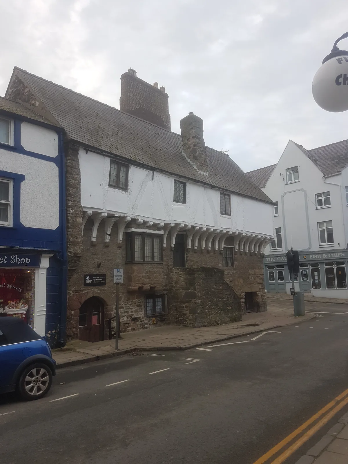
📷 4Museums · North Wales
Aberconwy House Museum
Aberconwy House Museum — museum in Betws y Coed.
 📷 3
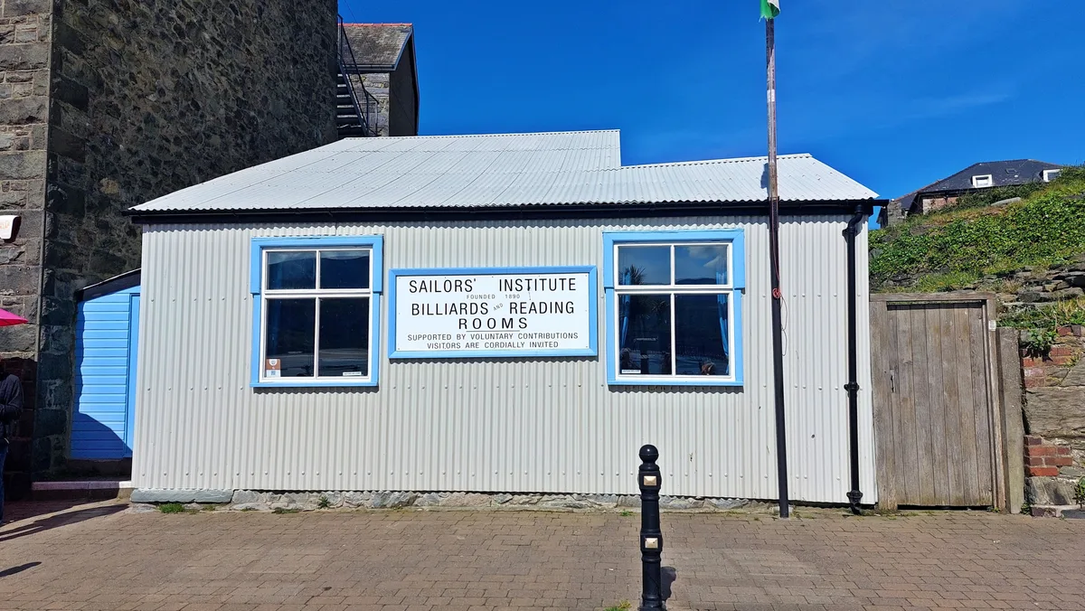
📷 3Museums · North Wales
Barmouth Sailors' Institute
Barmouth Sailors' Institute — Community centre, heritage organisation and museum in the Barmouth, Wales, UK.
 📷 3
📷 3Museums · North Wales
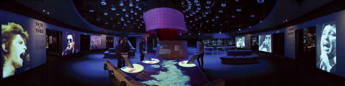
British Music Experience
British Music Experience is a museum in the United Kingdom.
 📷 3
📷 3Museums · North Wales
Caernarfon Castle and Town Walls
Caernarfon Castle and Town Walls — part of a World Heritage site in the United Kingdom.
Frequently asked questions
- Where is Eastham, Merseyside?
- Eastham, Merseyside is in North Wales, in the United Kingdom — coordinates 53.3130°, -2.9620°.
- Is Eastham, Merseyside wheelchair accessible?
- Partially — OpenStreetMap notes limited wheelchair access at Eastham, Merseyside. Check ahead for specific facilities.