Archaeological sites · Scottish Highlands
Durris Forest
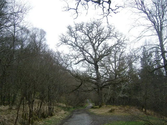
Durris Forest — forest in Aberdeenshire, Scotland.

Wikimedia Commons contributors — see linked file page for photographer and licence licence
Plan your visit
- Typical visit
- 45 min–1.5 h
- Nearest railway station
- Milton of Crathes · 5.8 km
- Free entry
- Dog-friendly
About
Durris Forest is an archaeological site in the United Kingdom. Wikidata describes it as: "forest in Aberdeenshire, Scotland". Coordinates: 57.0280°, -2.3490°.
Photo gallery
From the Wikipedia article
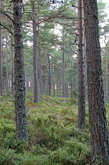
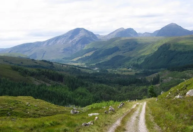
Durris Forest is a chiefly coniferous forest south of the River Dee approximately three kilometres west of Netherley in Aberdeenshire, Scotland. The A957 road forms the southwest boundary of Durris Forest, separating it from Fetteresso Forest. The Durris Forest includes several smaller named woodlands. The ancient route of Elsick Mounth crosses the Grampian Mounth within the Durris Forest. Notable natural features in the vicinity include Red Moss and Meikle Carewe Hill. Notable historic features in this area include Raedykes Roman Camp, Muchalls Castle and Maryculter House.
Excerpt from Wikipedia under CC BY-SA 4.0. See the source article linked in Sources below.
Background
History
Roman legions marched from Raedykes to Normandykes Roman Camp through the Durris Forest as they sought higher ground evading the bogs of Red Moss and other low-lying mosses associated with the Burn of Muchalls. That march used the Elsick Mounth, one of the ancient trackways crossing the Mounth of the Grampian Mountains, lying west of Netherley.
Sourced from Wikipedia under CC BY-SA 4.0.
- Coordinates
- 57.0280, -2.3490
- District
- Aberdeenshire
- Postcode
- AB31 6DX
- Parliamentary constituency
- West Aberdeenshire and Kincardine
- Nearest railway station
- Milton of Crathes — 5.8 km
Sources
- wikidata: Q5316753 (CC0)
- wikipedia: Durris Forest (CC BY-SA 4.0)
- commons: Road through Durris Forest - geograph.org.uk - 178311.jpg (CC BY-SA 4.0)
Other places nearby
Loading nearby places…
Nearby
 📷 3
📷 3Natural landmarks · Scottish Highlands
Cairn Mon Earn
Cairn Mon Earn — mountain in Aberdeenshire, Scotland, UK.
 📷 3
📷 3Stone circles · Scottish Highlands
Clune stone circle
Clune stone circle — a stone circle in scotland-highlands, United Kingdom.
 📷 5
📷 5Historic bridges · Scottish Highlands
Balladrum Bridge
Balladrum Bridge — category C listed building-listed bridge in scotland-highlands, United Kingdom.
 📷 5
📷 5Historic bridges · Scottish Highlands
Old Bridge of Durris
Old Bridge of Durris — category B listed building-listed bridge in scotland-highlands, United Kingdom.
 📷 3
📷 3Memorials & monuments · Scottish Highlands
Durris War Memorial
Durris War Memorial — a memorial in scotland-highlands, United Kingdom.
📷 5Historic churches · Scottish Highlands
St Comgall's Church, Kirkton Of Durris
St Comgall's Church, Kirkton Of Durris — category C listed building-listed church in scotland-highlands, United Kingdom.
More archaeological sites in this region
 📷 5
📷 5Archaeological sites · Scottish Highlands
Ariundle Oakwood National Nature Reserve
Ariundle Oakwood National Nature Reserve — forested nature reserve in Highland, Scotland, UK.
 📷 3
📷 3Archaeological sites · Scottish Highlands
Abernethy Forest
Abernethy Forest — forest in Highland, Scotland, UK.
 📷 3
📷 3Archaeological sites · Scottish Highlands
Abriachan Forest
Abriachan Forest — Forest near Abriachan village in Scotland.
 📷 3
📷 3Archaeological sites · Scottish Highlands
Achnashellach Forest
Achnashellach Forest is a archaeological site in the United Kingdom.
Frequently asked questions
- Where is Durris Forest?
- Durris Forest is in Scottish Highlands, in the United Kingdom — coordinates 57.0280°, -2.3490°. The nearest railway station is Milton of Crathes, around 5.8 km away.
- Is Durris Forest free to visit?
- Yes — admission to Durris Forest is free.